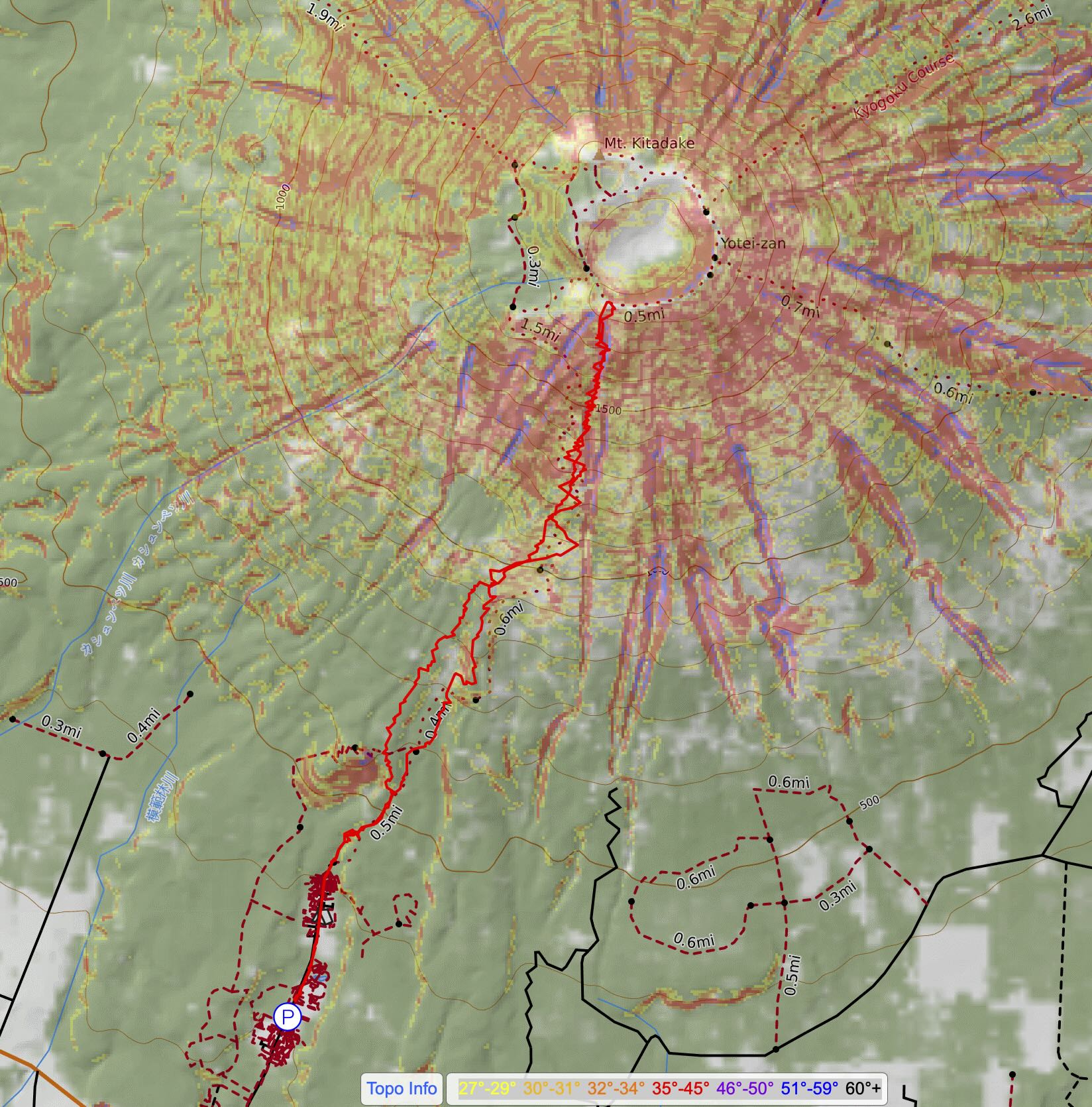
ghost of yōtei | ski tour via makkari
8 miles . 5000 ft gain . 6045 ft high
Shikotsu-Toya National Park, Hokkaido, Japan
It is amazing how many popular ski tours exist in Hokkaido, the north island of Japan. We were thoroughly overwhelmed by the options but it helped that some friends had some vague ideas from their previous trips. But then there was Mount Yōtei. We were first enamored by it partially due to its proximity to Niseko, the biggest ski resort in Hokkaido, and also because of the new video game Ghost of Yōtei. While I did not play this game, I definitely saw bits and pieces of it and it was cool to see all the gingko trees in the game and the idea of being in the area of Mount Yōtei. We were sold! We had to ski tour on Yōtei.
TL;DR: This was the most amazing experience of this Japow trip! Definitely do your research and go get it! Key things to know are in the Notes section below
Trip Planning
Initially, we wanted to ski the crater of the volcano since Kyle had never summited a volcano nor explored one. I was more ambivalent since I had a few more experiences on a volcano like on Mount Baker and Mount Saint Helens, and even my first volcano in New Zealand (Mount Taranaki). So it wasn’t a make-or-break situation for me. But obviously, would be soooo cool to ski into the crater!
As the trip approached and we checked out the weather, we planned for skiing on the sunnier day with the most potential for good views and good weather. We did not want to be turned around due to weather for such a cool peak and experience. Unfortunately, the timing meant that we had to ski tour on our last day in Hokkaido with an evening flight to make on the back end and breakfast at the ryokan on the front end. So we really only had less than 12 hours to drive to the trailhead, ski tour, drive back to the ski rental the opposite direction of the airport, drive to the airport and return the car and all the hassle with that, maybe get some dinner food and to the gates.
Realistically, we only had about 9am-3pm. Since I hadn’t ski toured much in Washington due to the poor snow pack (hence also you haven’t seen any winter trip reports on this blog this year of 2026), I was not confident in my strength and ability to summit and didn’t want to push it, so we budgeted for just turning around when we felt like it was time. Playing it by ear, if you will.
Trailhead
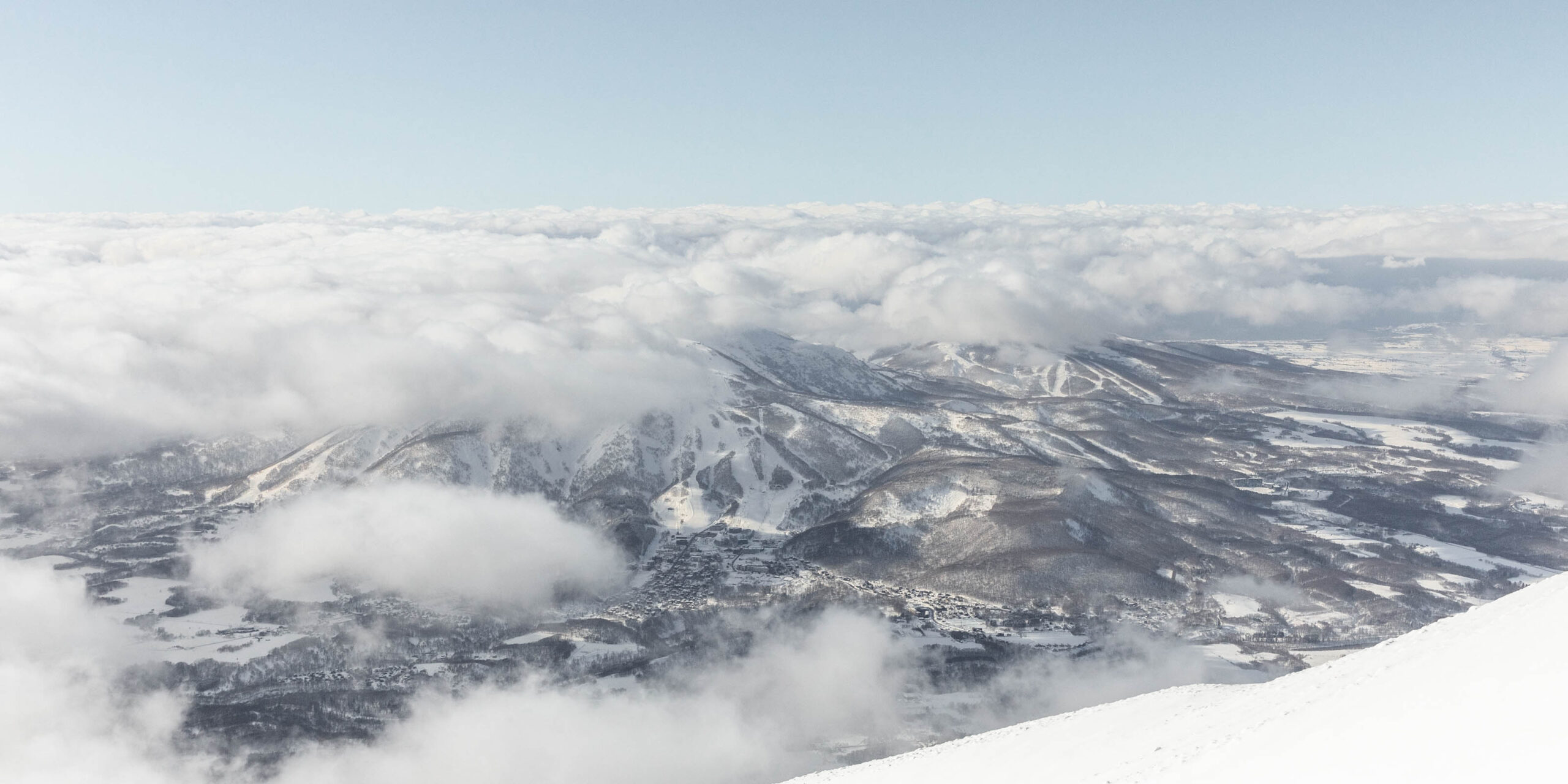
After breakfast, we loaded skis into the car (we pre-loaded our luggage in the car for efficiency before breakfast). Honestly with the ryokan breakfast, it’s hard to eat much faster than 30 minutes but we booked it out of there as fast as we could at 8:40am. I was still sick from the previous days getting to cold and with a runny nose, so I wasn’t feeling too hot. But at the trailhead, I was very stoked! We could see the base of Mount Yōtei as we drove closer from Niseko to the Mount Yōtei Makkari Trailhead. There were plenty of other cars there, probably mostly foreigners too on a Monday who decided to ski tour as well.
I felt like we were late since there were already so many vehicles there. But we weren’t the only late ones. The car that pulled in right after us fit 5 friends and somehow 5 skis that they ingenuously fit through lowered windows in the second row. Creative, but dangerous. But the scary part was that as they got ready, I overheard a conversation that went: “Hey, have you put skins on before?”, “No”, “Okay, I’ll teach you”. Massive facepalm and honestly shock. I gathered that one or two of those friends had skied toured before and decided that it was fine to just take someone with zero avalanche/touring experience out in a different country. Though Yōtei is probably a “safer” tour than other places, it’s still quite the trust you need to blindly follow a friend.
Anyway, we put skins on our own skis and started up the trail, following a few other groups. I stopped so many times to blow out my nose and it was one of the most uncomfortable experiences with a brain freeze and headache out of nowhere.
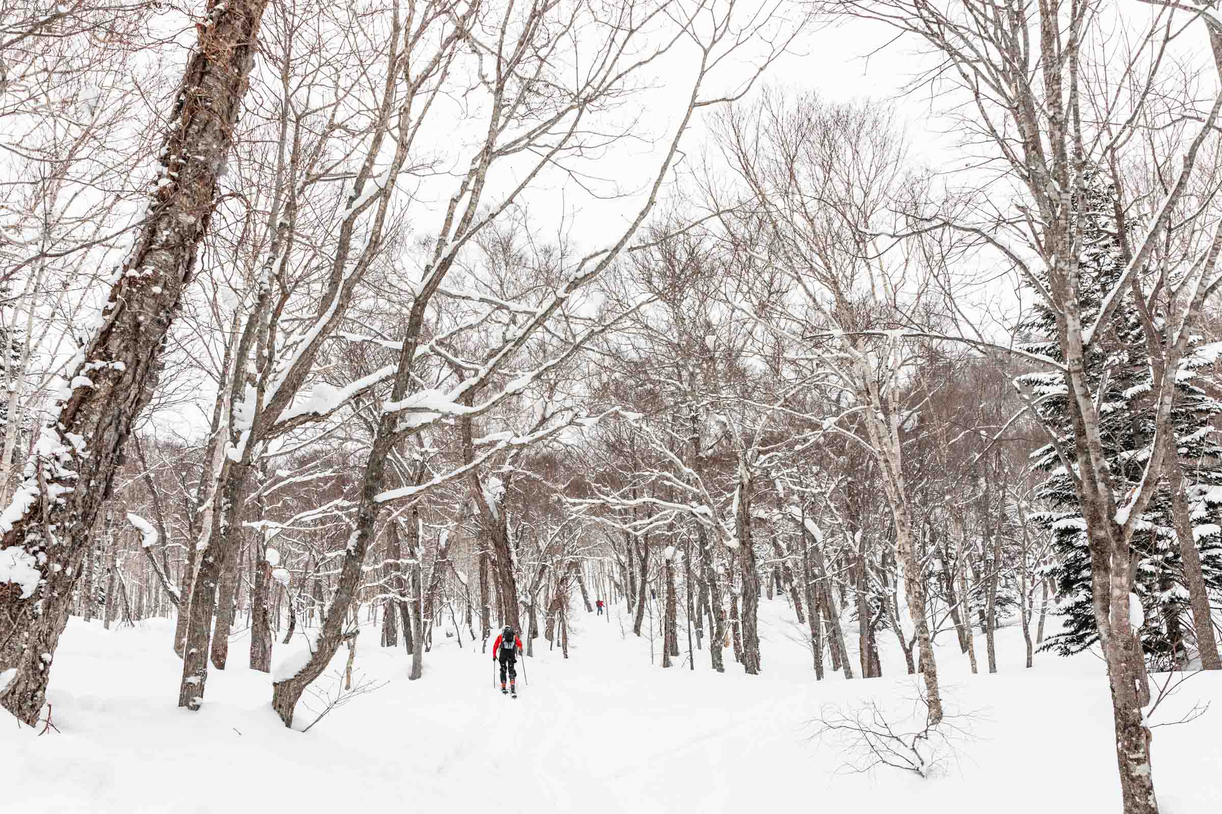
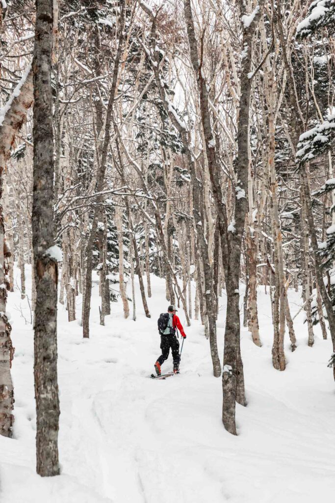
The Forest
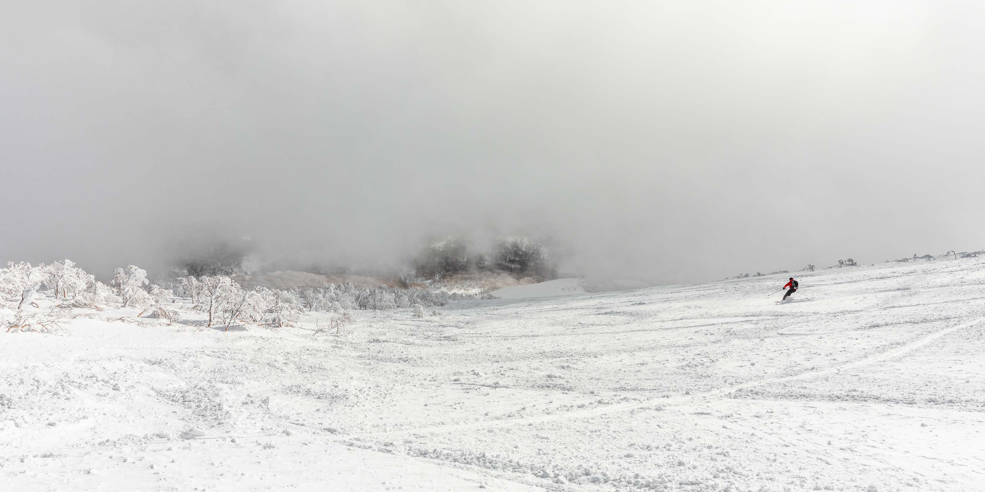
Surprisingly despite being sick and feeling unwell, my legs moved at a steady pace. Soon we started to catch up to other groups and it made me feel better. But I still had my sights set on turning around early. I figured, 4 hours up, 2 hours down, that’ll put us at 3/4 of the way to the top, thinking that the goal was 4000 ft. But then I realized it was 5000 ft (poor trip planning on my part) but Kyle really wanted to reach the summit. We agreed that if the pace seemed like we could make it we can consider going up, but in my heart I was set on turning around early. We were still under the clouds, so it was unclear if we would break through with views.
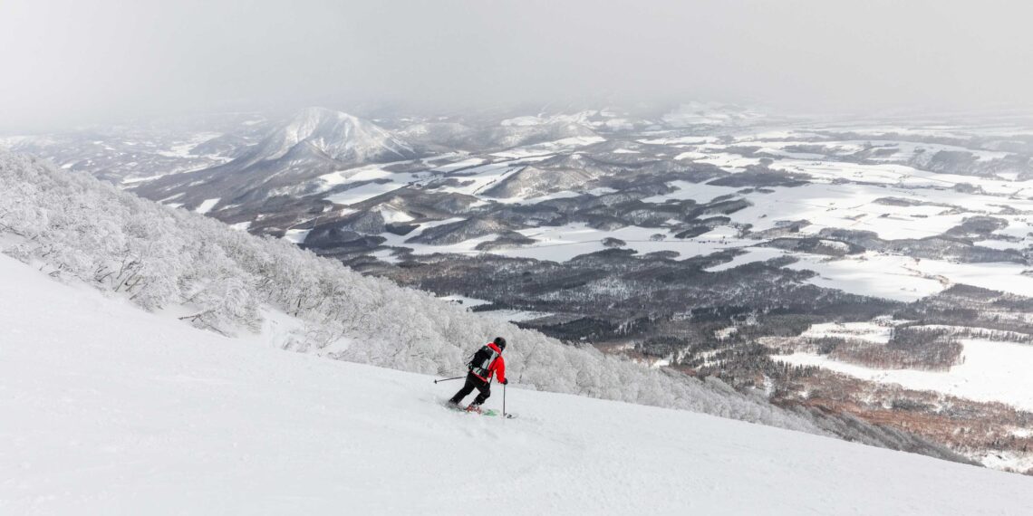
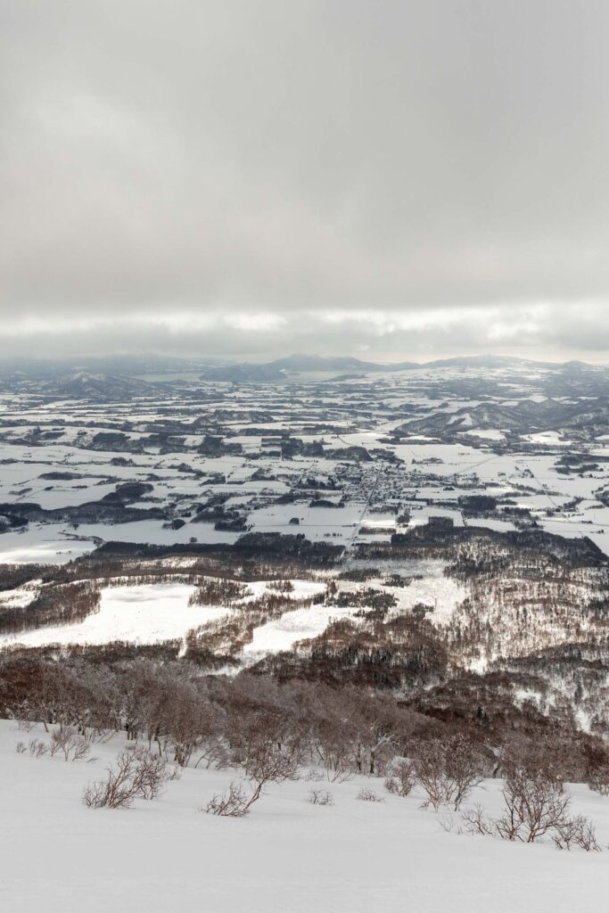
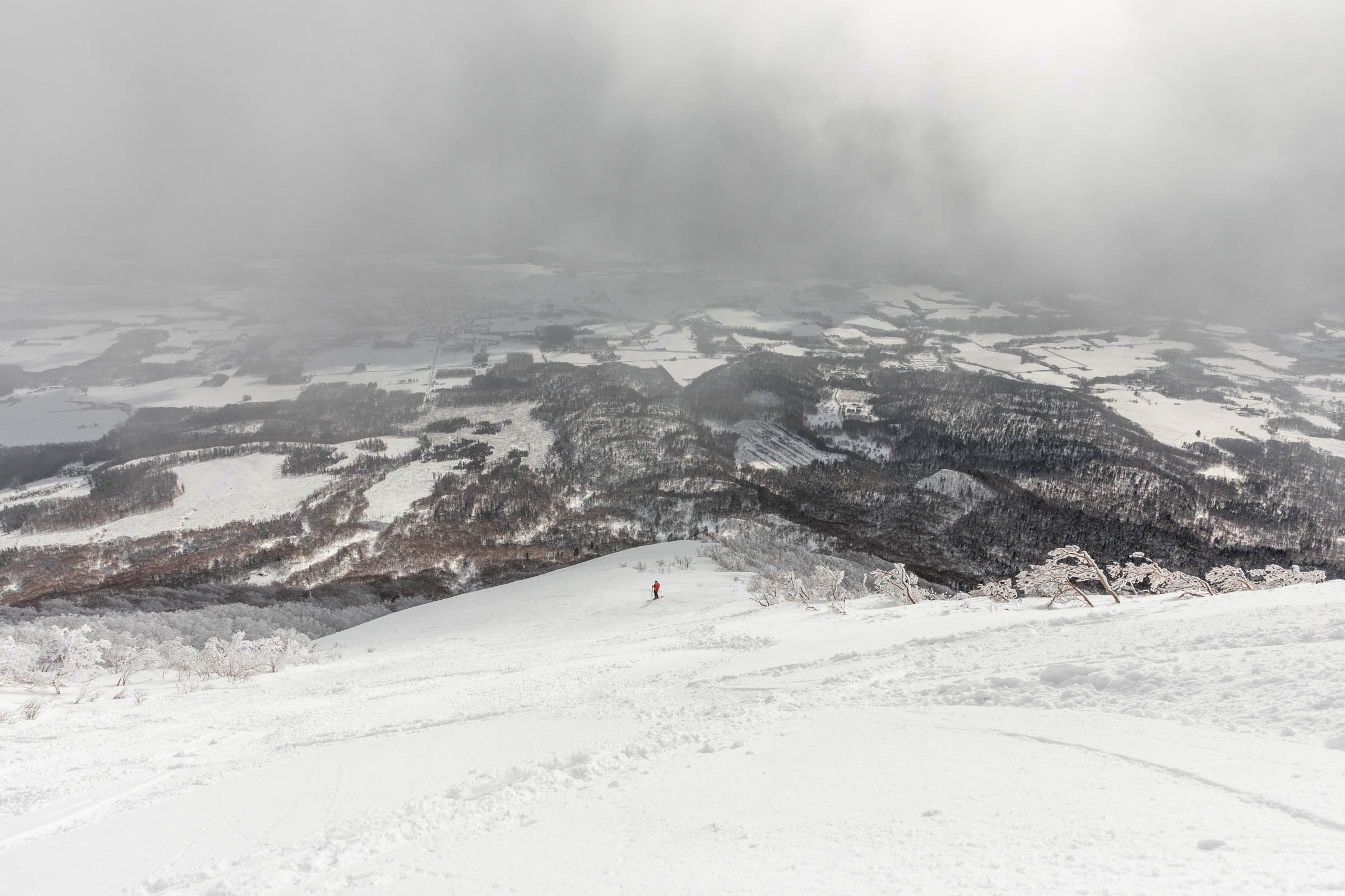
As we passed some Canadians and our 1.5 hour mark, I realized we were actually making good pace. Slightly better than 1000 ft/hr going uphill. Plus, our speed was increasing as I was stopping less frequently. The trail took us through the forest and up to a ridge where we followed it for another 500 ft. Here, we finally got better views of the area and the open slopes to our right. Somehow people were already starting to descend! I wonder how far they went up or when they started in the morning. It looked sooo good and I was envious, hoping that the snow quality would still stay good.
At about 3300 ft from the trailhead, we ran into another guided group that decided to turn around there. I was so ready to turn around too, but then the clouds lifted and I was motivated again. It had been just about 3 hours and if we spent 2 more hours going up and budget for 1 hour going down, we would be in good shape to get to the airport.
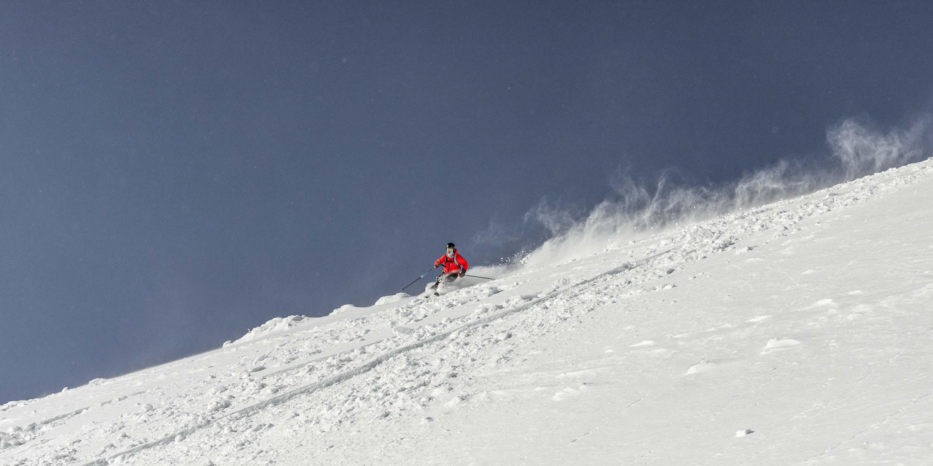
The Summit Bid
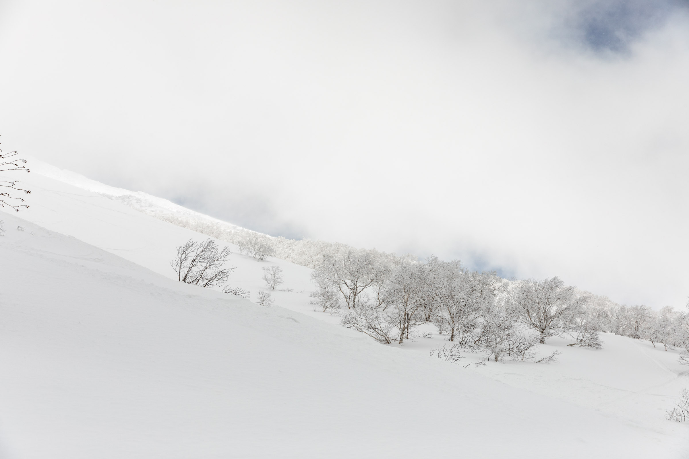
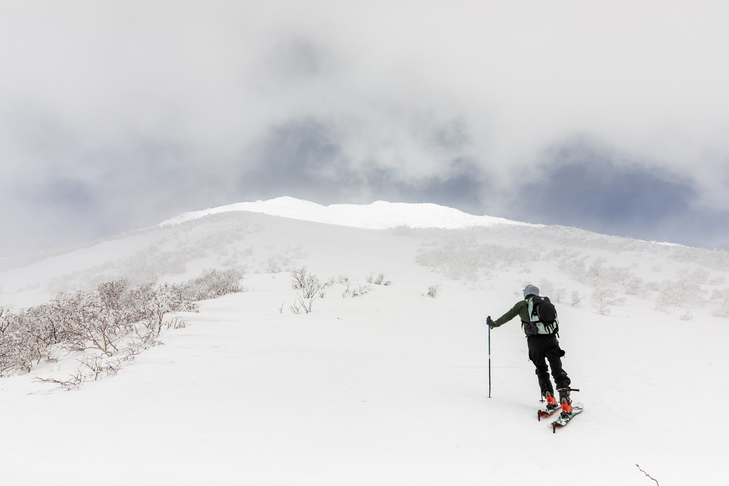
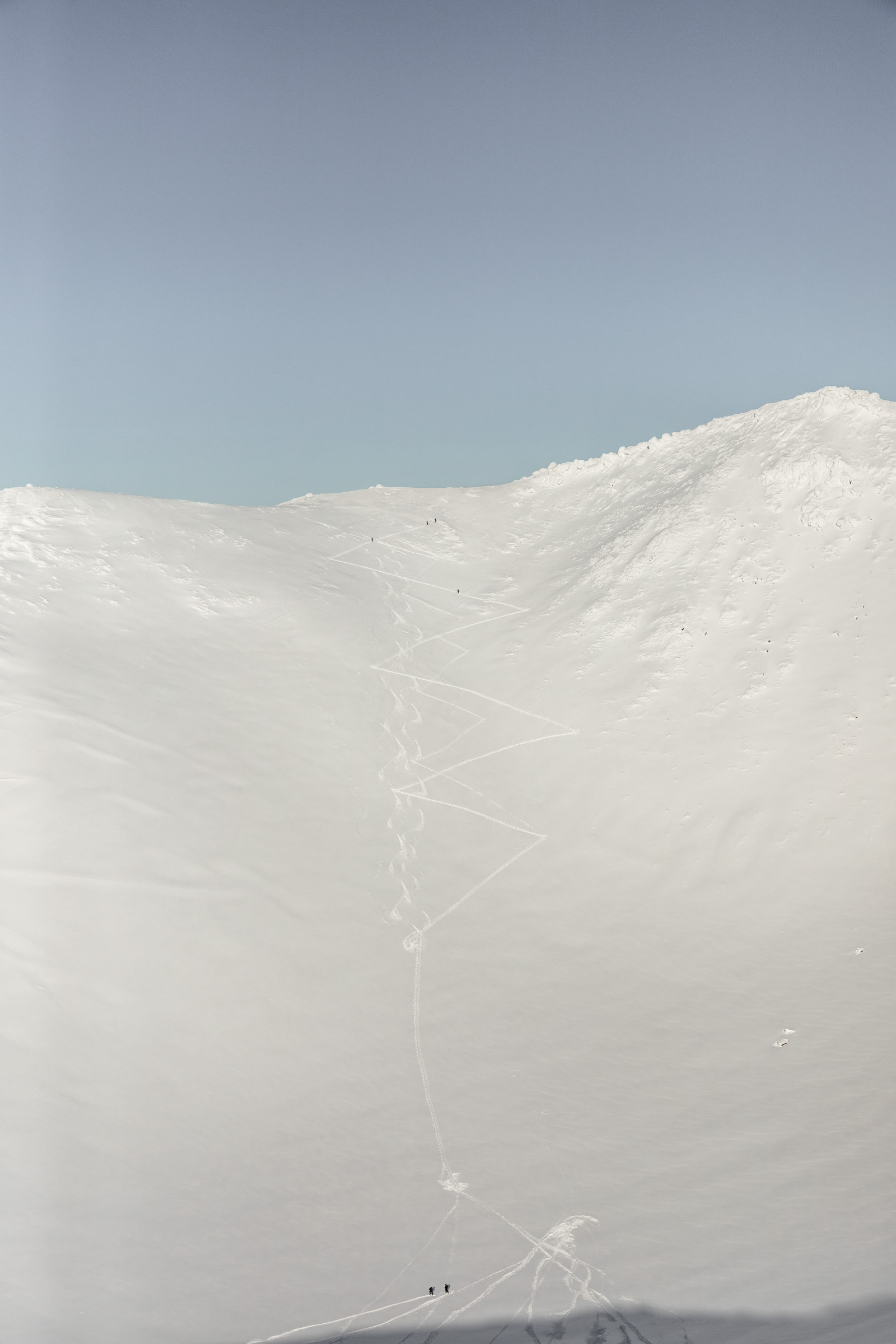
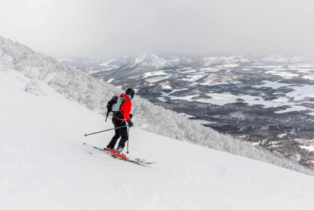
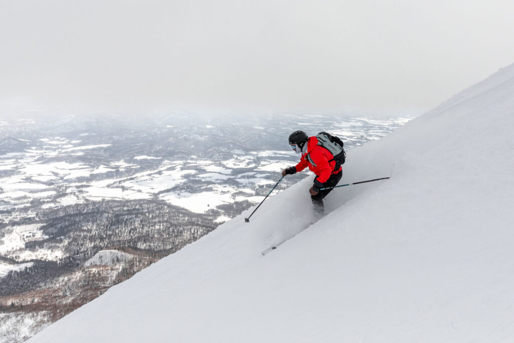
Per usual, seeing the end is not a good motivator because it’s always further than you think. If you’ve ever hiked or skied to Camp Muir, you’ll understand that. Foot in front of the other, I kept making progress. It was really exciting to see more views the higher we went, though sometimes the gusts would pick up. To our right, there was so much rime ice covering all the trees. And if you went too far left, it felt like there’d be a drop off. So we stayed squarely in the middle face where it was least steep and smoothest to travel. But eventually for the last 250 feet, we decided to boot pack it like many other people ahead of us did.
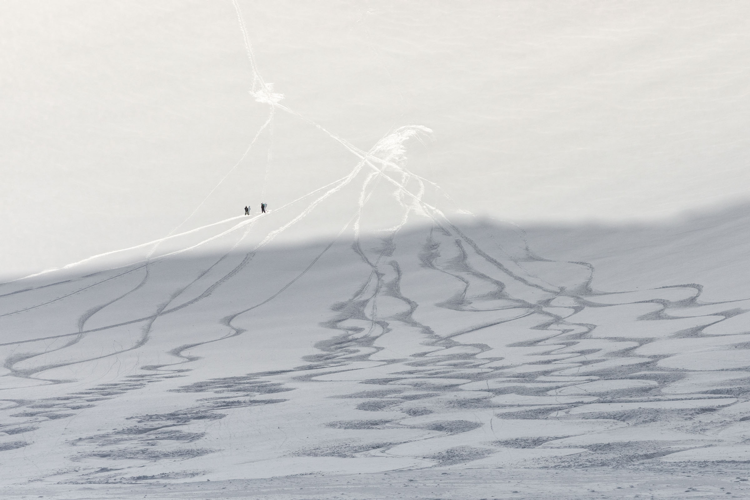
It was extremely windy at this point and movement was much slower. I think it took me nearly 25 minutes to gain those measly feet. So I was pretty happy to call the summit the end of the uphill rather than skiing into the crater bowl. Though that did look super super fun! It seemed like a few people went down and across to the other side and a few others went up the north route.
At the summit, we got our views, I snapped a few photos and we had to transition for the way down quickly. We couldn’t lose any time!
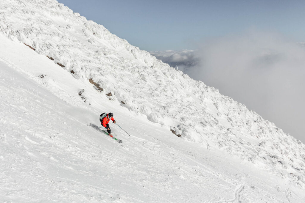
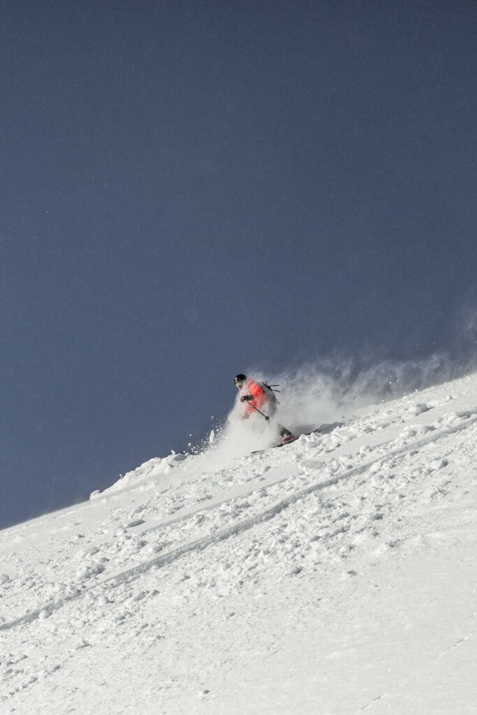
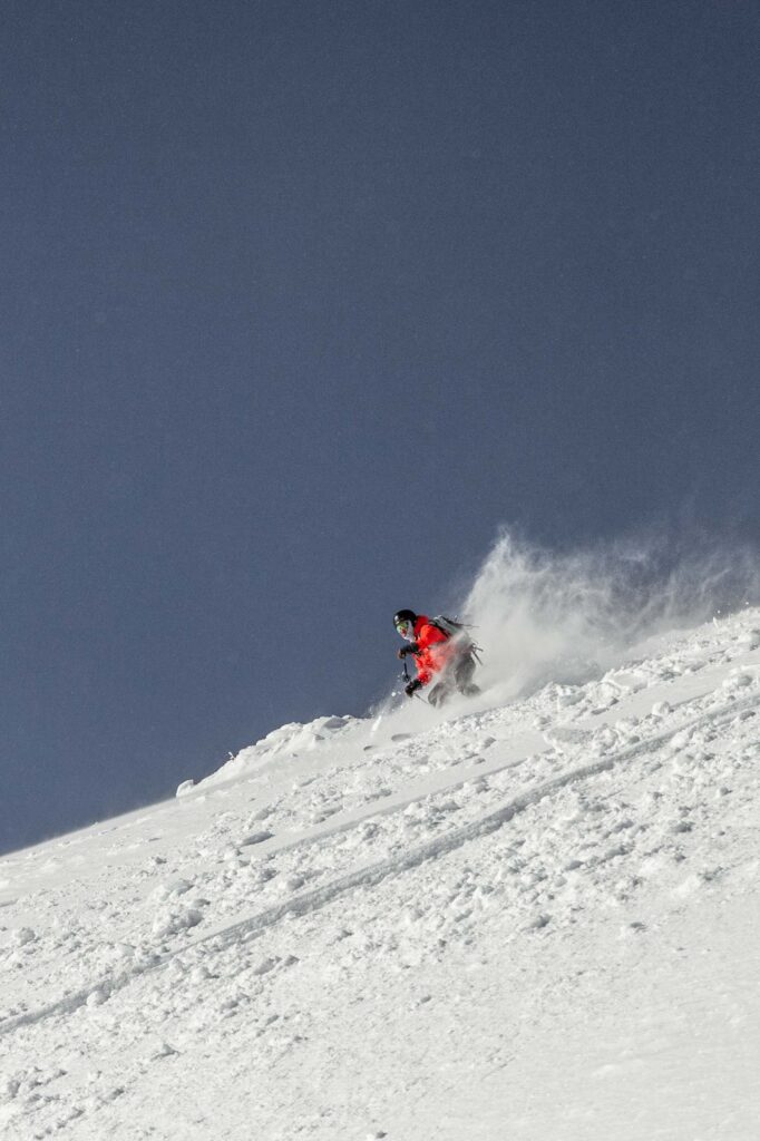
Skiing Yōtei
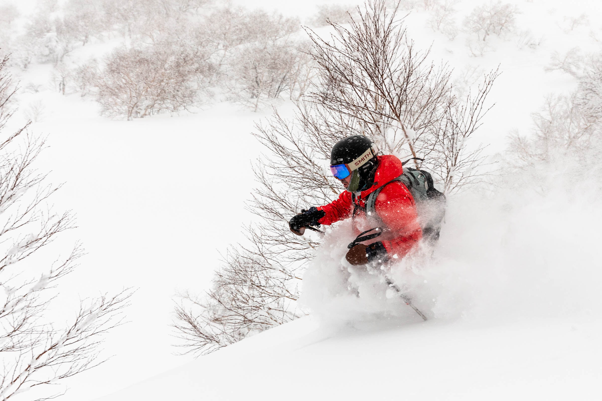
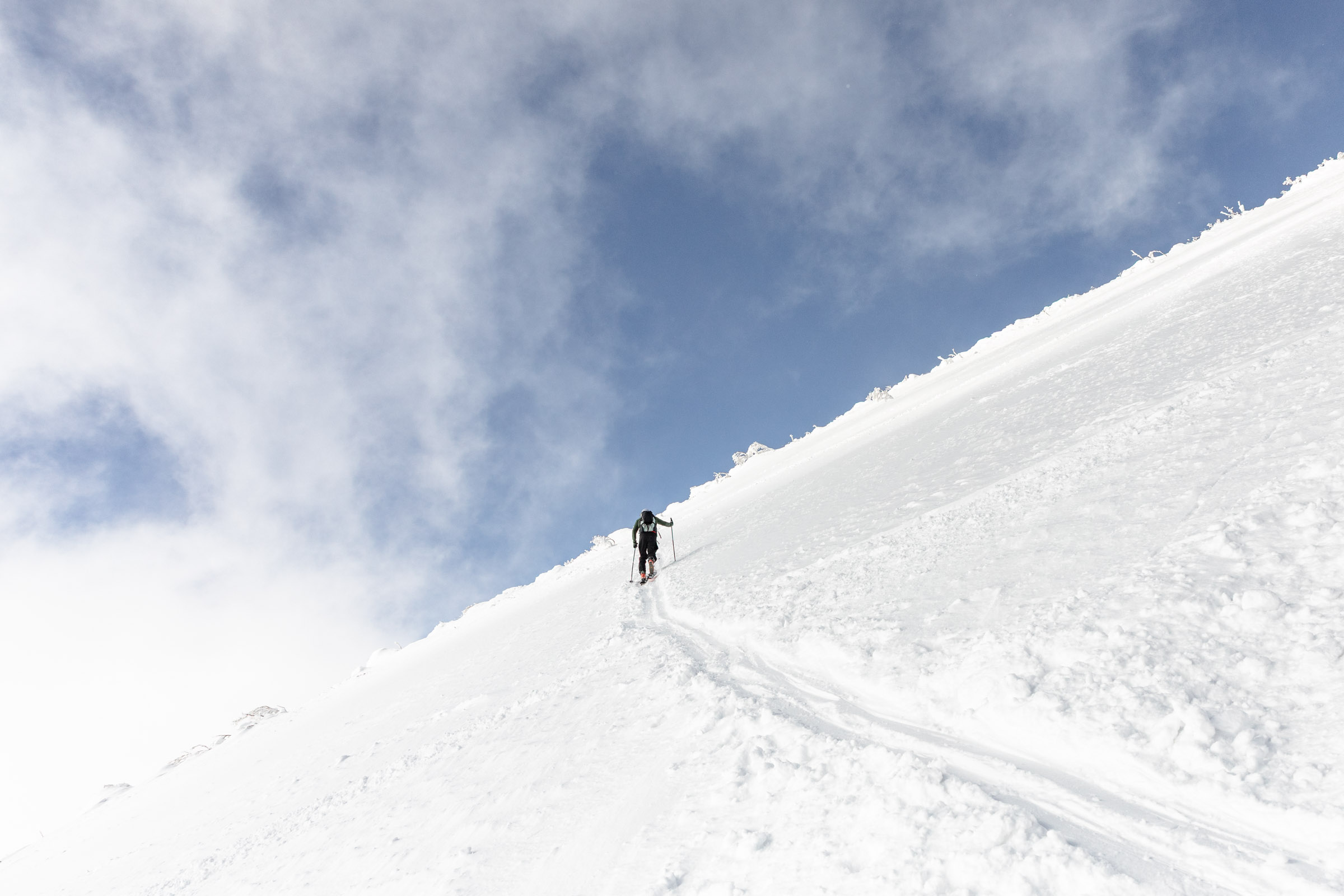
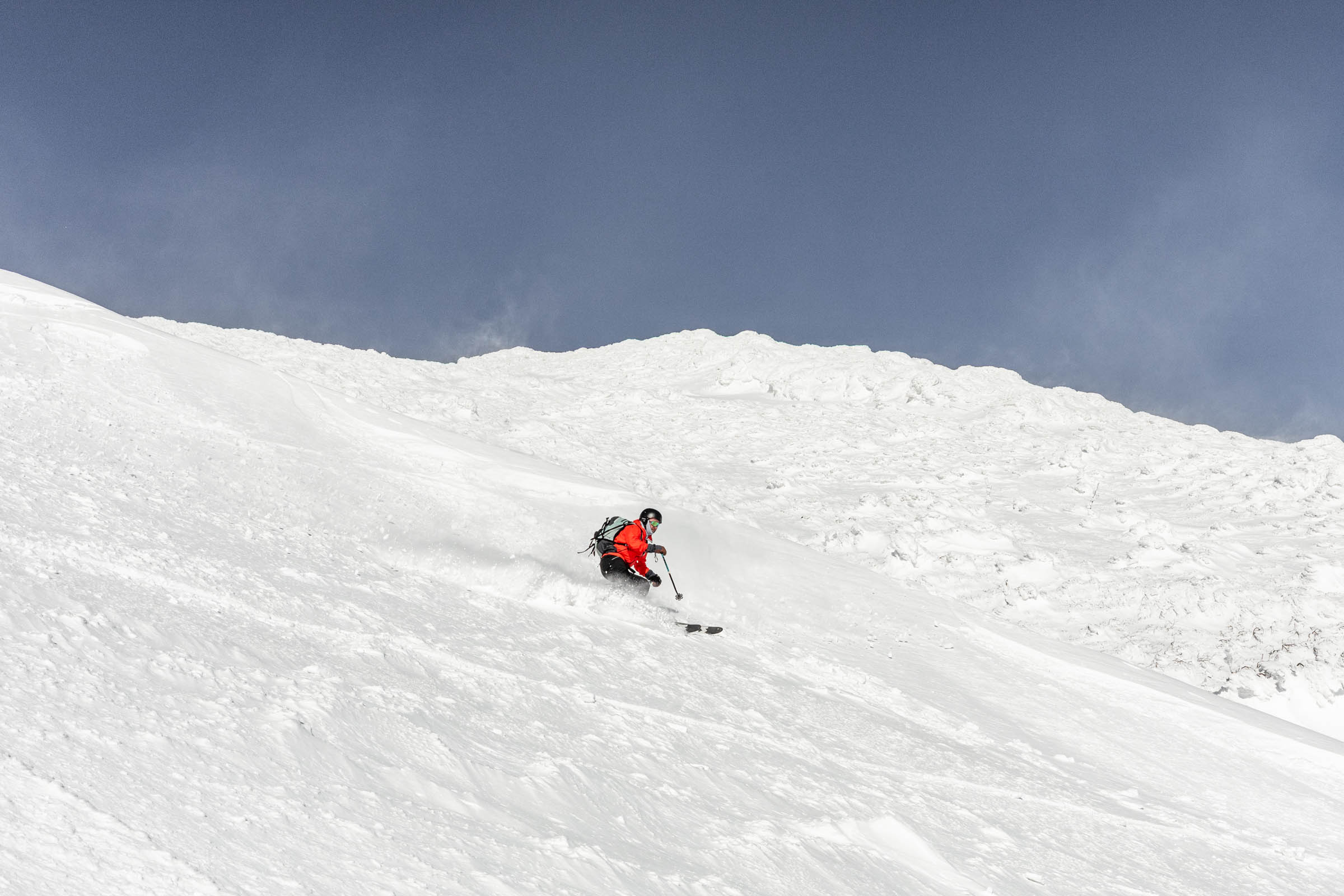
From the summit, I was a bit cautious with the descent. There was just enough space to make a few turns and side slip for me. I was glad that one of the trio from the summit headed down earlier to sort of show the way for me. No photos taken here because we were keen on getting down safely and efficiently. A few tenuous turns and then I scooted skiers right back towards the up track to get out of the wind-effected ice/snow. Here we began to find the great snow!
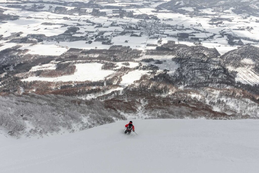
The snow wasn’t fresh by any means but it stayed cold enough that it still felt powdery. I’d call it variable snow with plenty of lovely pockets if you knew what icy patches to watch out for. On this day, some of the best snow was about 500 feet from the summit and stretched all the way down to the forest for a great 2000 ft skiing powder.
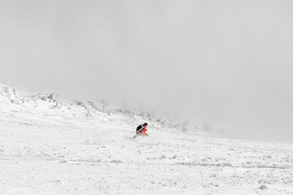
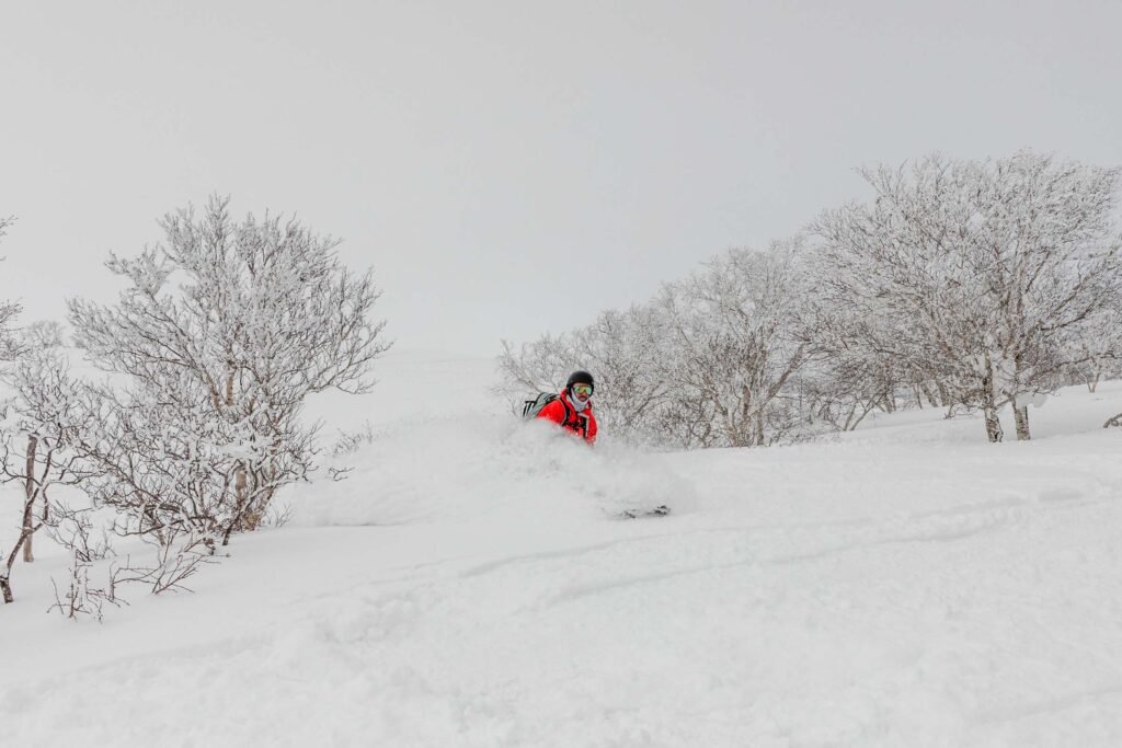
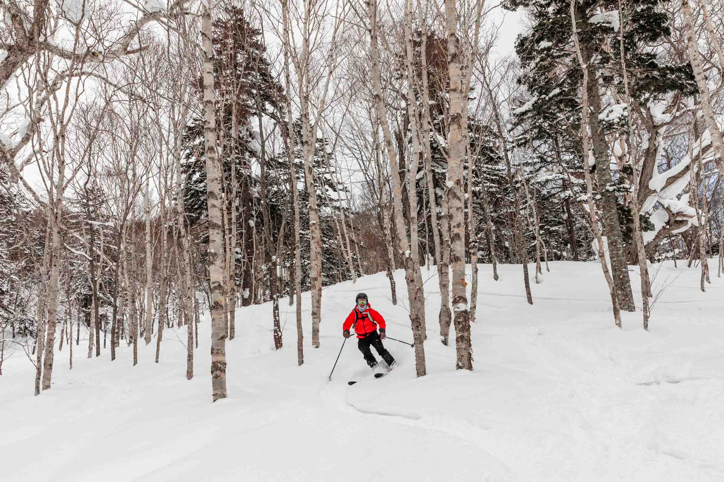
As we crossed over the ridge to get back to the Makkari side, we entered the forest. It wasn’t steep but maybe that was the issue because that’s when the snow started to get grabby. We’d cut through the crust but it would take so much effort to turn and so easy to get stuck.
I couldn’t have been happier to see the exit luge route where it wasn’t overly firm but firm enough to not get trapped. It was quite speedy too but the perfect amount of speed to send us all the way back to the trailhead without any issue. 6 hours later from the start, we were back at the cars. So many other cars had left at this point. I think since people descended early or turned around earlier.
We had just enough time to make it to the rest of our evening activities, including getting some delicious treats at the Niseko Takahashi Dairy Farm right next to the backcountry ski rental shop!
Notes
- Start: Park at the end of the road to the Mount Yōtei Makkari Trailhead. It’s about a 15 minute drive from Niseko area. It’s not plowed all the way to the summer trailhead but far enough. There are signs for where to go and likely a good skin track.
- Gear Rental: Obviously you can bring your own gear but with all the tight travel planned, we decided it was worth paying for ski rentals and bringing our own boots. We rented from Niseko Basecamp and they had plenty of new Weston skis and splitboards. It’s worth booking ahead of time to make sure you get your skis. We booked about a day or so in advance once we knew what our inbound/ski tour plan was.
- Avalanche Conditions: Check Nadare the national avalanche website for Japan. Use SW Hokkaido. It gets updated daily at 6/7am. For weather I still used Windy but definitely check different forecasts to make sure you get a good read on conditions.
- Route: There’s plenty of different routes to summit Yōtei but we decided on Makkari since it was most popular and seemed like a better route for us not knowing the area. And more likely there would be a solid skin track. Our goal was to get up and have a good time, not explore new terrain. Hokkaido Wilds is a great resource if you want to check out different routes.
Photos taken on Canon 5D Mark IV
You May Also Like
best of singapore
central coastal and city japan | kansai and chūbu region