getting lost in the meadows | lost creek ridge – meadow mountain backpacking
48 miles . 13300 ft gain . 6450 ft high
Glacier Peak Wilderness
Every year I promise myself that I’m going to explore the Glacier Peak Wilderness and the North Cascades. And every year, I manage to make it up to the North Cascades and I fail to explore the Glacier Peak Wilderness. So when my friends decided to backpack a long weekend in the Glacier Peak Wilderness, obviously the answer is yes. For years I’ve looked at the amazing trails along ridges next to Glacier Peak, a mountain I still have yet to climb. Many of the trailheads are difficult to get to and require a high clearance car, making many trails feel more inaccessible to me. And then wildfires often billow near the peak, forcing me to hike elsewhere. This year, it felt like all the stars aligned.
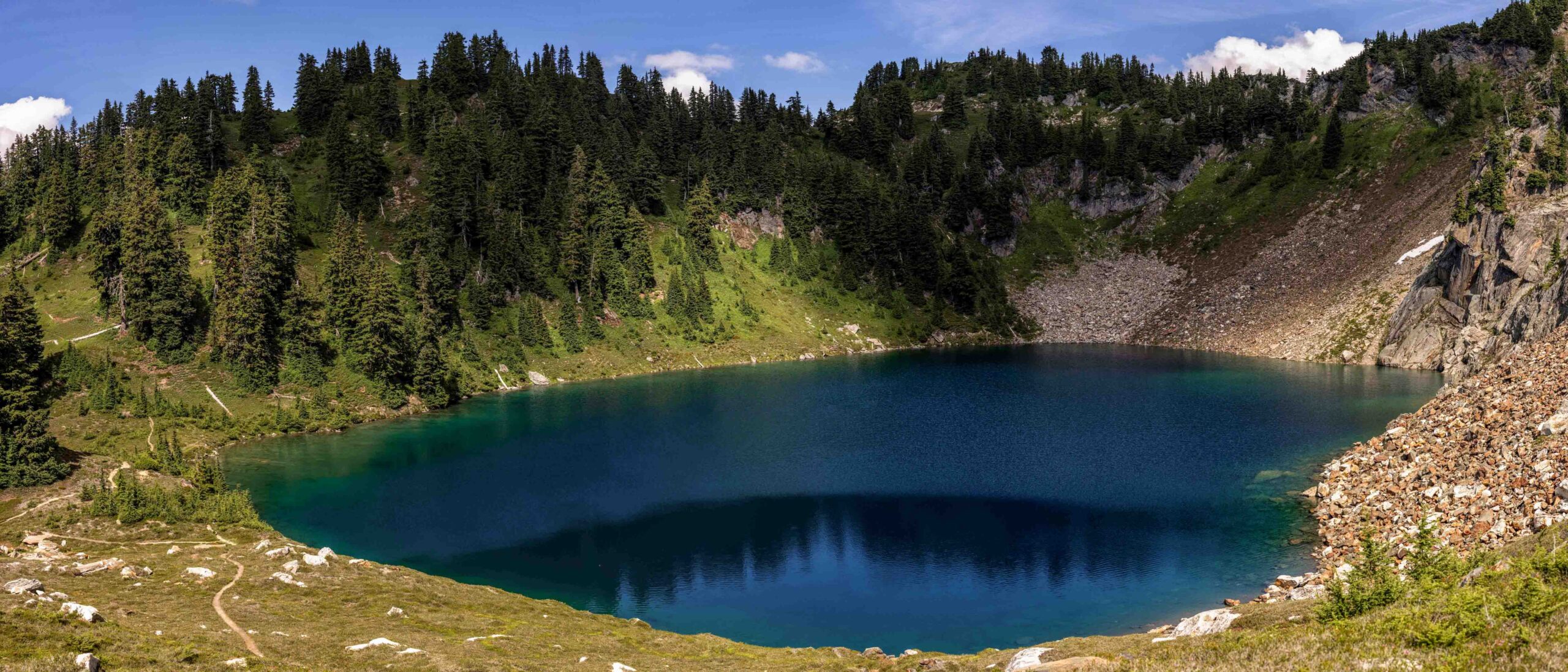
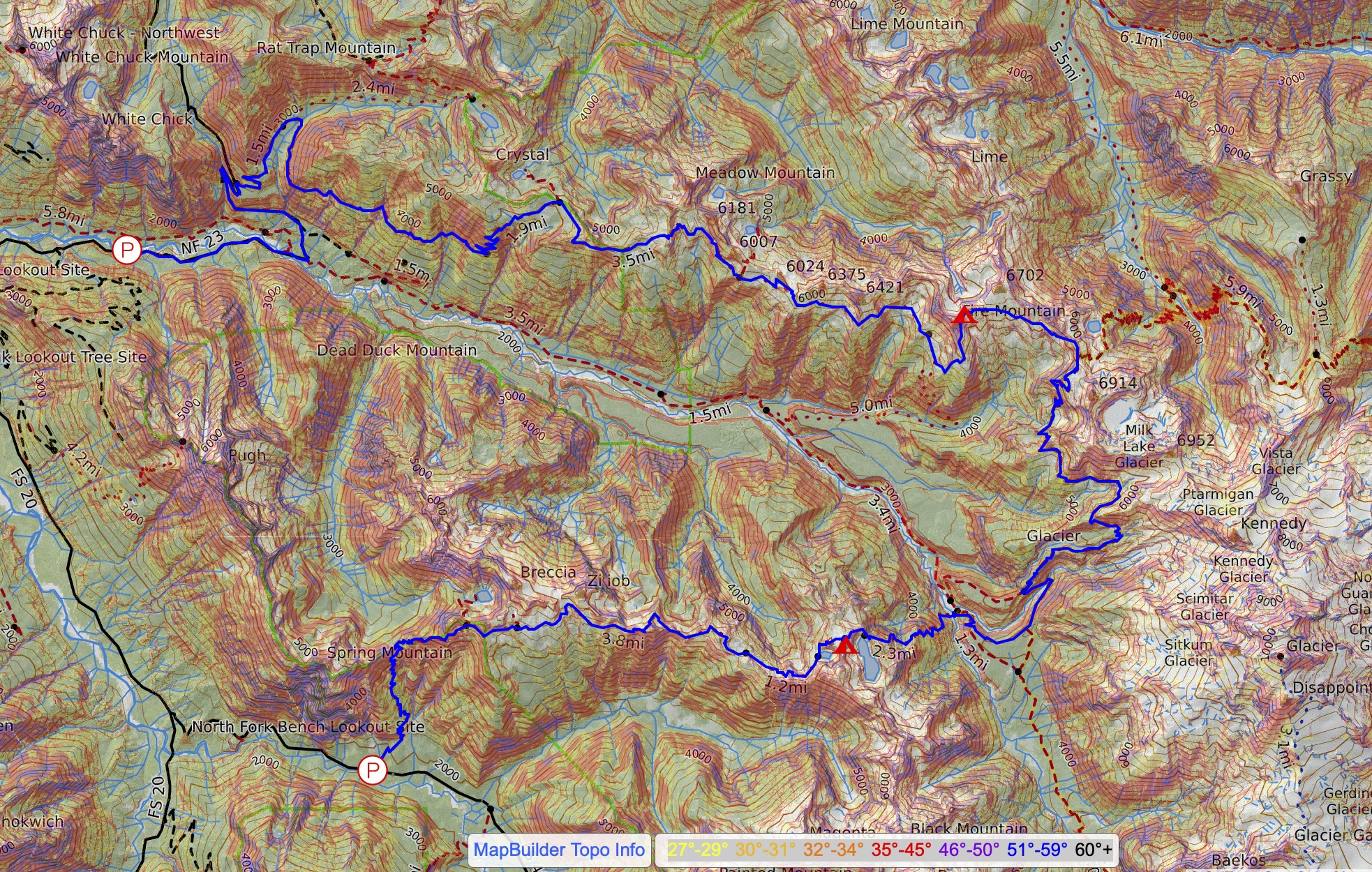
A few years ago, I hiked Breccia Peak, a little off trail destination from the Lost Creek Ridge Trail and was excited to get back on the ridge after hearing about people backpacking to this lake called Byrne. Meadow Mountain was also high on my list since the name itself seemed to hold regard. And of course there’s also Pilot Ridge and a very off trail Painted Ridge that were good options all along the west side of Glacier Peak. We settled on Lost Creek Ridge and Meadow Mountain and linking them via the PCT.
Day 1: Innocence and Ignorance
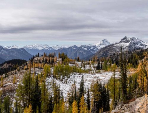
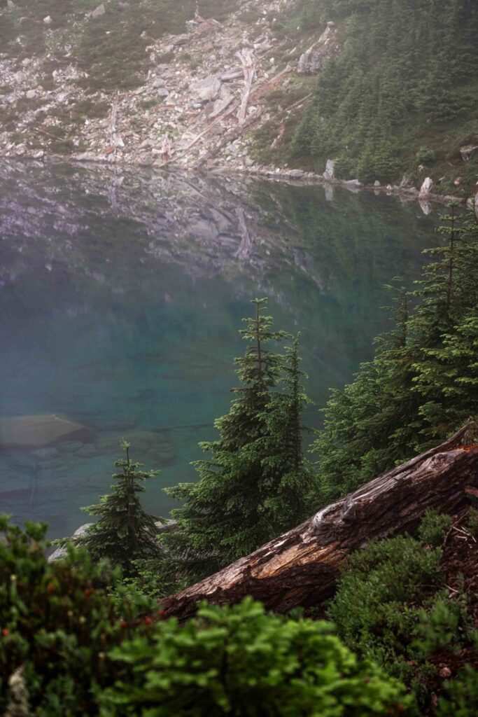
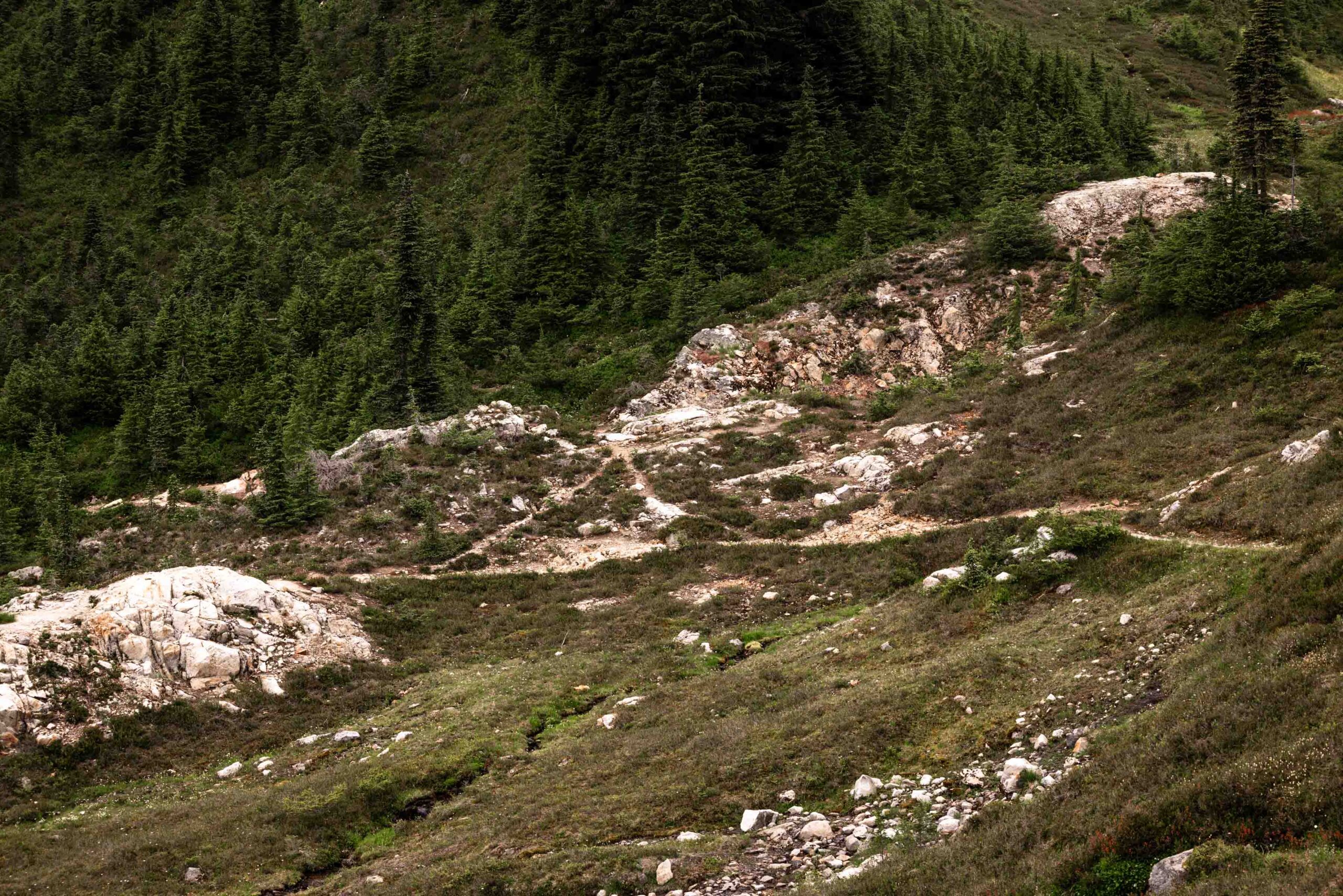
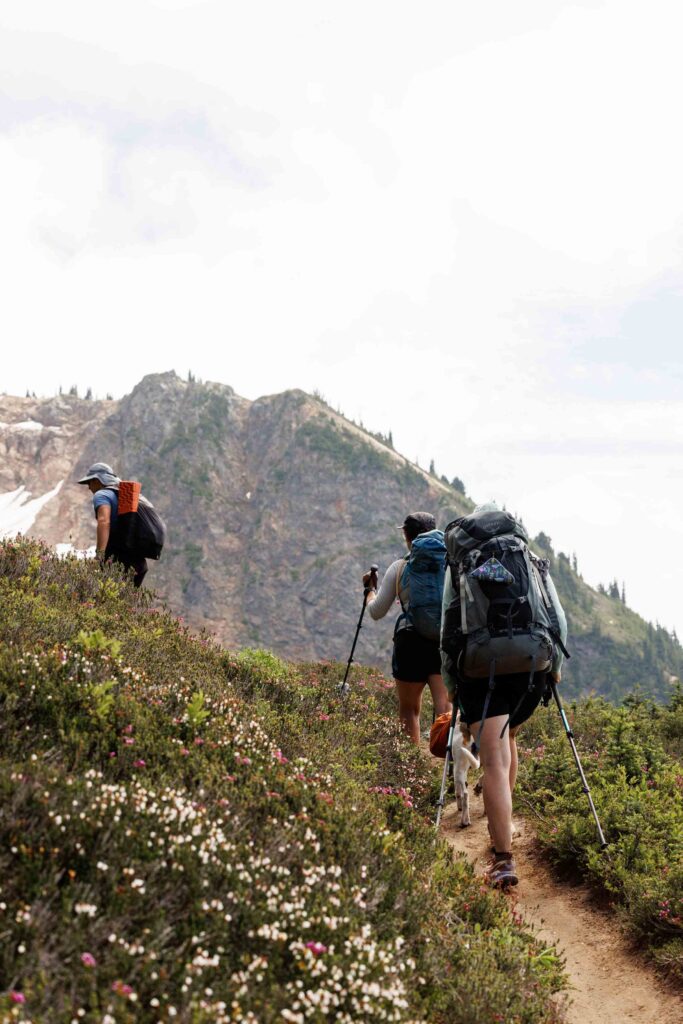
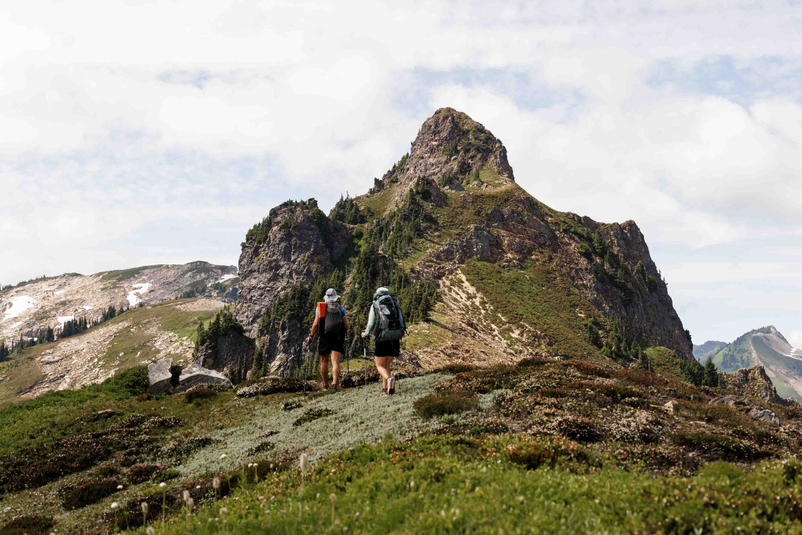
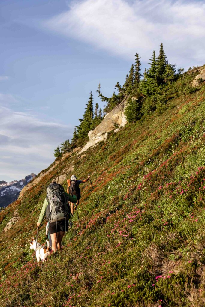
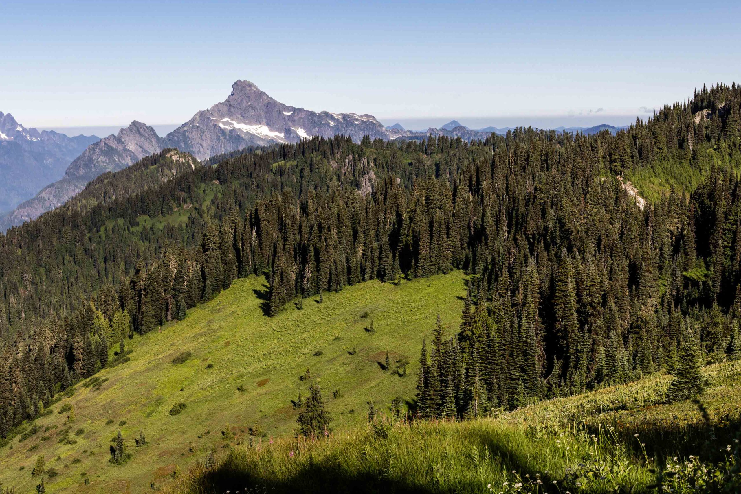
I admittedly did not research the route at all. I assumed everything was on trail and that the trail was good. And didn’t quite believe that the car shuttle would truly take an hour. We were all pleasantly surprised by how many people were at the Lost Creek Ridge Trailhead. From my last hike up here, I remembered it being more busy than I expected too! It goes to show that people find trails to hike on even when you maybe haven’t heard of them. People do their research! But I do love that usually people on these lesser known trails aren’t those big influencers (who’s to say what I am though). We had a steady climb through great trail up to Bingley Gap where we had our first snack break. I forgot that views were going to be in sight shortly so I forced us all to have a break because I was hungry. Even before the turnoff to Round Lake, the views were already opening up and stunning. Technically after, the trail is not marked as a maintained route, but it was very good. After all, people regularly hike to and camp at the Camp Lake area.
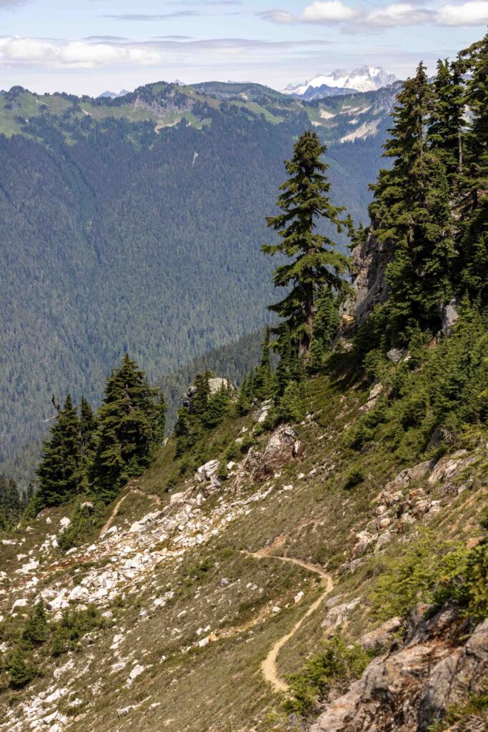
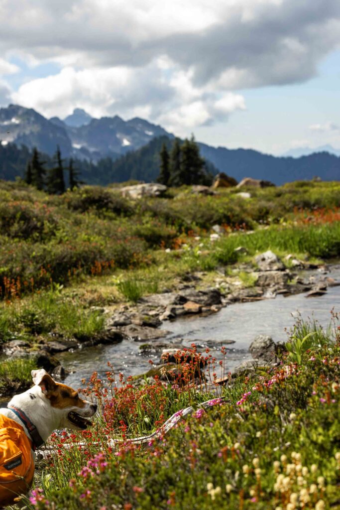
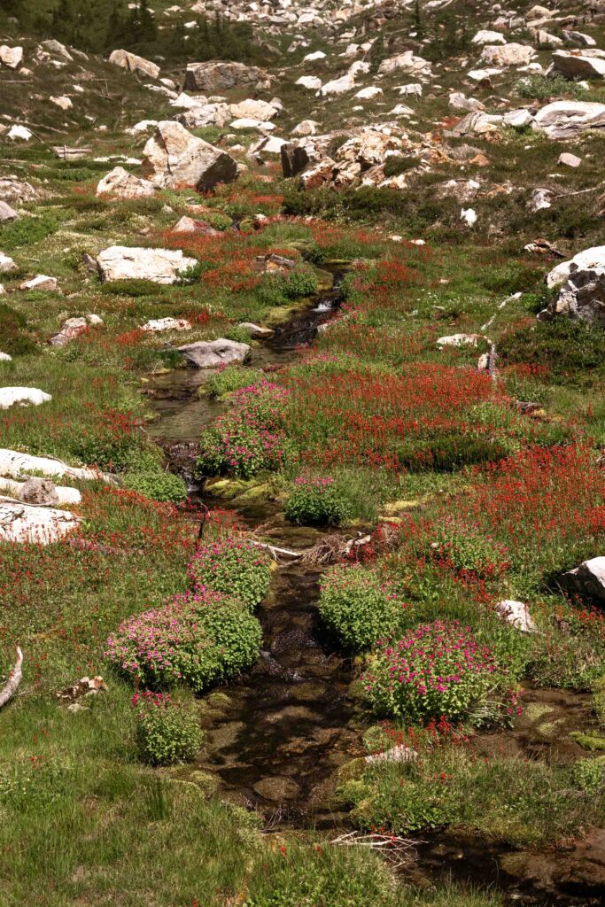
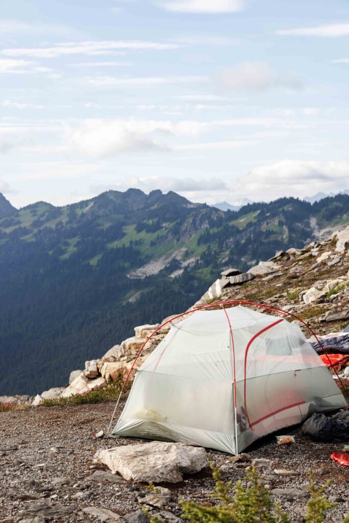
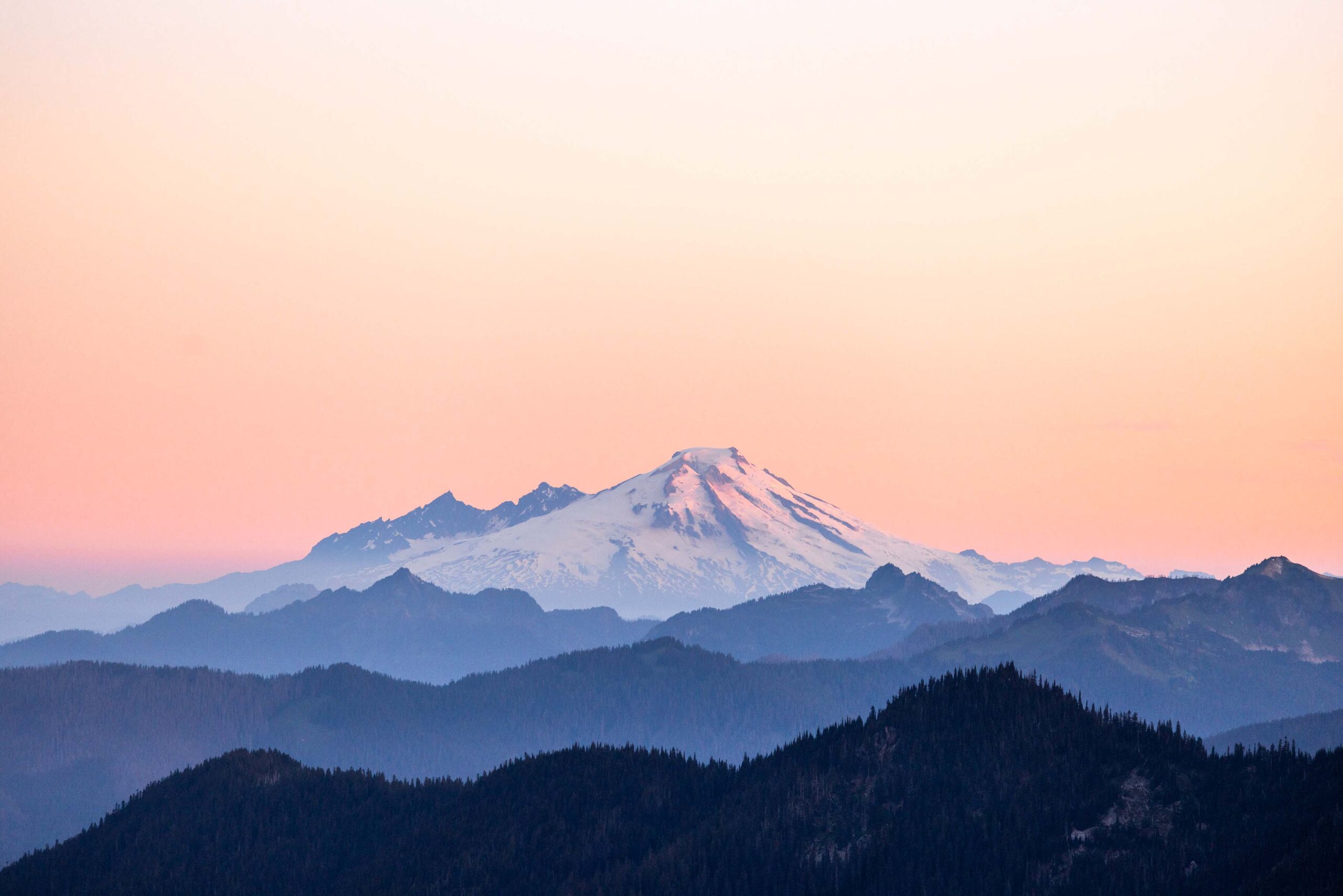
We so enjoyed the meadow walking and admiring the views of Sloan and Black Peak. Here and then, Glacier Peak would pop into view and we had plenty of water opportunities, which allowed me to only carry a 1L bottle. However, that also meant mosquitos were bountiful. I tried my best to keep my feet and legs fresh, pushing just hard enough to make good time on the trail without overtiring myself because long days were ahead. Somehow our first day turned from 9 miles to 12 miles tracked but I was glad to make camp once we passed the beautiful Camp Lake. It might be controversial to camp outside an established campsite, but if you’re far enough from the trail and not visible, it is usually minimal impact.
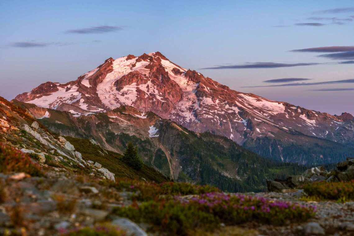
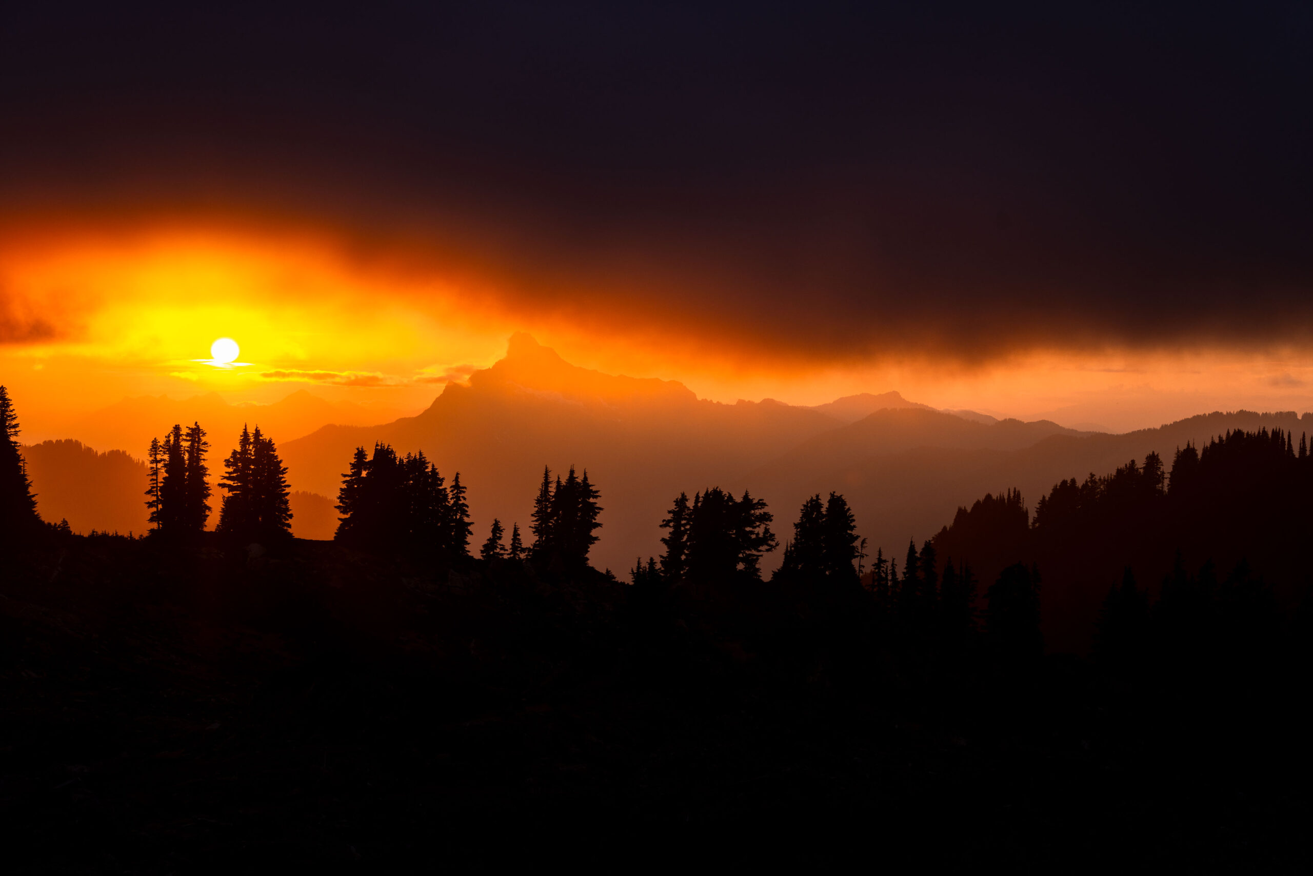
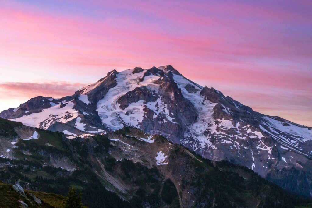
We made such good time, we were able to relax and take plenty of naps in between cooking dinner and watching the sunset. I nearly didn’t get out for sunset until I saw the pops of red at the base of Glacier Peak. The clouds had descended on us and I almost didn’t believe the west side of the ridge would have views. But remembering it was much more clear during dinner, I gave it a try and was absolutely mind blown by the fiery sunset we got! These sorts of conditions are things you can’t fully anticipate so I was so glad that it worked out well.
As we got ready for bed, I was nervous about the next day. We would have more distance and just as much elevation gain. And my friends were talking about a river crossing, and I thought little about it. I was more worried about how slow the off trail might go and if it was going to be as mellow as I initially thought. And I brought the wrong phone charger cable so this was the end of my phone and intense mapping to prep myself the next two days.
Day 2: Cruising with Cruxes
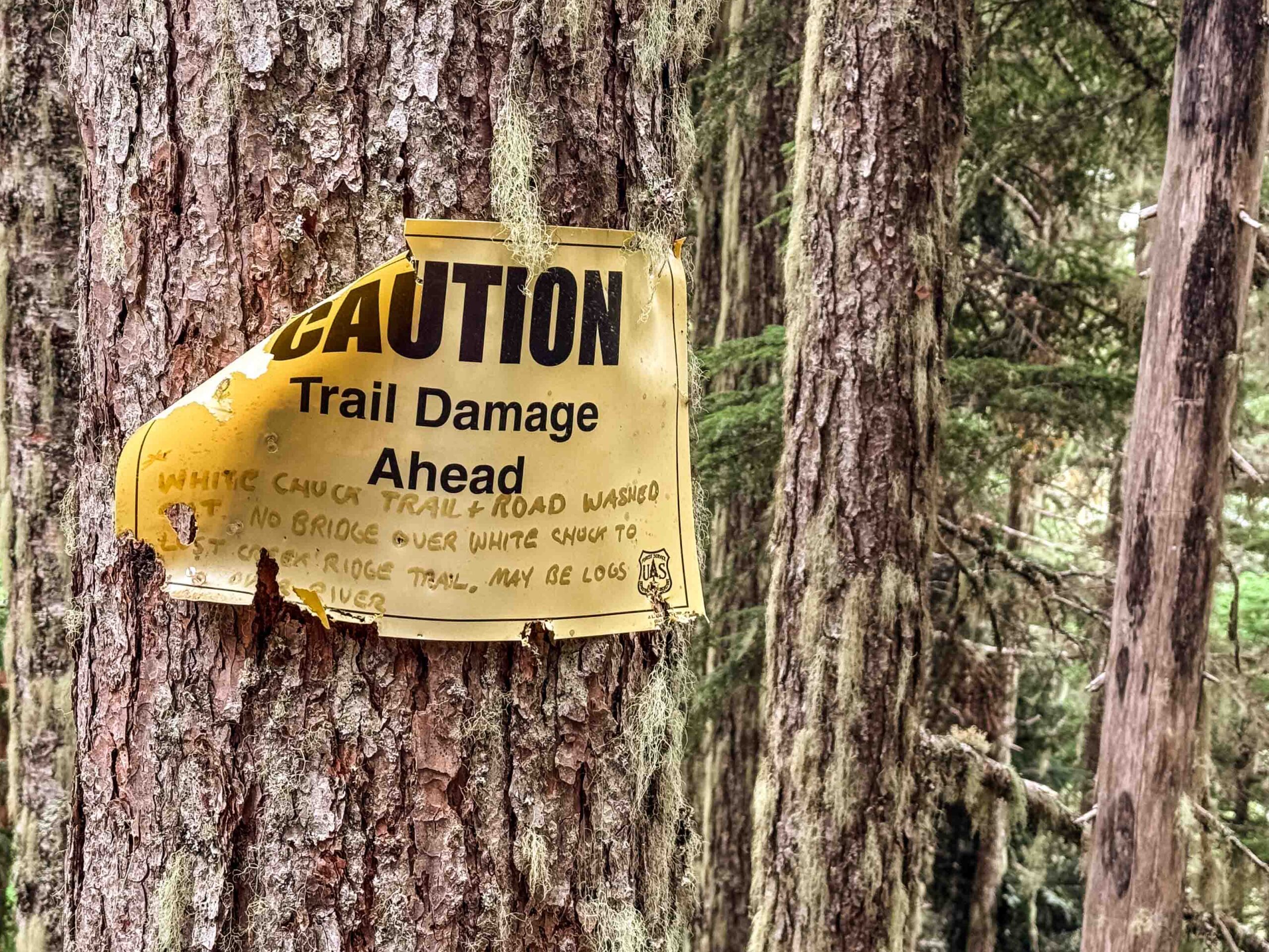
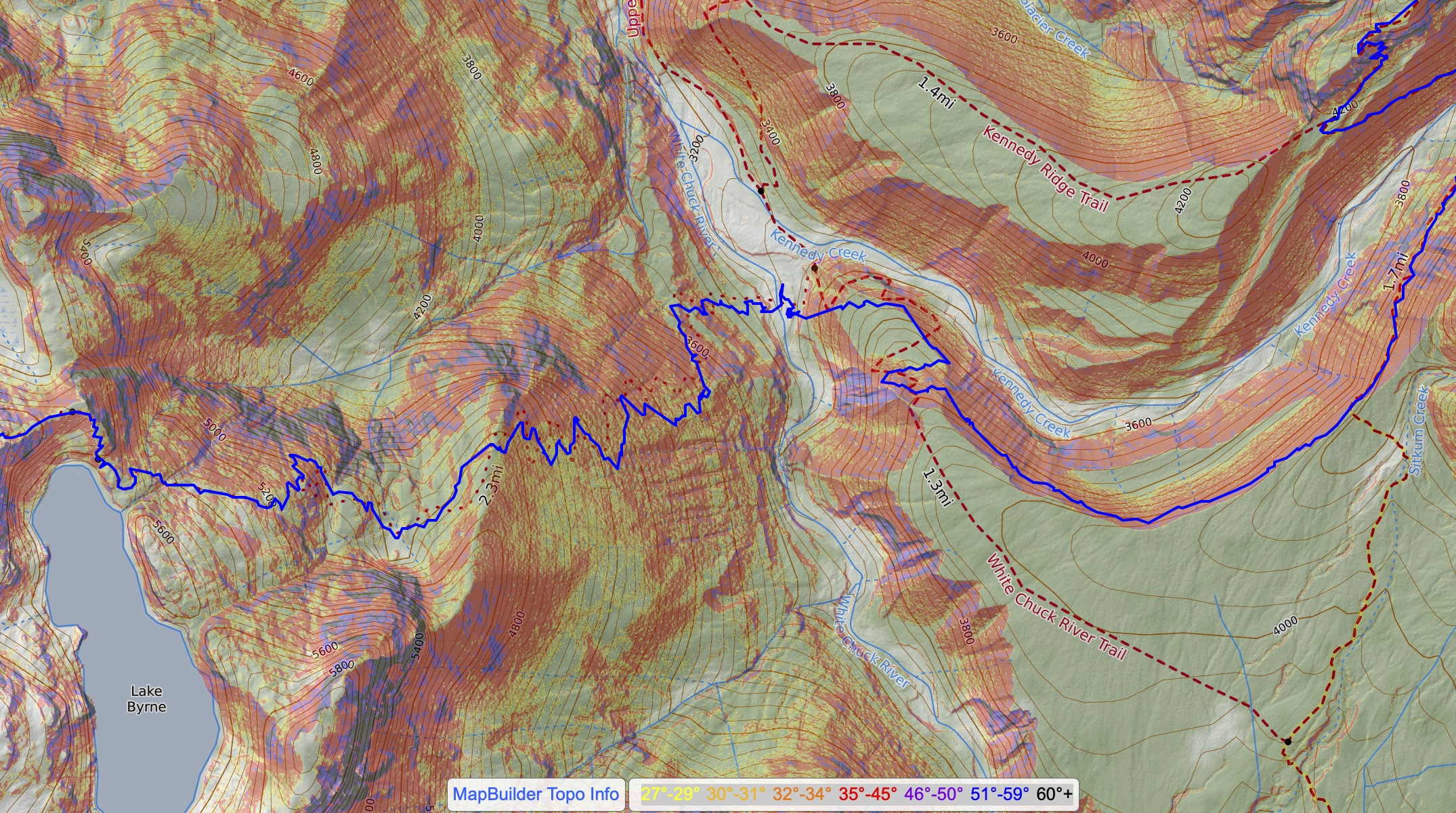
We woke up in a cloud and packed up, walking by 7am after no sunrise. It was nice to start with a descent. They’re basically easy miles, I thought to myself. But this side of the trail was much more bushy, getting scraped legs for the next hour. Clearly people don’t hike this side as often. We kept passing different water filtering opportunities since we knew we’d get more and more ahead. But as we got down to the White Chuck River, it dawned on me that my friends weren’t joking about the crossing. It was going to be a legit fording. Hard to imagine the Kennedy Hot Springs used to be such a destination out here before the washout. Additional photos from friends since I had only brought my telephoto camera and was quite a bit scared.
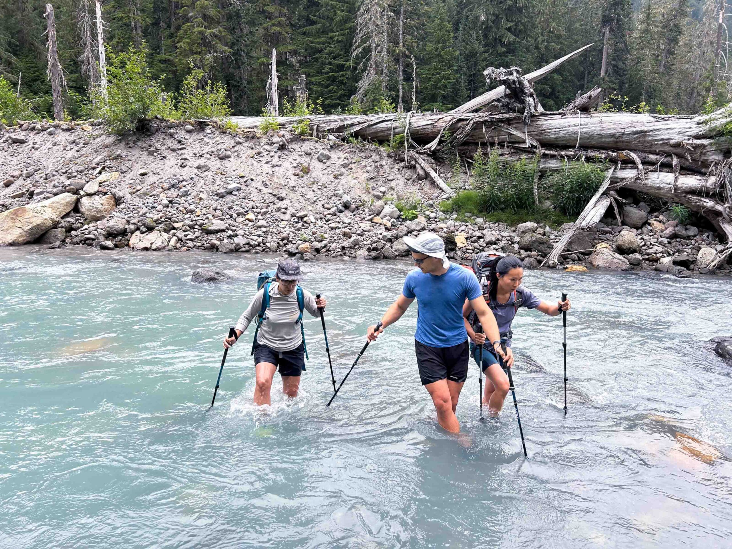
It turned out that the river fording was easier than expected. The water wasn’t frigid and while flowing fast and high, the river didn’t sweep us away. One big sigh of relief. Who knows what the water levels could be at different times of year and day. I think it was fortunate for us that the last couple days were cool and we crossed in the morning, meaning less snow melt than potentially possible. We then climbed up a very loose dirt path 40 feet up. I thought there would be other options, but we decidedly went up the “shit stain”. To our great surprise, we found a trail that was not marked the same on Caltopo, but does exist on Gaia actually. So we ended up cutting off about a mile of what we thought we would be walking on a plateau to reach the PCT. I’m not sure when it was rerouted but it was a very good trail and once we neared the PCT, there was a big old sign saying how dangerous it was to cross the river. Oh well!
Big problem down! Onto the easy cruiser bit. I hadn’t hiked the PCT much, maybe a few miles here and there and it’s so try that the PCT is mellow in general. Most of the trail has had great work done so you’re often surprised when there’s a log to scramble over or under. The gain is also mellow and I thought my legs would be cooked. Rather, as I kept chugging along, it was a very steady and relatively easy climb. Maybe it was good that my phone died because I could just play tricks in my mind with how far we had left. Don’t think, just walk.
After our major river fording, we had a very easy crossing of the Kennedy Creek and were surprised that the PCT section/state hikers were so scared about it. Laugh as we may, the creek could have very easily been a high flow, tricky fording. Later, one of my friends mentioned that experienced hikers have been known to get swept away and survive. That definitely sounds scary! I was grateful for our mellow experience.
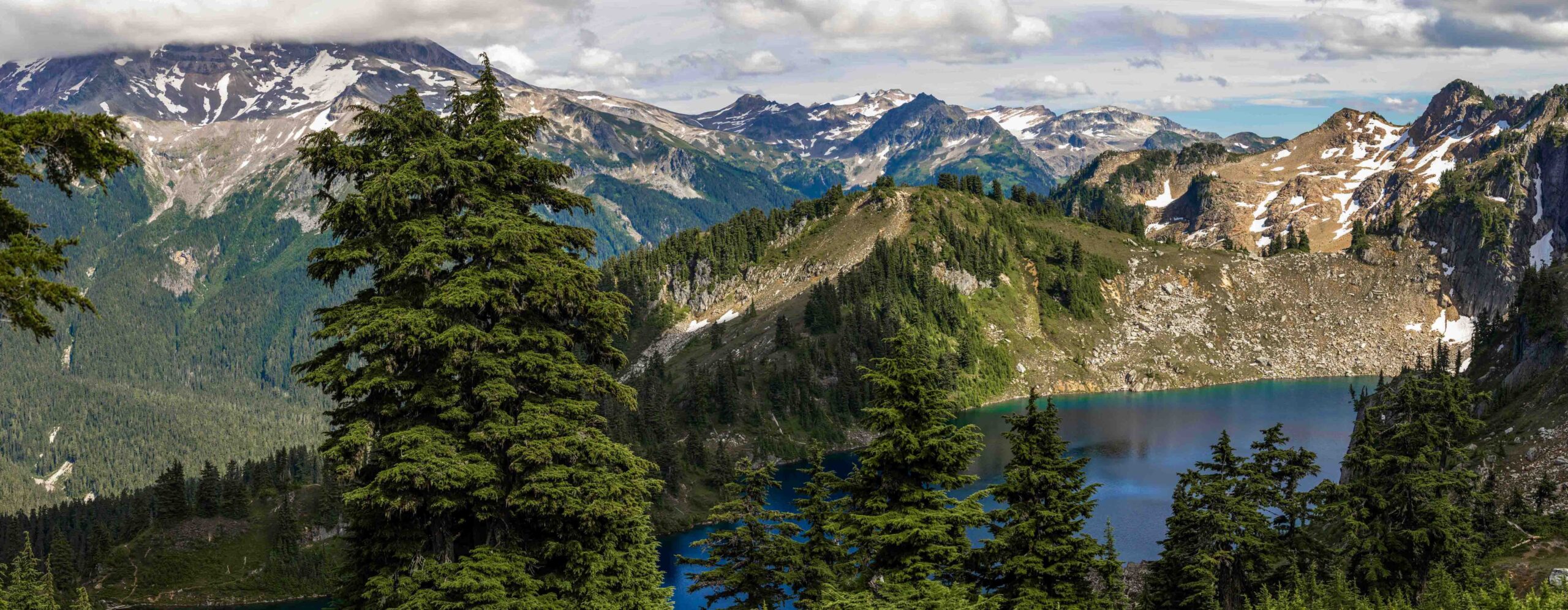
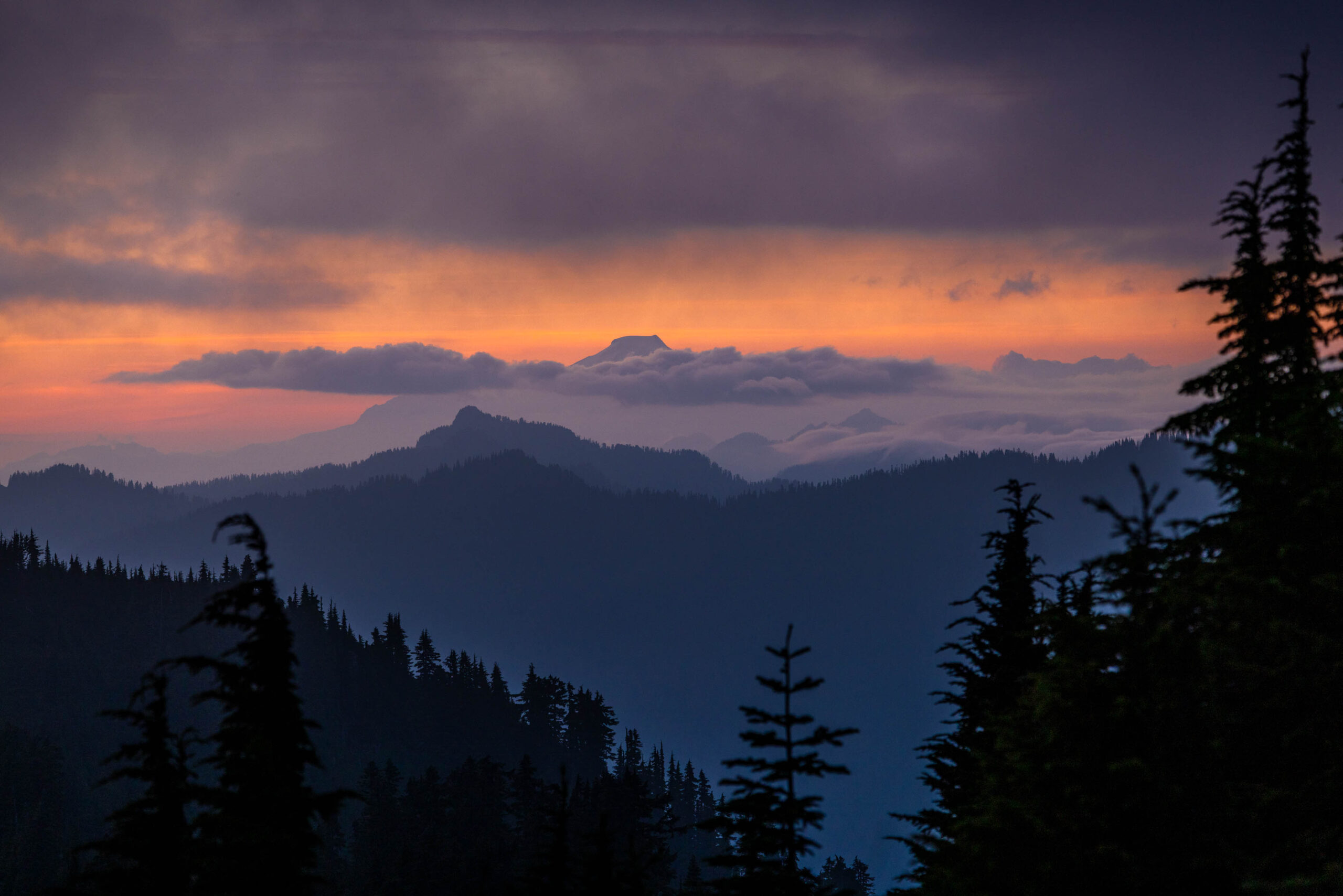
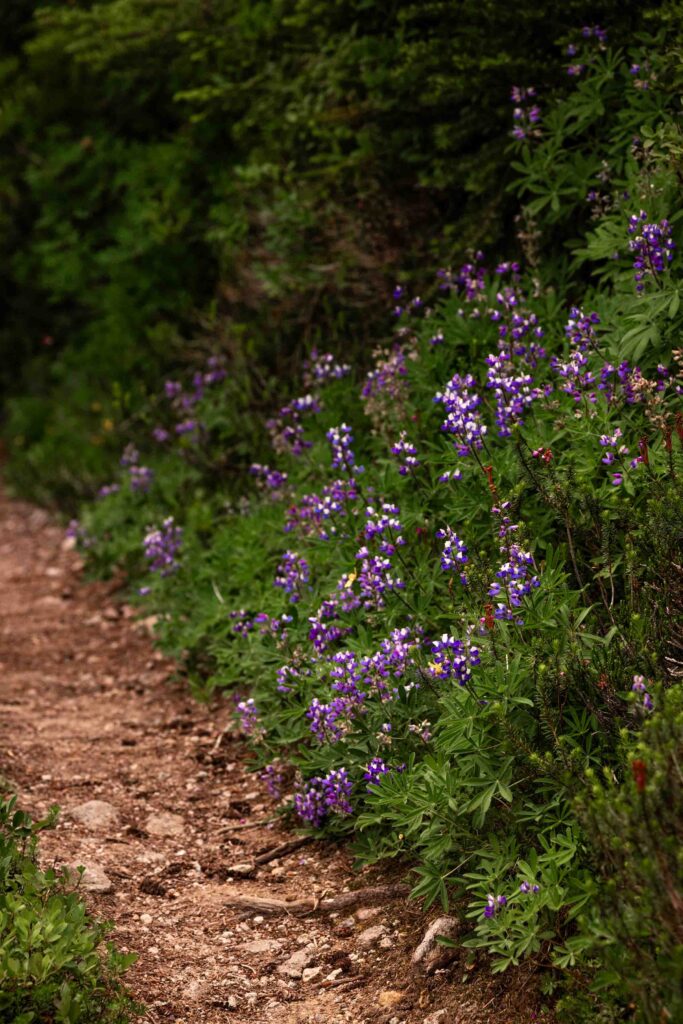
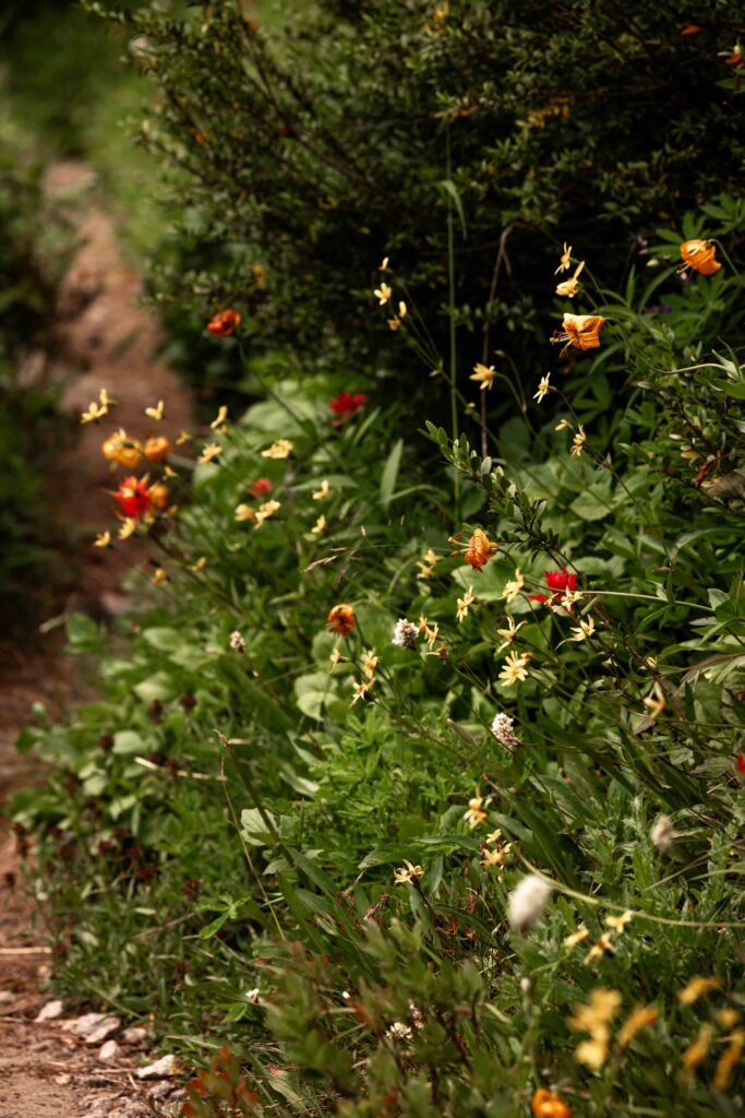
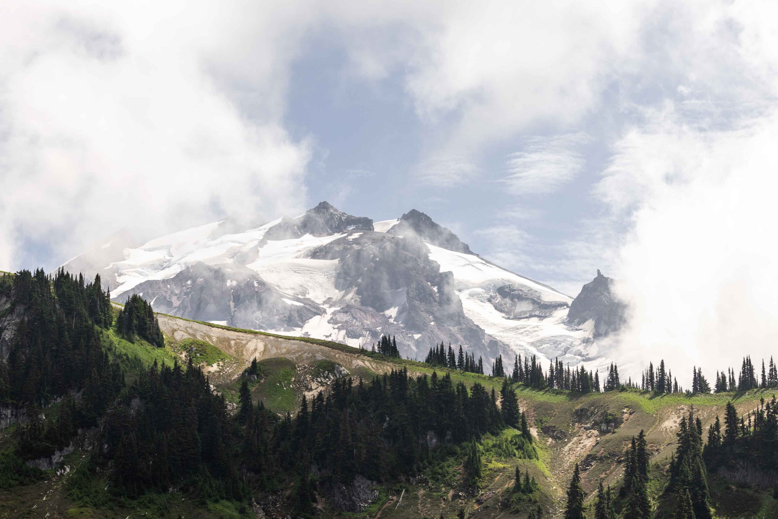
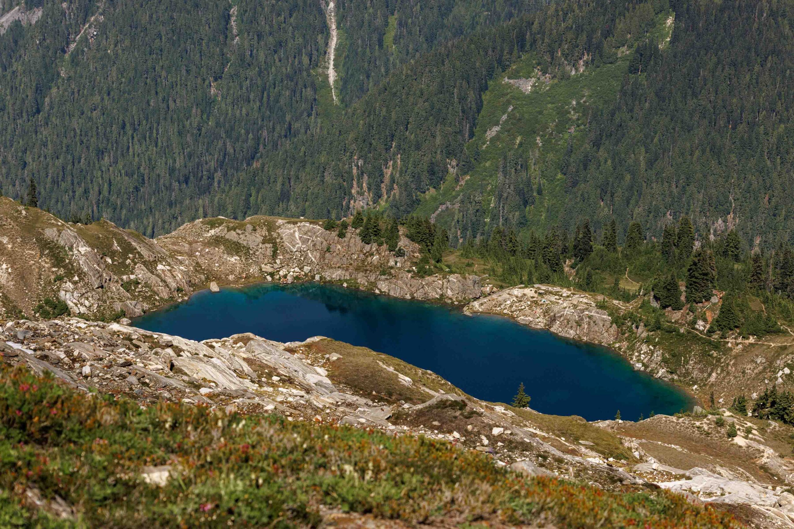
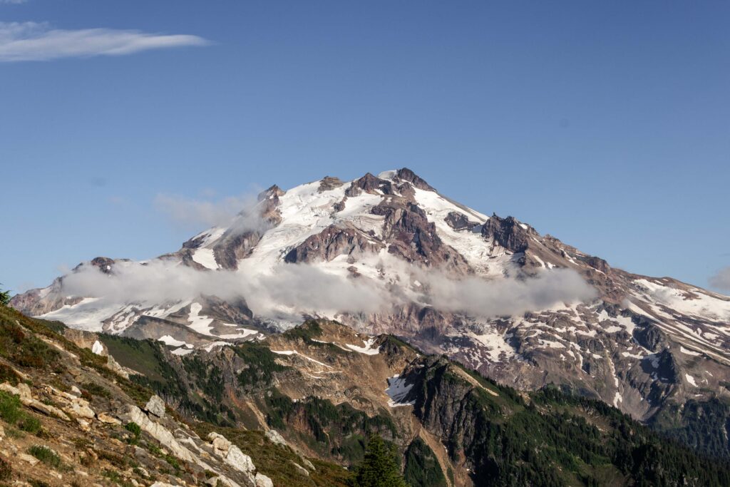
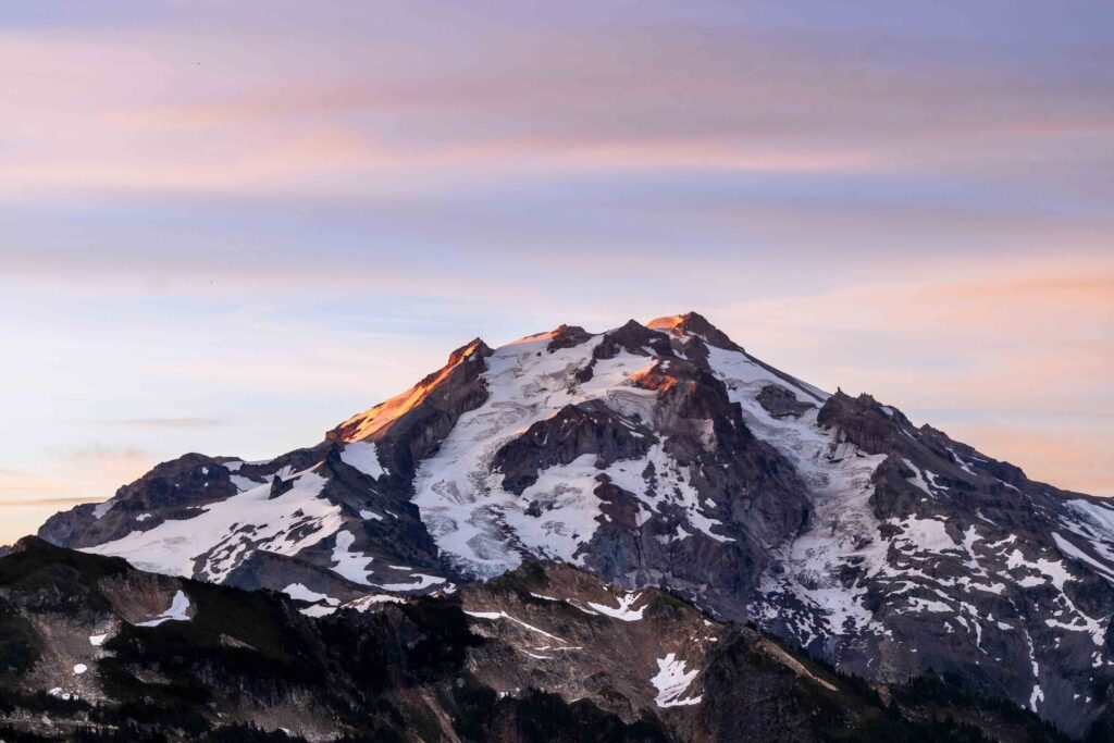
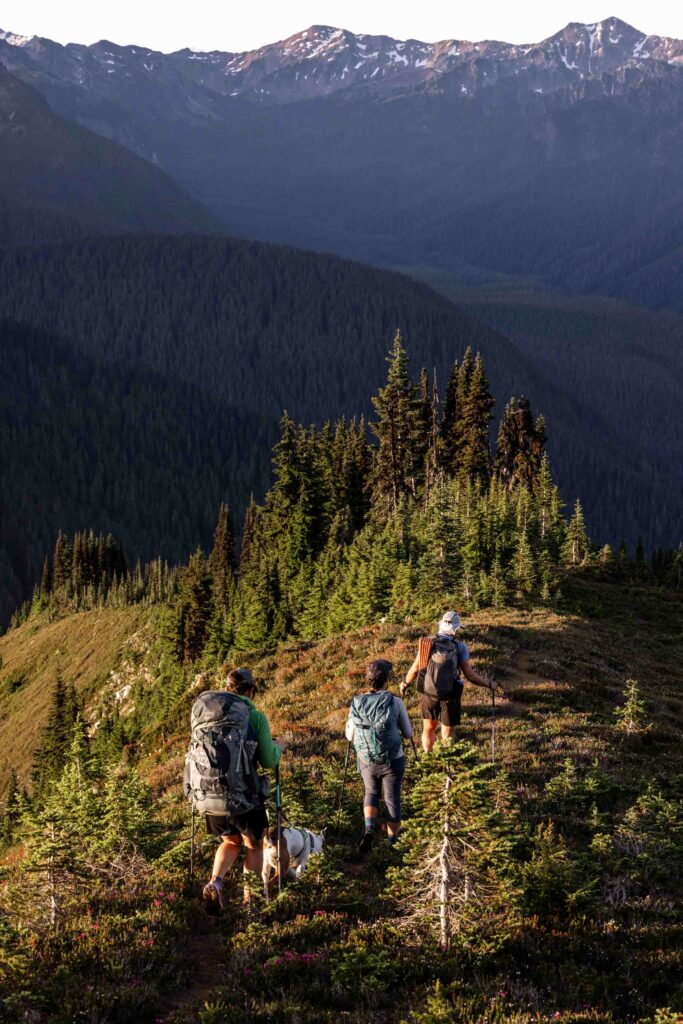
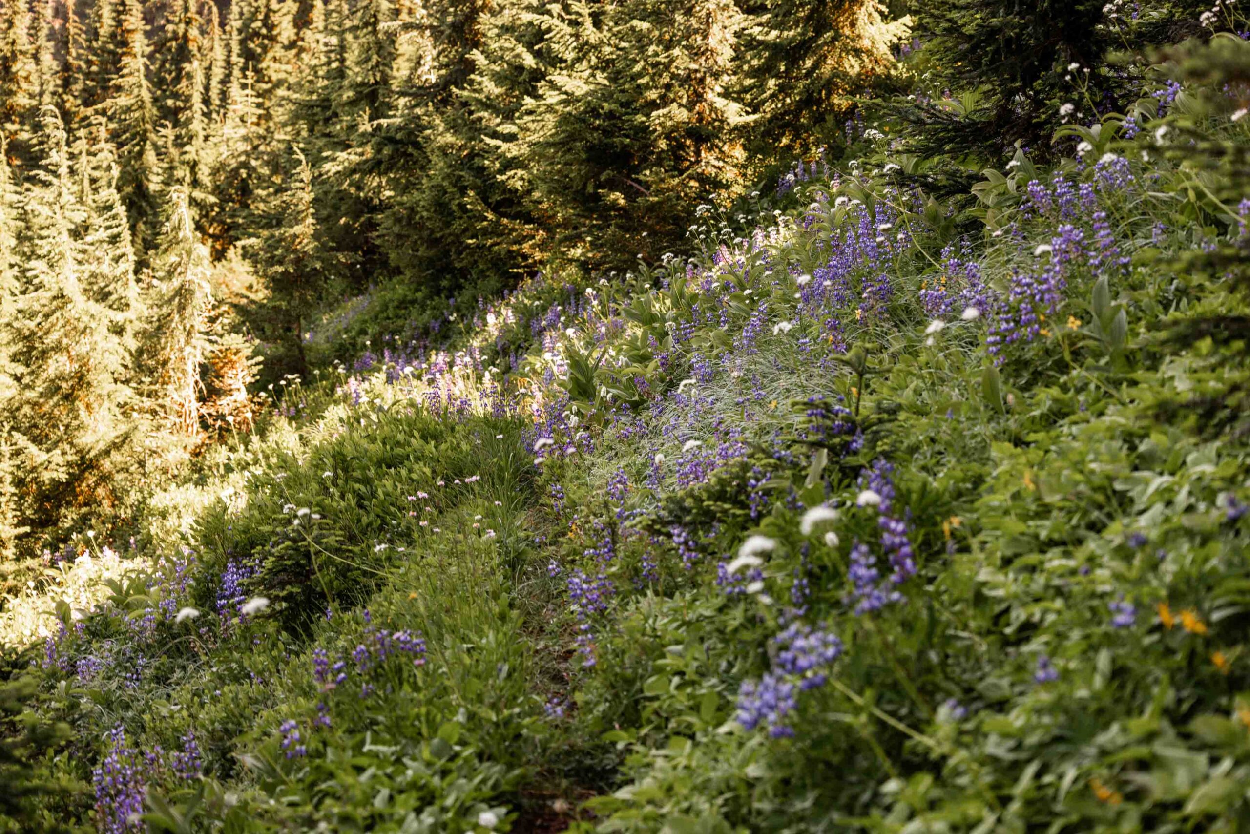
At our lunch spot (also great camp spot), the clouds started lifting so once we started walking out of our lunch spot, we got incredible views of Glacier that were like BAM! It was way more impactful from not seeing the peak since the day before due to the clouds. It was just so beautiful between the flowers and the mountain and ridge lines.
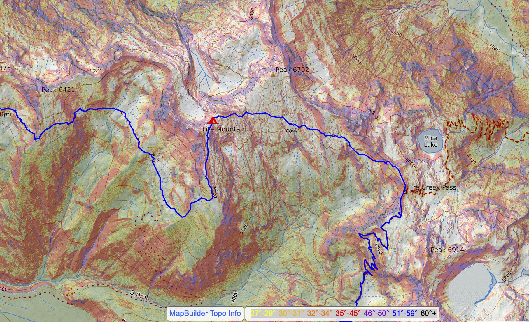
It was many more miles before we got to Fire Creek Pass and I was getting quite slow on every uphill. We had a lot of debating whether we wanted to camp where we initially thought or further since we didn’t know the condition of the Meadow Mountain Trail. Personally, I was hopeful that since it was a marked unmaintained trail, there would be a good semblance of a trail. But we wanted to set expectations low that the trail could be washed away, making travel more difficult on those steep, potentially wet meadows.
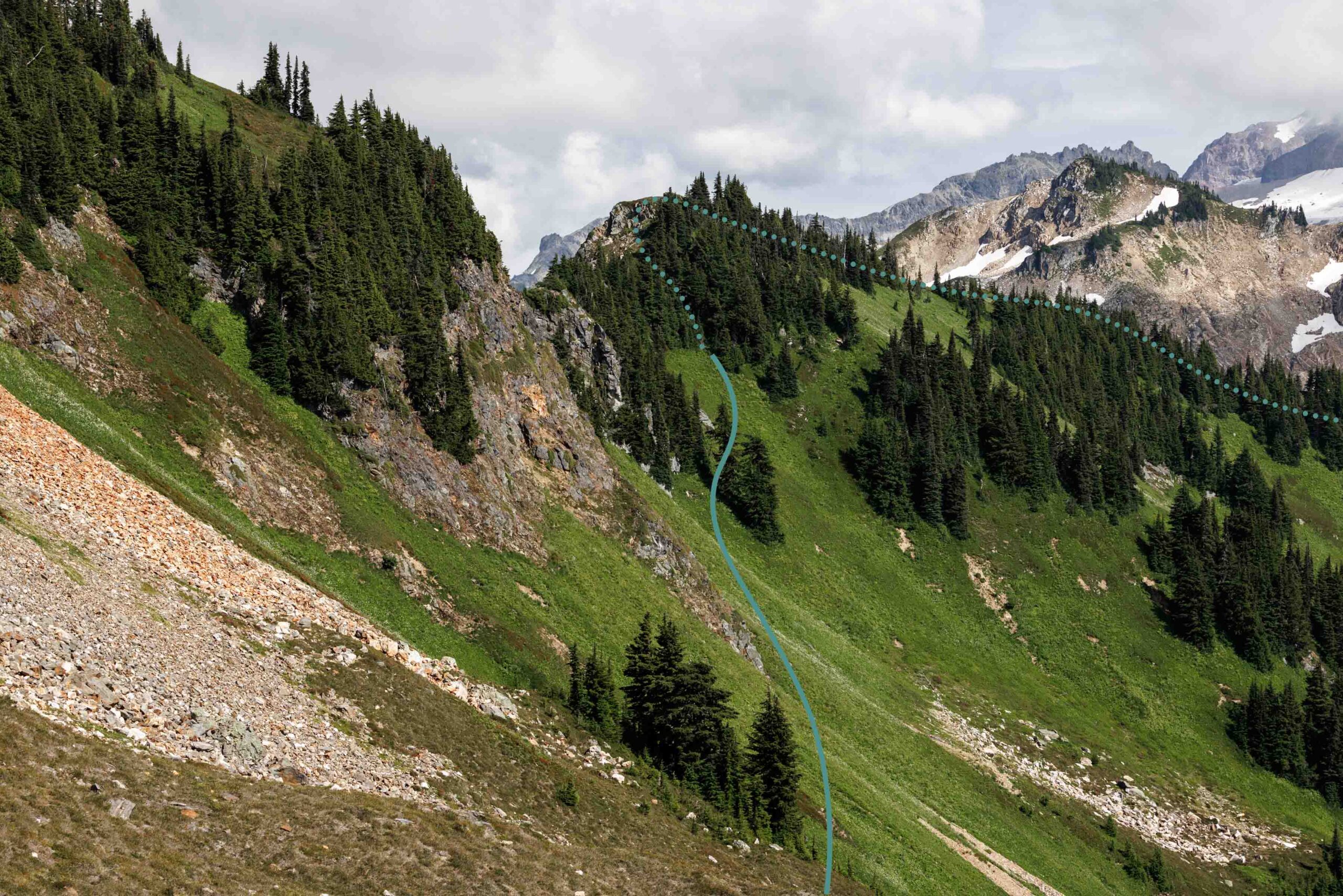
Without delay, we started heading up north on the ridge as far as we could make it before dropping west on the meadow. It was indeed steep but the veggie belays were good. This was when we learned that blueberry bushes are particularly good for hand held belays since they are well rooted. With careful footing and lowering, we eventually made our way to the less steep areas, traversing above the cliff bands. That was crux 1 of 2 for our off trail. We had one more steep cliff to navigate before it was smooth going. It was rather fine and less scary as the first crux, perhaps having gotten used to it. It was very interesting to see how we all handle off trail differently. For me, I’m better at anything that goes up and on rock and very slow on traversing soil.
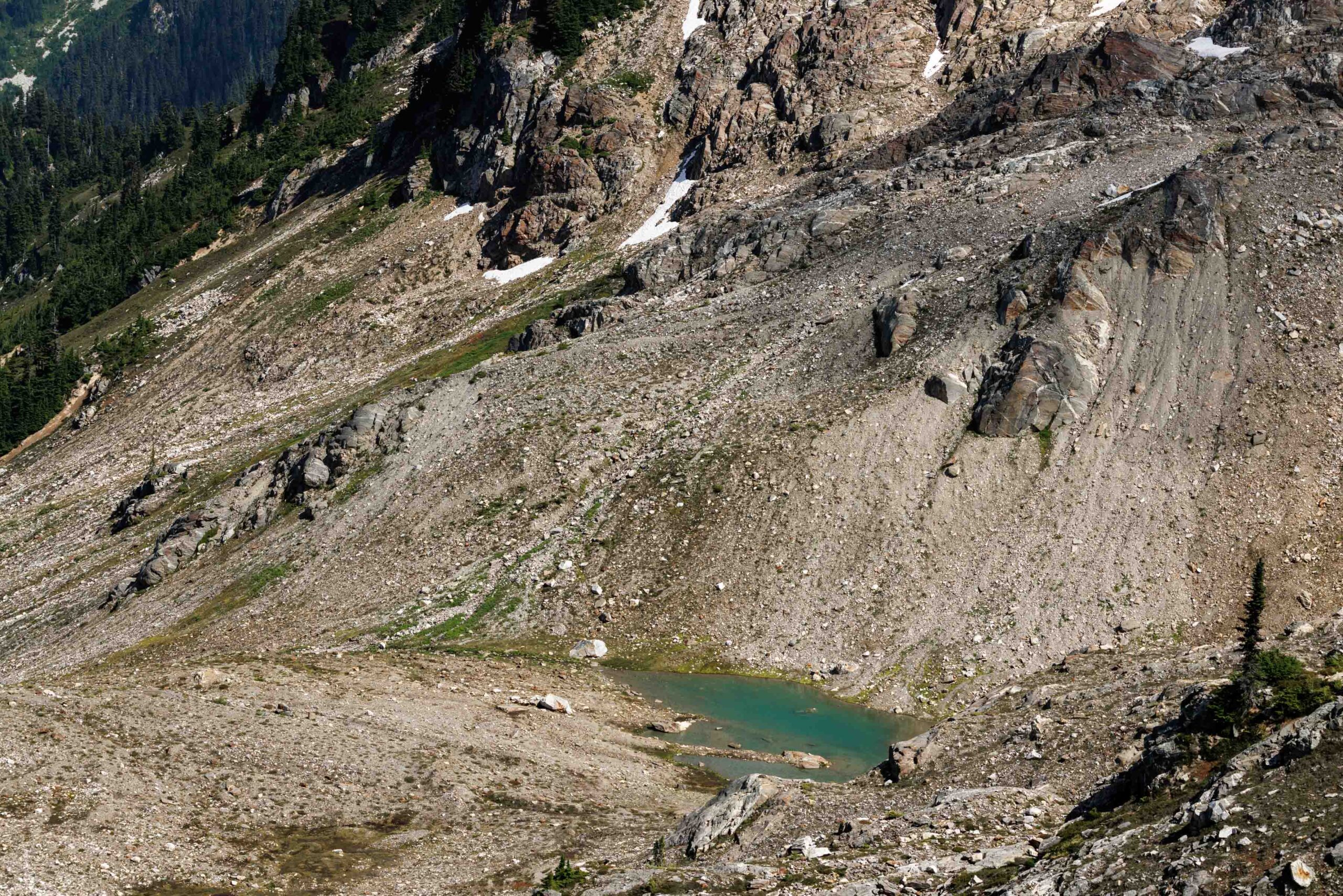
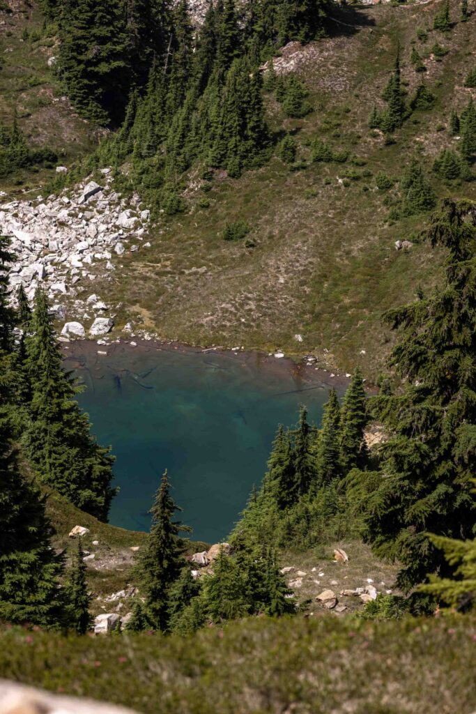
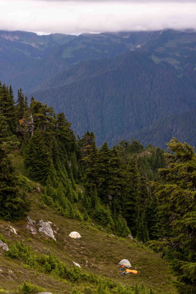
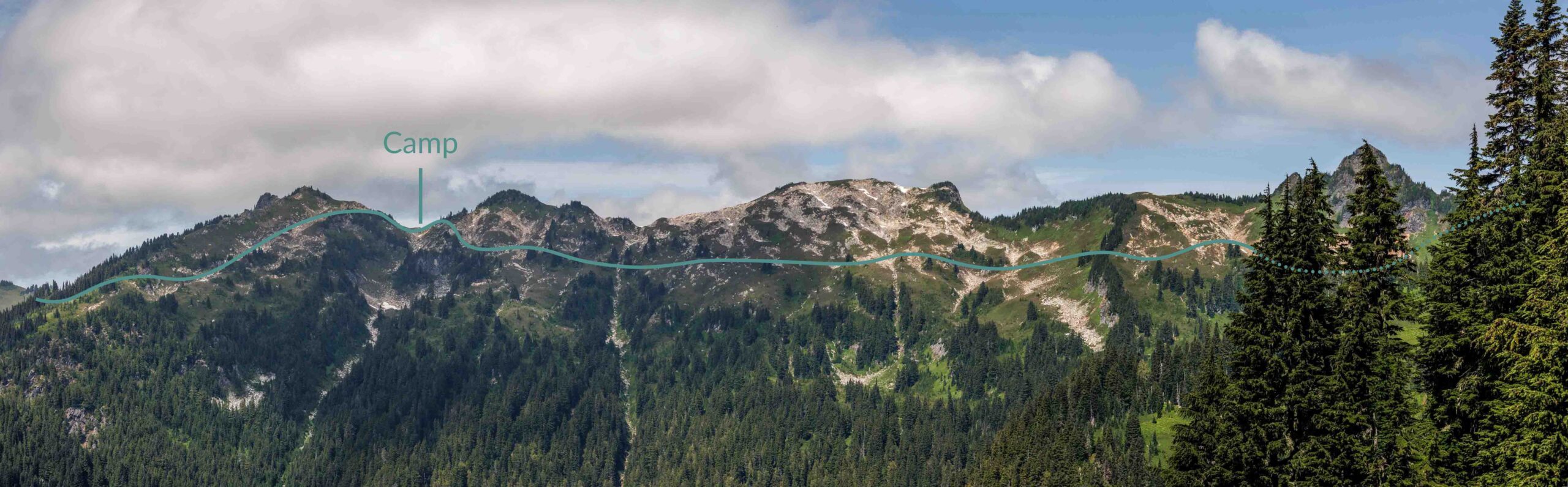
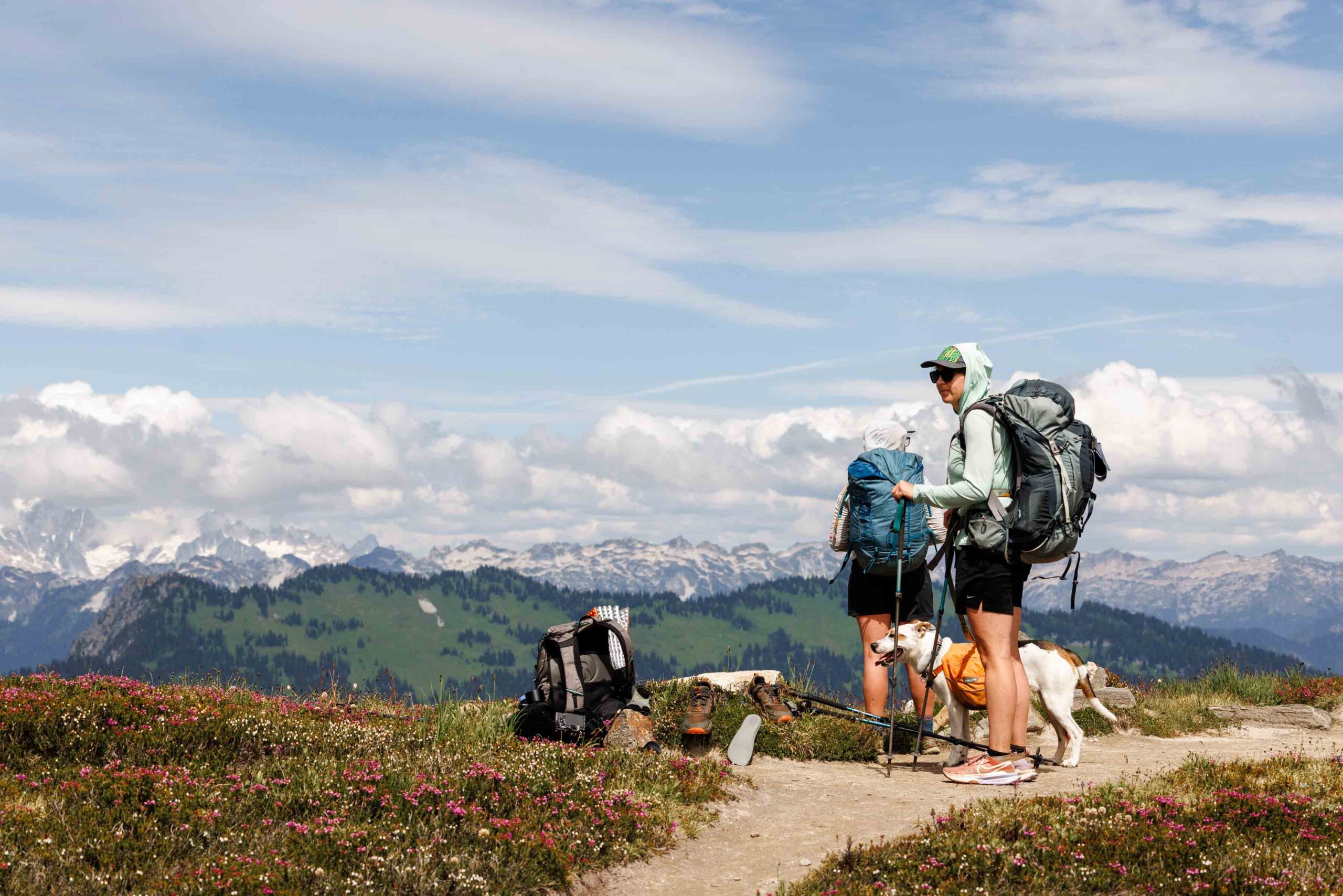
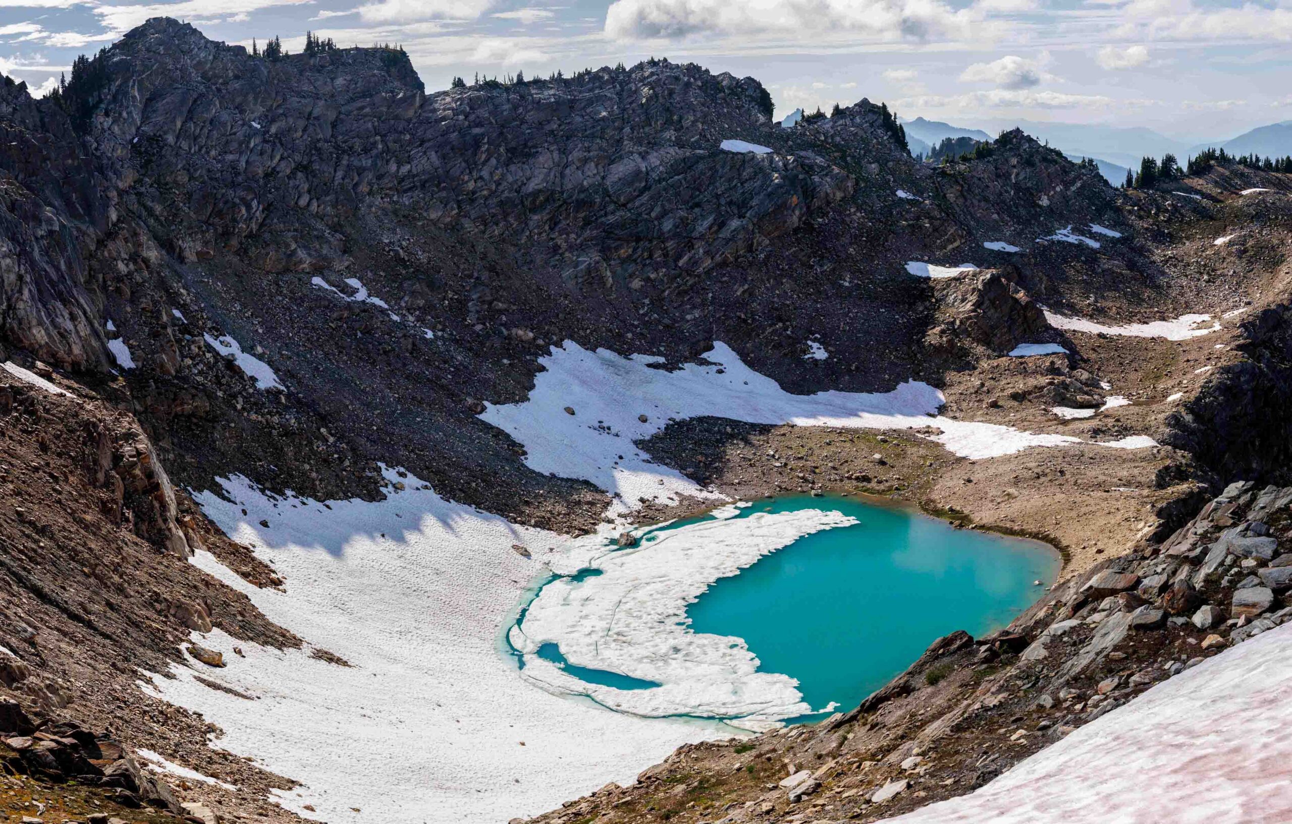
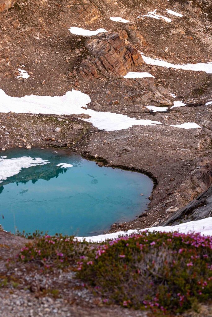
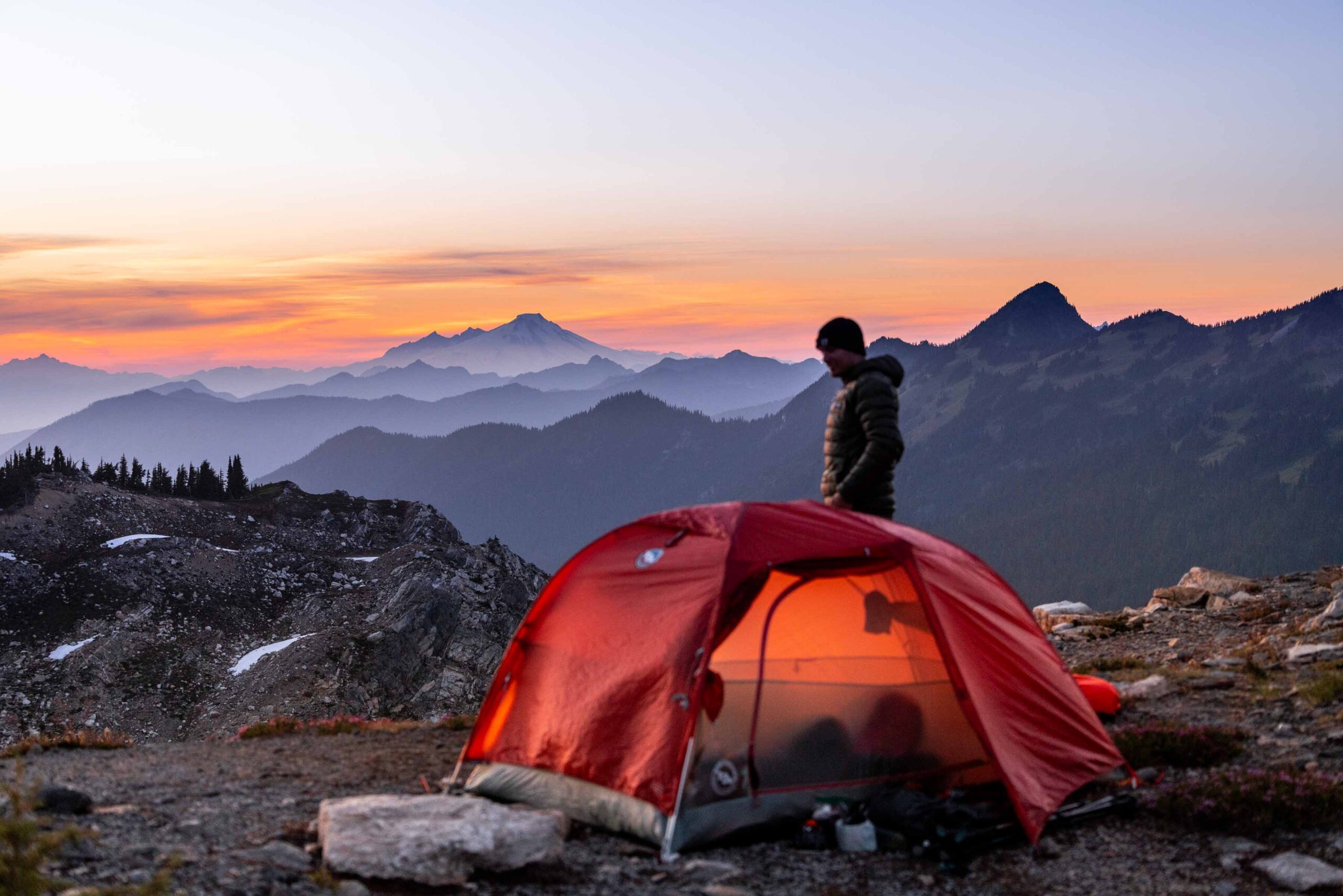
At this point, our pace had decreased dramatically and hopes of hitting the Meadow Mountain trail were getting slimmer. We thought about making dinner and then continuing. But we at last got to the col east of Fire Mountain. And wow was my friend right about the tarn below! And to my surprise (not having a phone to check tracks), we were past our original intended spot for camp. So it was great to have made a little extra progress. We decided to make camp here at the col. There were at least 3 perfect spots for a tent, as if people had camped here before. I’m sure we weren’t the only ones but I’m sure we were one of a few! Cols are so interesting because they often have a flat spot for camp by natural circumstances.
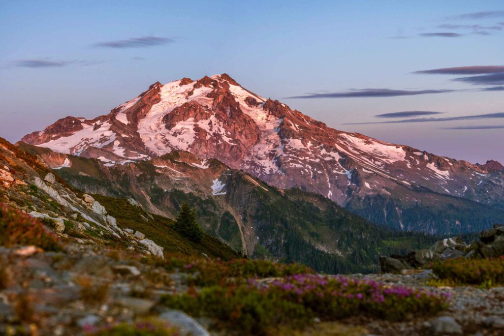
This was an incredible camp and I could finally relax a little more and be thankful for where we’re at and enjoy the views. More naps were had as we waited for the sun to set and give us a great view compared to the day before. There was a lot of getting mentally prepared for the next day. We got an updated forecast and determined that it was unlikely to be dew in the morning due to a lower dew temperature than low temperature.
Day 3: Speedy Sauntering
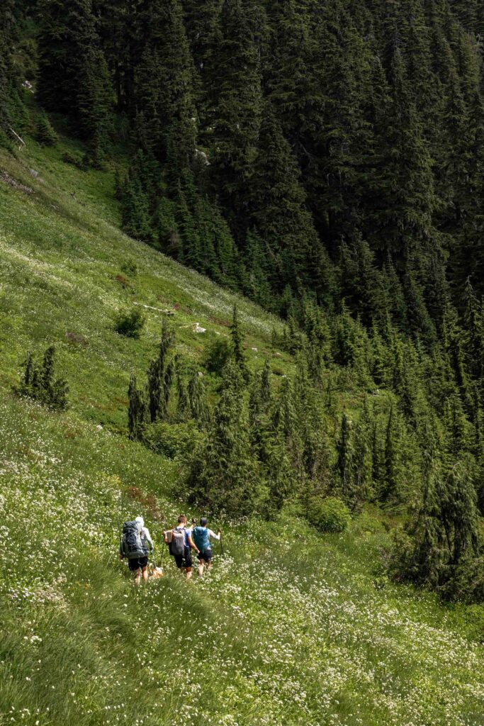
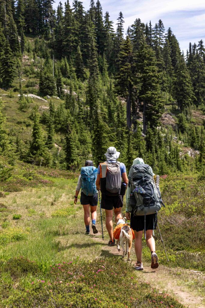
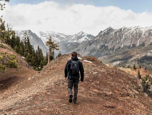
We woke up earlier on the third day to give ourselves the most time since we didn’t know what was ahead and had 20 miles to hike out. Big oof! After the sunrise, we started hiking around 6am, beginning with a short uphill climb to reach the ledge before descending and descending. It was fun walking above the cliffs with beautiful morning views. We found an easy way to get up and over the ridge where we kept descending on the more mellow southern slopes of the ridge. Then we turned north west and made our way down to the supposed Meadow Mountain Trail. I was thankful for friends to navigate so I could sit back and enjoy the views and take photos. And be slow.
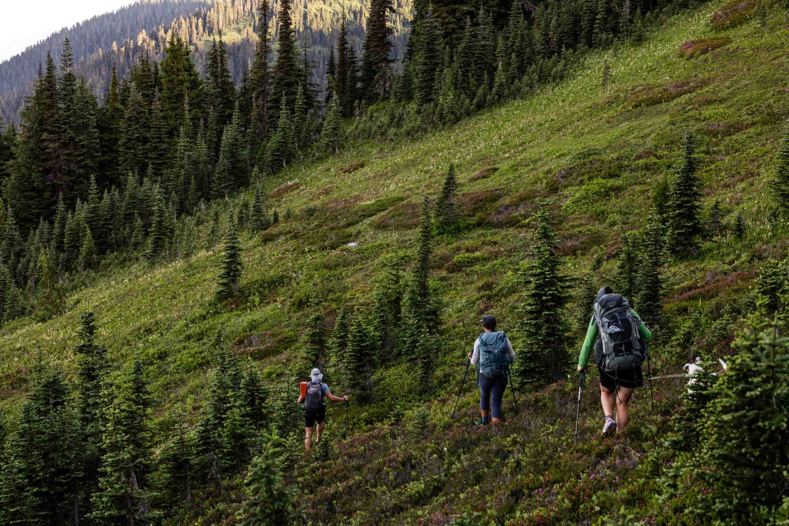
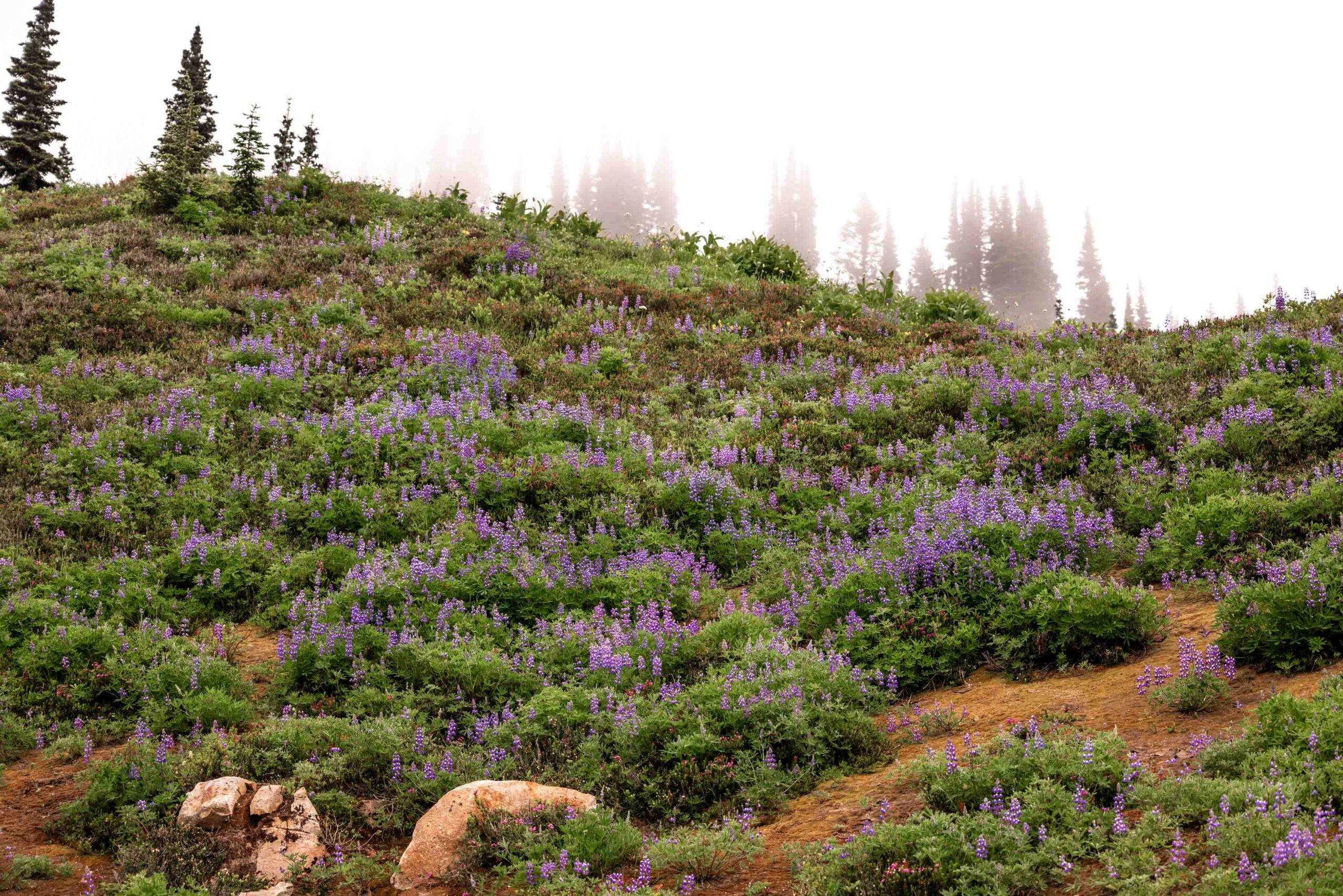
Surprise, surprise! We found the faintest trail in the open meadows that sometimes would fade out, but it was clear the trail was still being used. It could only get better the closer we got to the trailhead!! This meant that we wouldn’t have to have weird sidehilling to traverse the ridge. I really wanted to soak in all the views but we were on a schedule and I had to keep my feet moving. My leisurely 45 min/mile was not going to cut it for a 20 mile day. Every little uphill we named a bump or lump was difficult. It was the gentle downhill that really made it better for me. Less effort and more about keeping the feet fresh. We ran into one older gentleman and his dog. What it would be like to be retired (I assumed) and enjoying solitude in the mountains! As we reached the Meadow Lake turnoff, we quickly descended into the forest sooner than I thought with still so many more miles left. I think it was great that there were variations in the trail from a trail to an old forest road until we were back at the Meadow Mountain Trailhead. It was such a large parking area — I could see how this was once a very popular trail. Another break and then we were headed down on the actual forest road to where we parked our cars. These last 4.5 miles were so rough as my feet were starting to blister. Just the thought of being done and enjoying conversations with friends kept me going.
Less than 9 hours from camp, we were 20 miles of trail back at the cars, ready to dip our feet into the river! I felt accomplished, since this was the longest backpacking trips I’ve done in terms of distance and gain! Just a tad more than my Devils Dome – Crater Mountain loop a few years back. Who knew this was possible for me? I had last promised myself to never do more than 12 miles/day on backpack, yet here we are with relatively good feet still. The body is amazing!
Notes
- Parking: We did a car shuttle to complete this loop and approached it counter clockwise. I’m sure it would be fine the other way too! We just wanted a shorter day to start and optimize for camp locations. We parked near White Chuck Upper Bench Trailhead and started at Lost Creek Ridge Trailhead. Don’t forget to register at the trailhead!
- Trail notes:
- The route is almost entirely on trail. Past Round Lake, the trail is unmaintained but honestly very good. We only really lost the trail in the trees near the White Chuck River for the last 50-100 ft of descent and had a bit of devil’s club bushwhacking which was honestly a minimum.
- Tricky spots: There is no bridge to cross the White Chuck River or Kennedy Creek due to a washout years ago and unfortunately the Kennedy trailhead is also closed too or it would have made for a great short hike. We were able to ford the river in the circumstances we had and still it was at least 2.5 feet deep. Our shoes dried out surprisingly well. It is steep to gain the other side unless you find a way to skirt along the river.
- There is a trail marked on Gaia but not on Caltopo that is a new version of the White Chuck trail that connects to the PCT.
- The Kennedy Creek crossing along the PCT required no wet feet for us during this trip. But it is possible that a higher flow would be a tricky crossing. Use your best judgement.
- Off Trail Travel: From Fire Creek Pass, climb the ridge leading west and find a good place to drop down. For the most part you can stay in relatively low angle terrain but there’s about 200 feet of mandatory steep. Then there’s another ridge to pass that has a steep section, but there’s a couple ways to drop down for just about 100 feet. There’s a lot of passing in and out of little ridges and rivulets as you make your way to the col just east of Fire Mountain. Gaining the col NE of Fire Mountain is key to getting above a lot of the cliff bands as you can easily walk down and around one short uphill of steep 50 feet before descending down the south face. From there, stay on mellow terrain as you wrap around to the west face to gain the trail, which can be hard to follow at times in meadows but overall good.
- The Meadow Mountain Trail is largely unmaintained but decent to follow especially between the trailhead and the turnoff to Diamond Lake and if not, Meadow Lake. The descent through the forest is long but the trail is so soft and good and ends up on a long traversing old forest road decommissioned as a hiking trail now.
- As of 2025 We had to hike down 4.5 miles from the Meadow Mountain Trailhead to just before the bridge by the White Chuck Bench Upper Trailhead. Unclear when or if the bridge will be fixed.
- Main thoughts: I was happy to have done the loop counterclockwise to leave the long descent for the last day instead of a slow going uphill on the first day. The PCT was a welcome mental break and off trail is minimal for how long this trail is, but don’t underestimate the time off trail can take
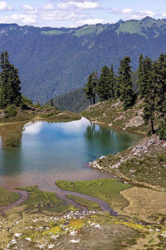
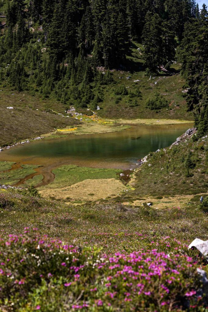
- There are established campsites by Camp Lake and along the PCT. You could feasibly break this up into a longer time frame, stopping at Round Lake, Camp Lake, Glacier Peak along the PCT, Fire Creek Pass/Mica Lake, upon reaching the Meadow Mountain Trail and multiple spots along the Meadow Mountain Trail if you don’t want to hike the extra to either Diamond or Meadow Lakes.
- Please be mindful of Leave No Trace principles as you head into any off-trail travel! Try to minimize off trail and opt for more sustainable paths
Photos taken on Canon EOS R5, iPhone 14 and iPhone 15


You May Also Like
teanaway getaway | johnson-medra-jungle traverse
goats | enchantments + little annapurna ski tour