long lost lollipop larch loop | chiwaukum via lake ida
14 miles . 6900 ft gain . 7121 ft high
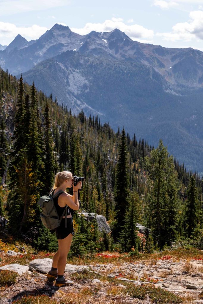
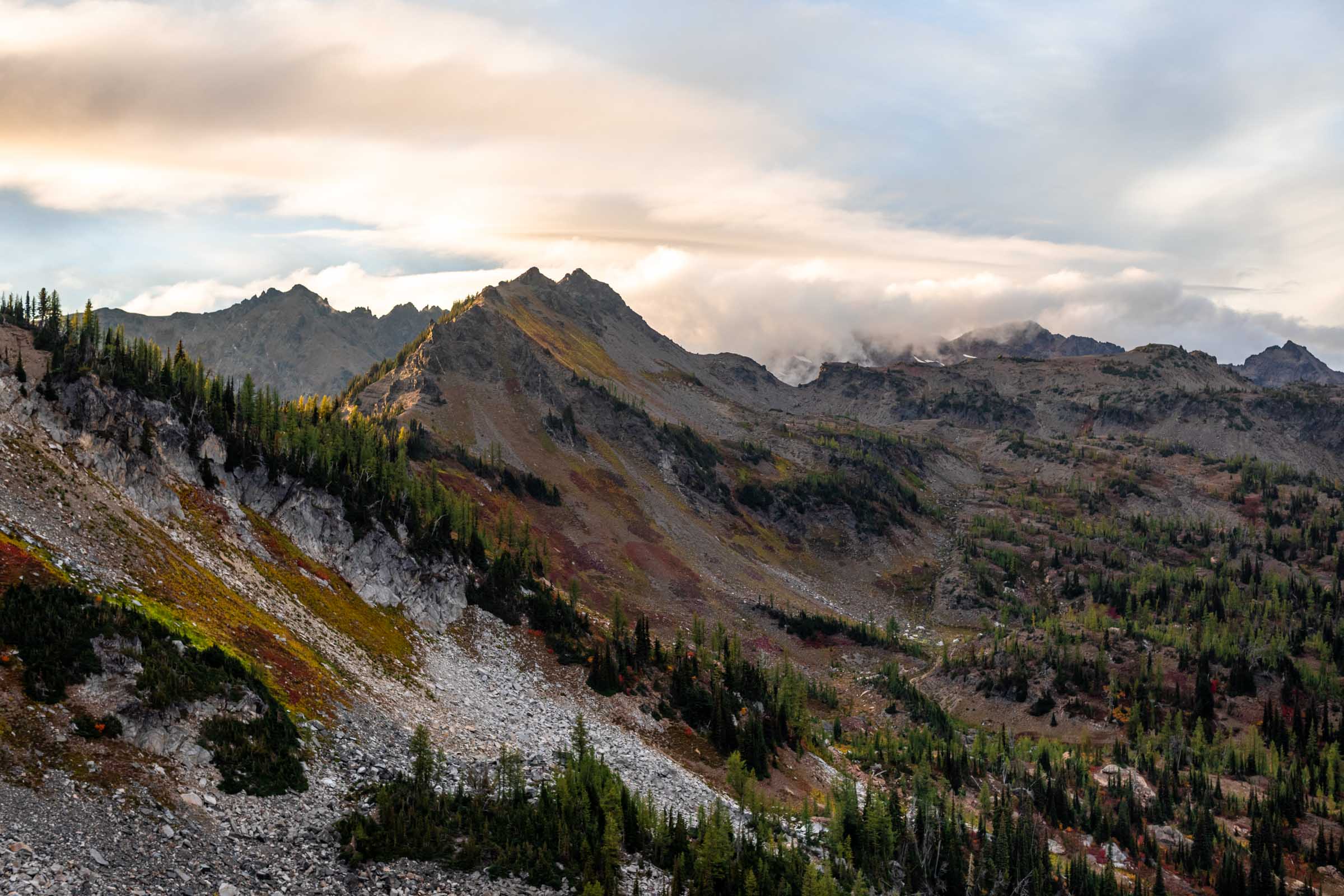
Let the larch marches begin. I didn’t intend for this to be a march. It was supposed to be short and sweet (and maybe a little difficult, but at least quite short). But obviously, that did not happen. Our main goal was Lake Ida, 3 miles and 4500 feet up. It was going to be a shorter day than going to somewhere like Cape Horn. And somehow we wound up with more than double the original route and tacked on some 3000 more feet of vert. But I think our hearts were very full, we took our time frolicking in the colorful hillsides.
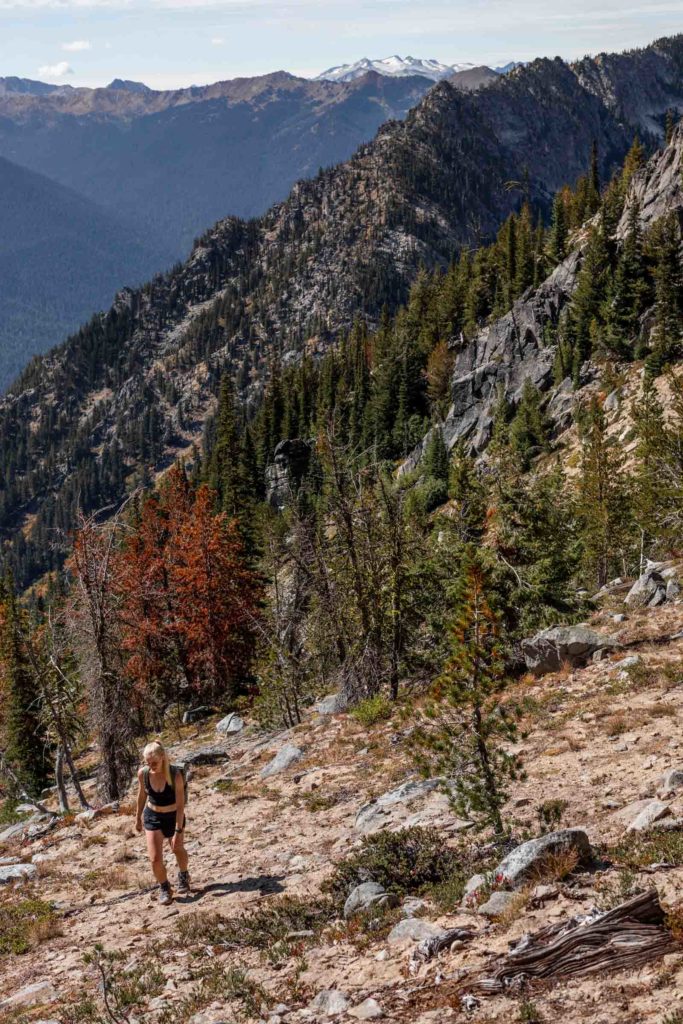
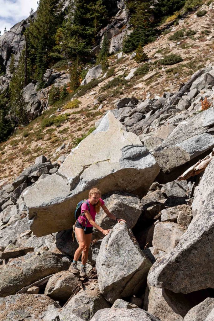
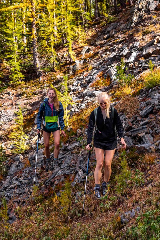
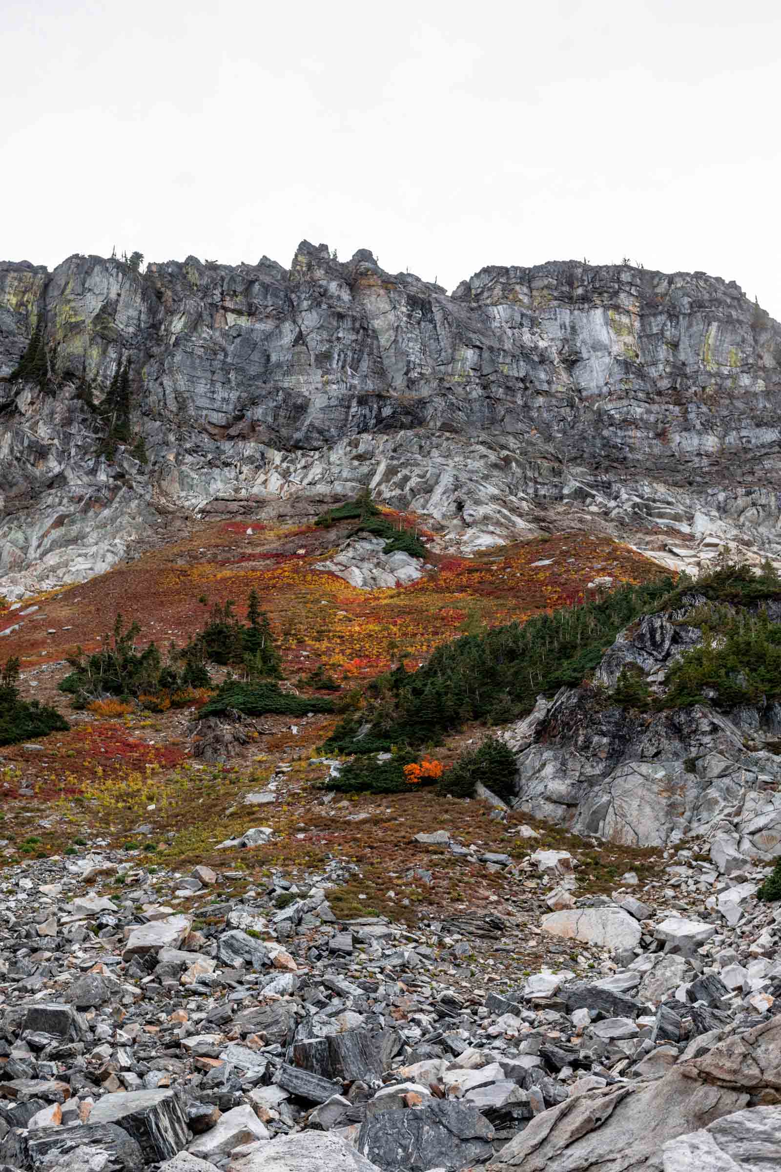
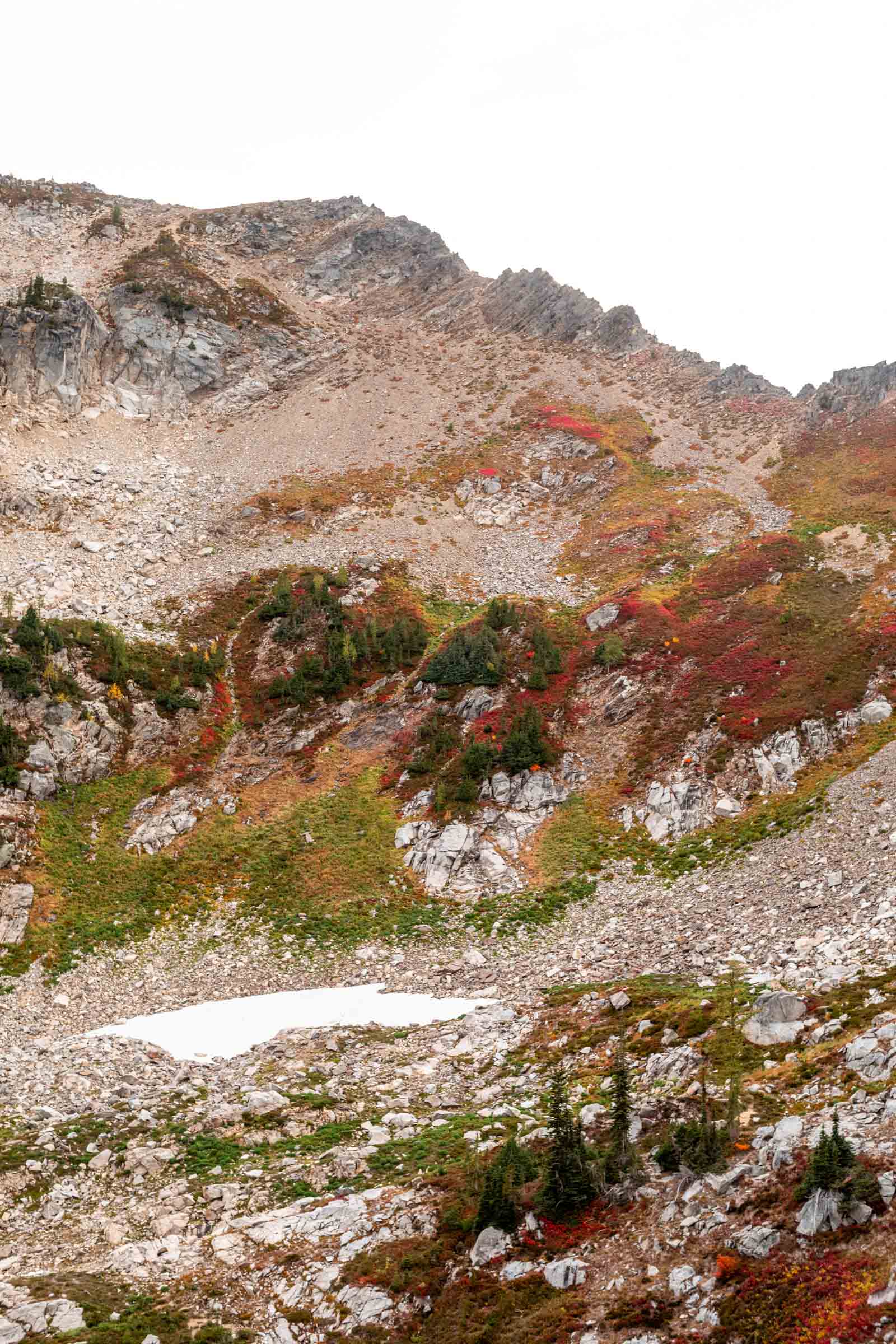
Only intending to be out for a shorter time, we had a fairly late start. It was no problem following the trail and meeting fewer than 5 people. The first mile is mellow and then it climbs steeply on somewhat slippery dirt. 2.5 miles in, we passed a campsite and then a major stream, our ticket to Lake Ida.The trail is obvious if you’re looking for it (red decomposing log) and actually quite easy to follow the whole way up. As it opens into the boulder field, you can choose to stay on the trail to the left or have some fun playing in the boulders. On the upper portions, the boulders actually got bigger in parts, making it harder to navigate, so we generally stayed with the trail. Eventually the trail starts to get steeper and less manageable, which naturally brings you across the boulder field again. You can see the trail on the other side, which you can start to take up to reach the meadow bench of the basin above.
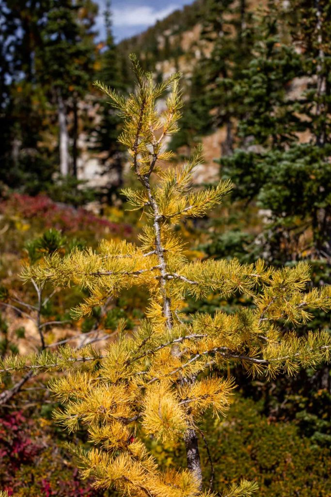
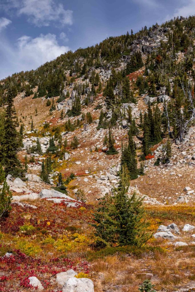
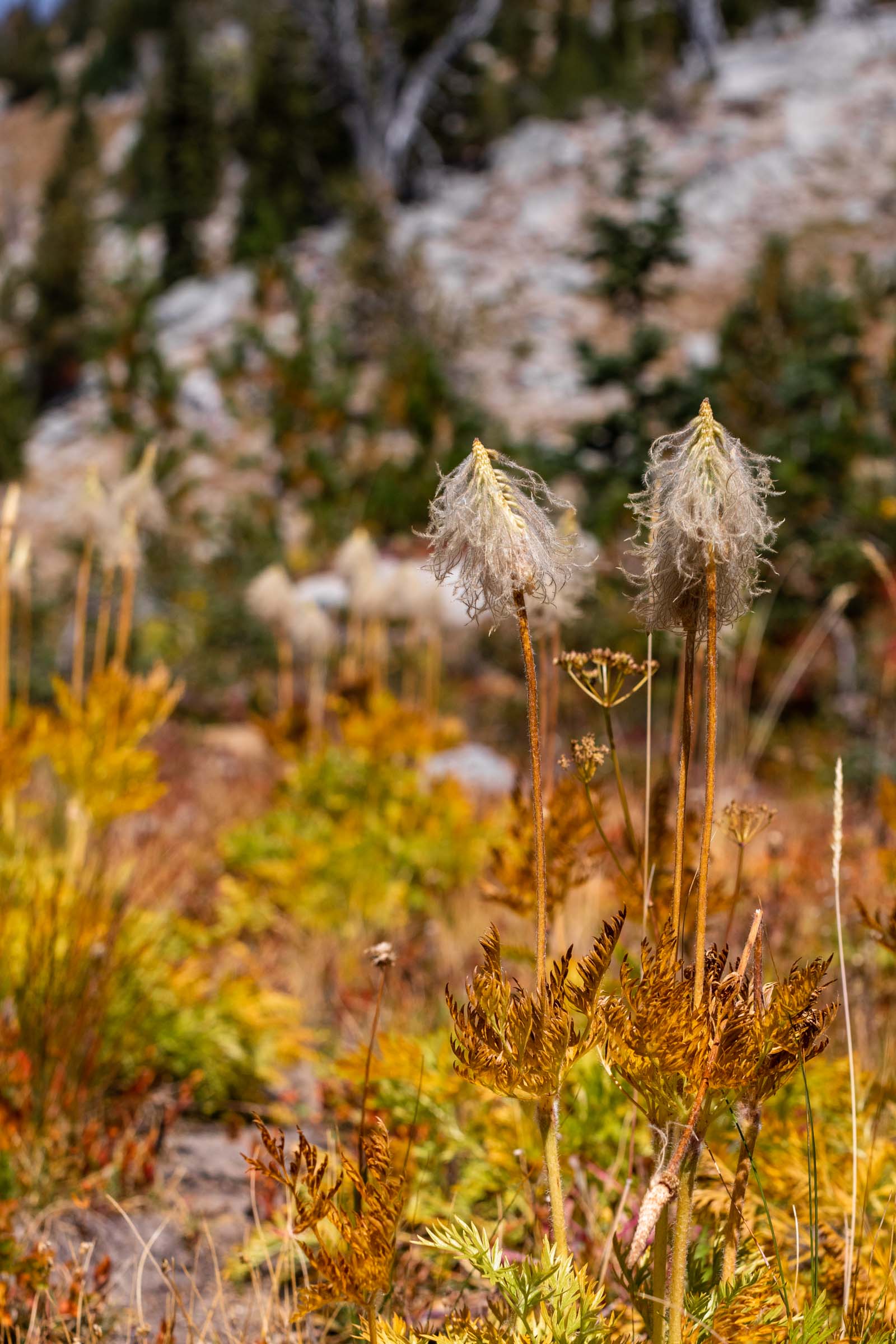

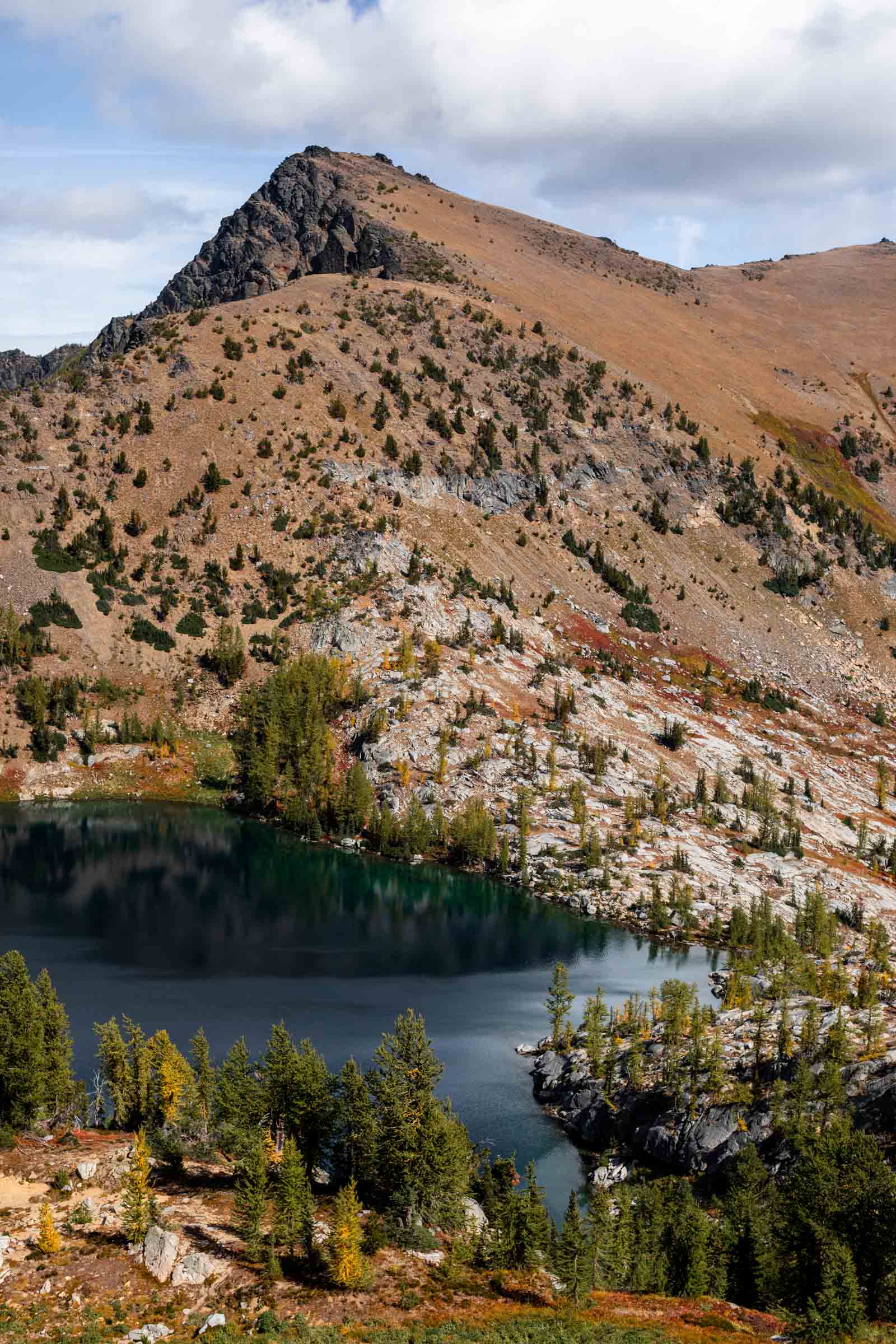
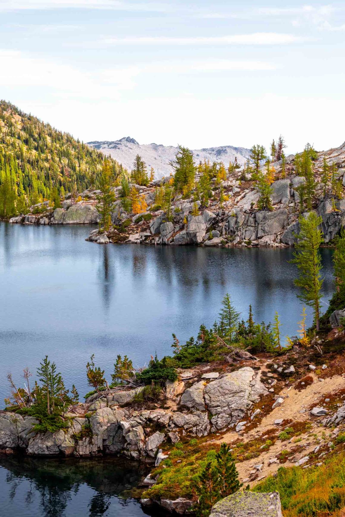
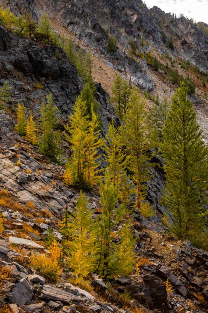
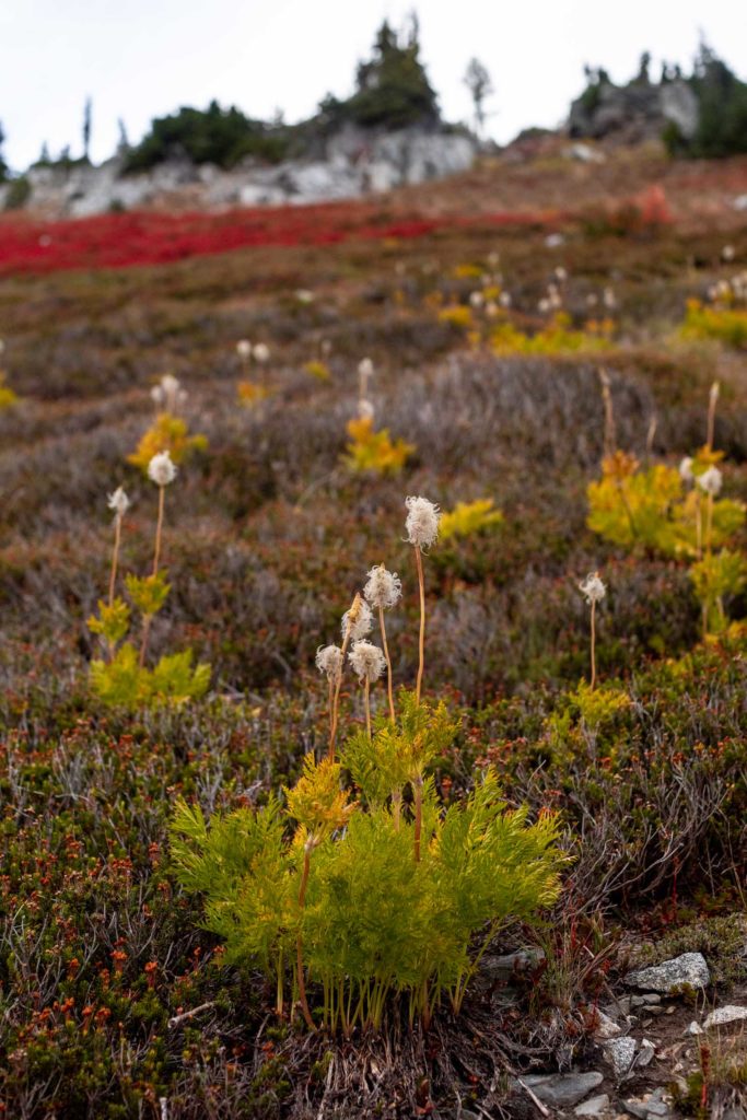
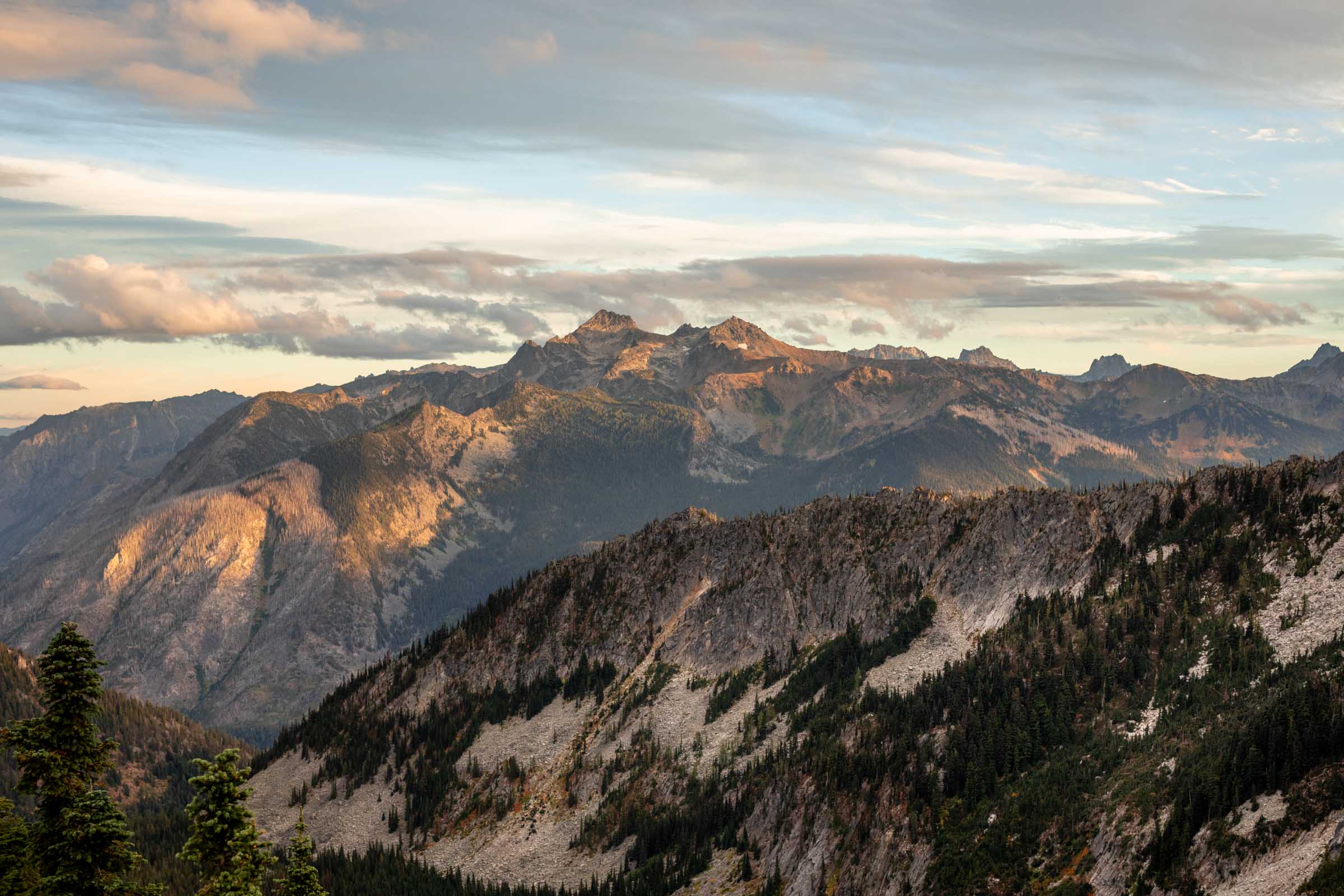
This was when we truly started seeing all the fall colors and we were getting so excited. A little exhausted from the sun and the long uphill, but at least we were rewarded. It would be almost another thousand feet till we reached Lake Ida from where we left the boulder field. There are good cairns marking the general direction. To reach Ida from the basin, we veered quite aways east. If you have good judgement, it’s the area where it looks sandy with small plants in place. No need to go through trees or rocks. On the top map, you’re hitting a saddle point in the ridge going the least steep route up.
Once on the ridge, we took a nice long break. We contemplated going back down the same way, but we were not stoked at the down climb. It would be slow for sure. Our other option was to go the long way around on trail without the technical aspect of going down steep terrain. I was hoping we could stay on the ridge to Frigid but from a look, there was at least one major section that looked improbable especially for beginner scramblers. Ultimately, we chose to take the long way for the extra views. We would be creating a sort of lollipop route, looping and ending back on the same last 2.5 miles of trail. Lake Ida already offered so many fall colors and plentiful larches, we were excited to see more on the inside of the Chiwaukum.
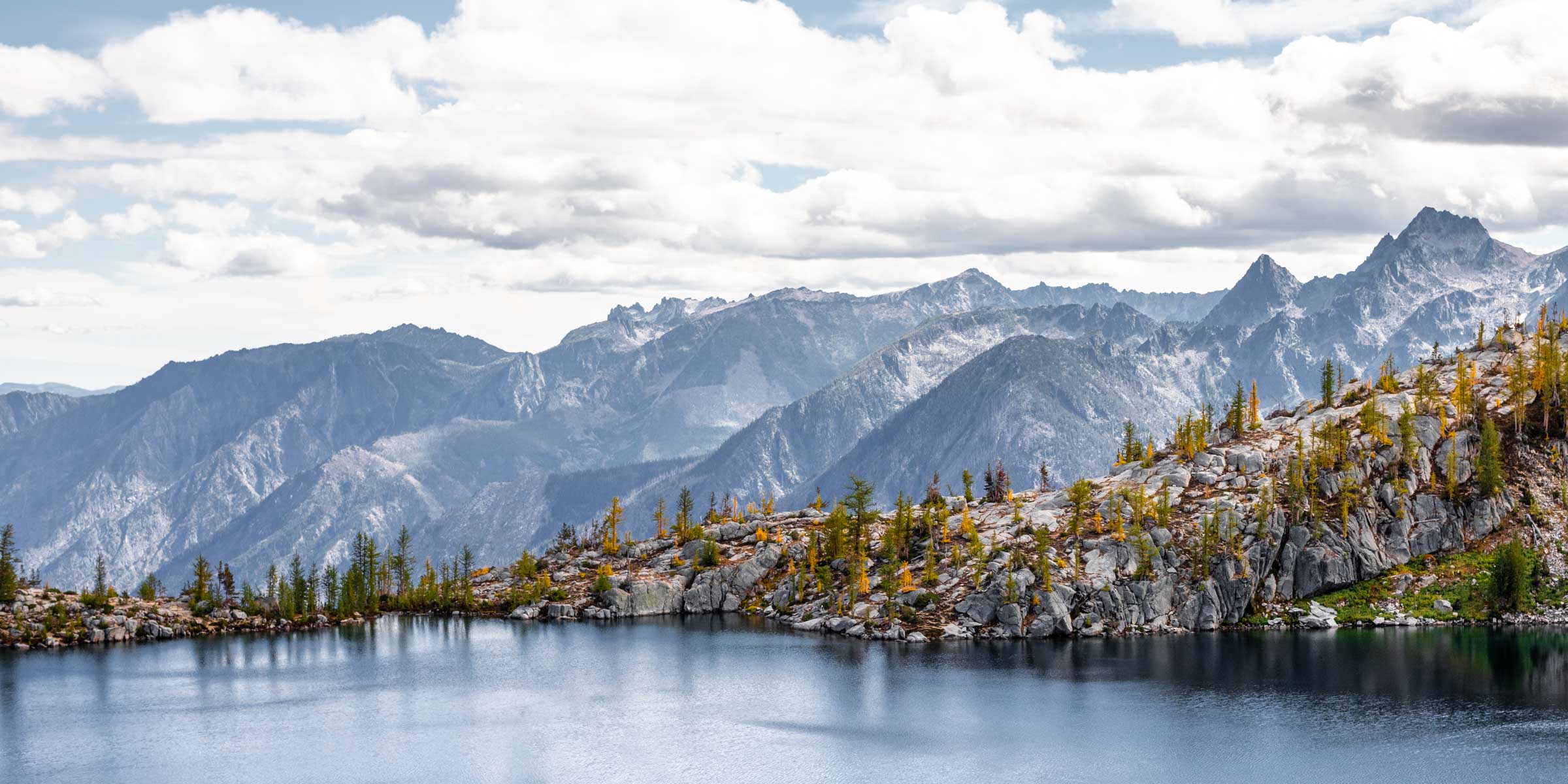
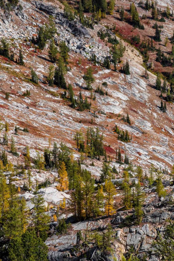
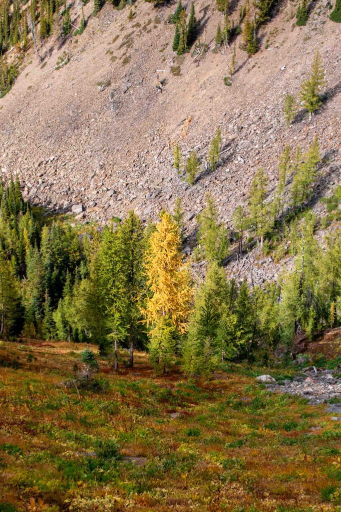
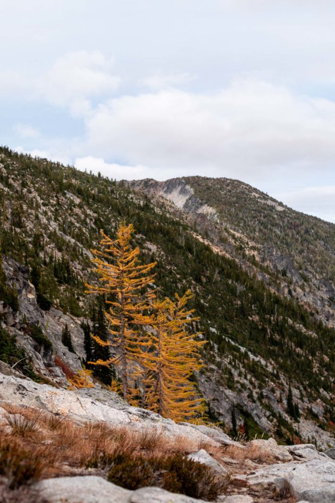
Ready for the 1000+ ft of uphill ahead, we descended down and out of Lake Ida. There’s a trail from the ridge! Instead of taking a trail all the way down to Painter Creek, we cut across the larch glades around 6600 ft and had an intimate time with them and the knee high grass. After a short scramble up a vegetated little 20ft gully, we met the main Icicle Ridge Trail again. However, the trail was much less a trail than the climber’s trail to Ida.
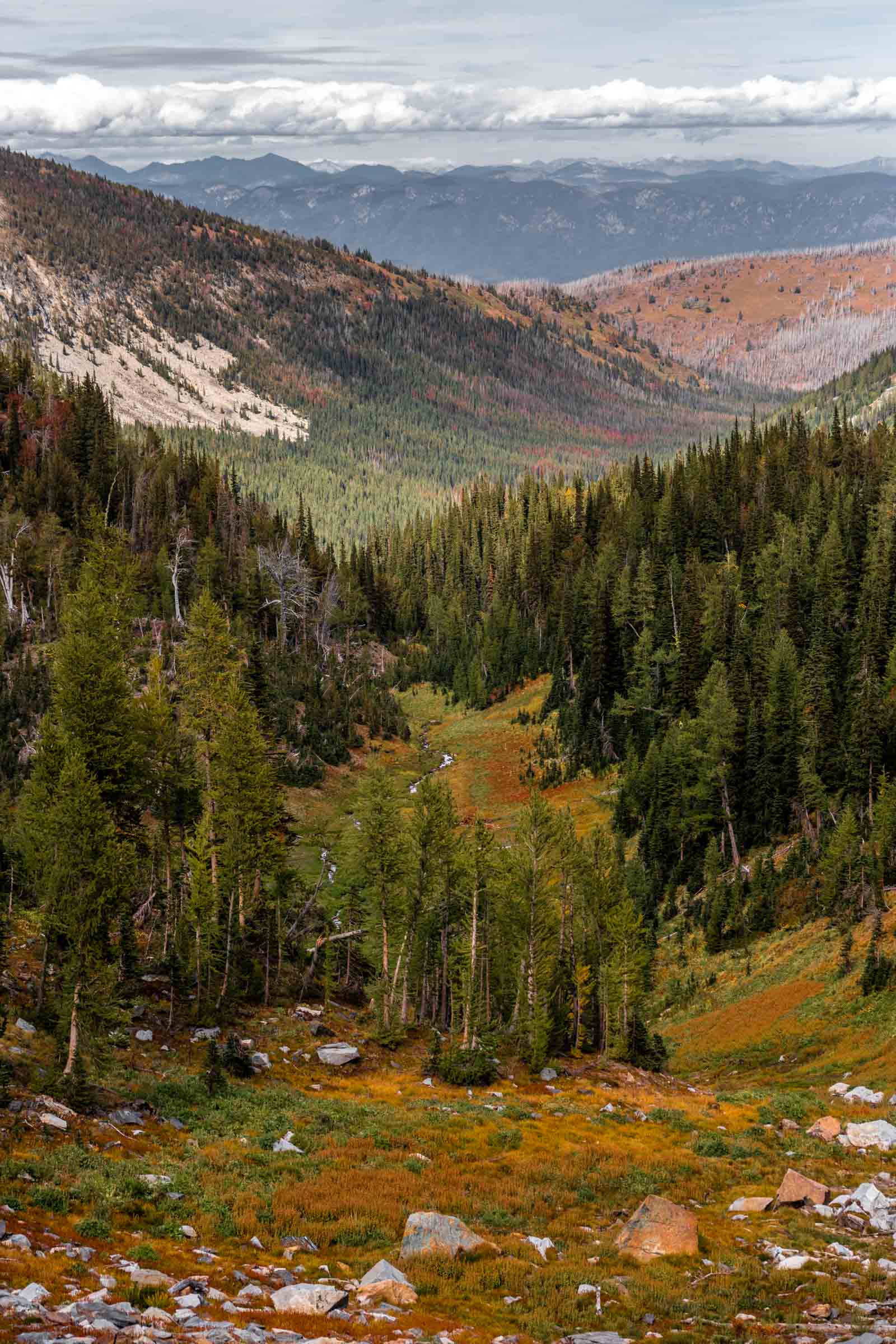
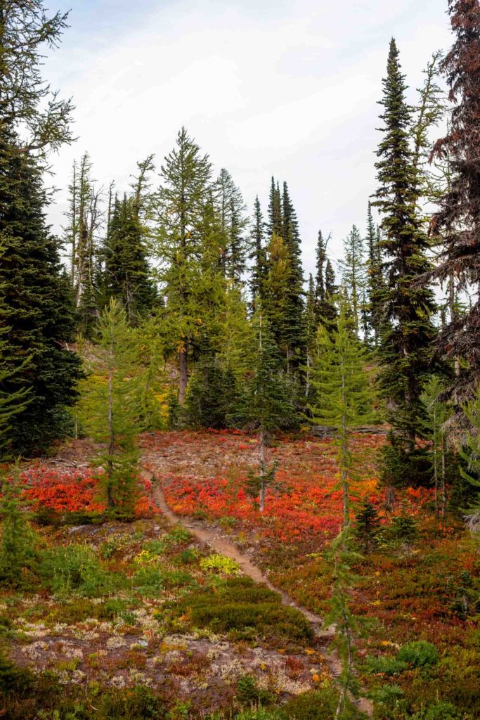
So weird that this one was marked on the map and the other wasn’t. And that didn’t match how well maintained each trail was. It was barely enough to make out but once we started descending into the forest, the trail was near non-existent (sorry I took zero pictures except videos on phone of this). It was so covered up by blueberry bushes that didn’t even have any blueberries to offer us. I managed to follow the trail the whole way down. You really have to pay attention and look in between the leaves for the open ground. At times the trail would open up to let you know you were on trail. And sometimes you don’t see a trail till you start climbing over a log. I wonder how this trail looked 50 years ago. When was it’s prime? Certainly not now.
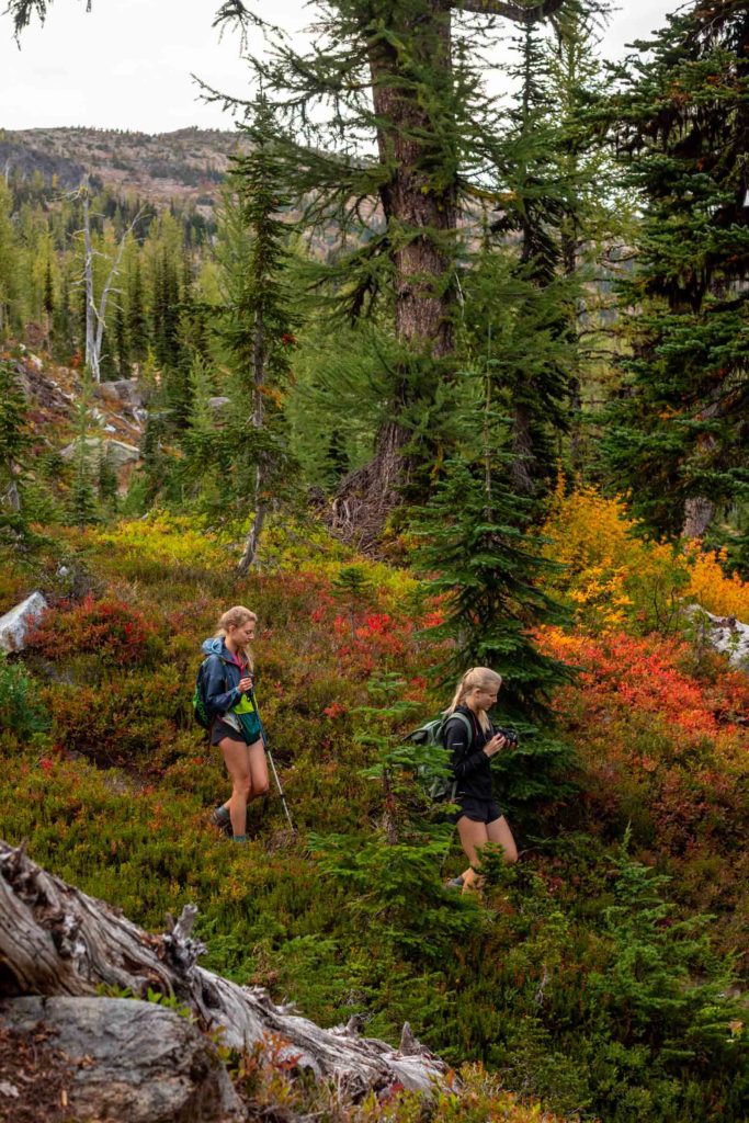
We were reassured of the trail when we found signs at the next intersection. We continued on the Icicle Ridge Trail heading towards Chatter Creek this time. It was a slow climb, but thankfully, this side was more hospitable with the blueberries. We got a break from getting whacked by bushes on our shins, a great change. The trail was still not in the best shape here, almost losing the trail by going up Index Creek instead of crossing the bog. At this point, the sun was starting to set, and we were definitely not going to take a look at Lake Edna, another popular Chiwaukum lake.
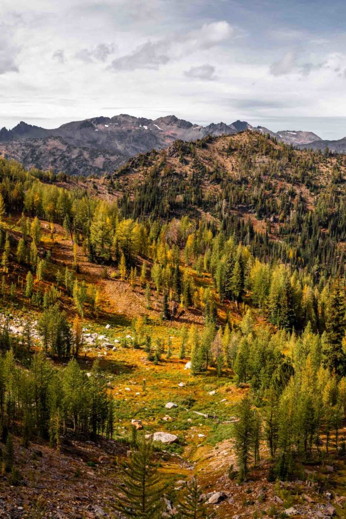
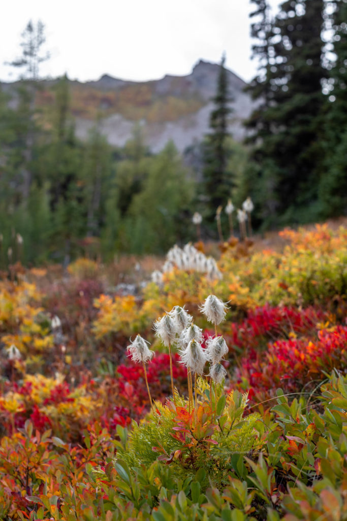
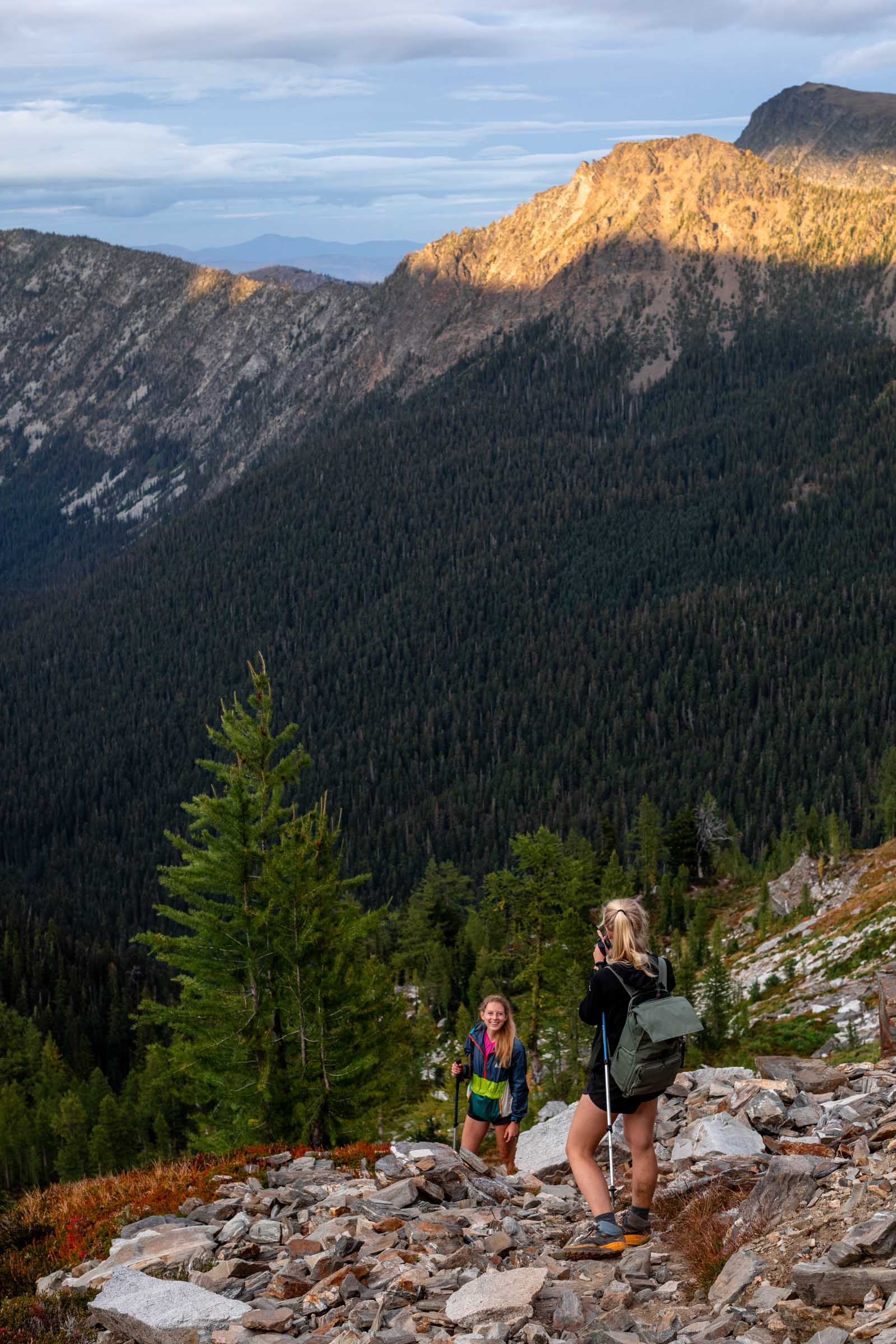
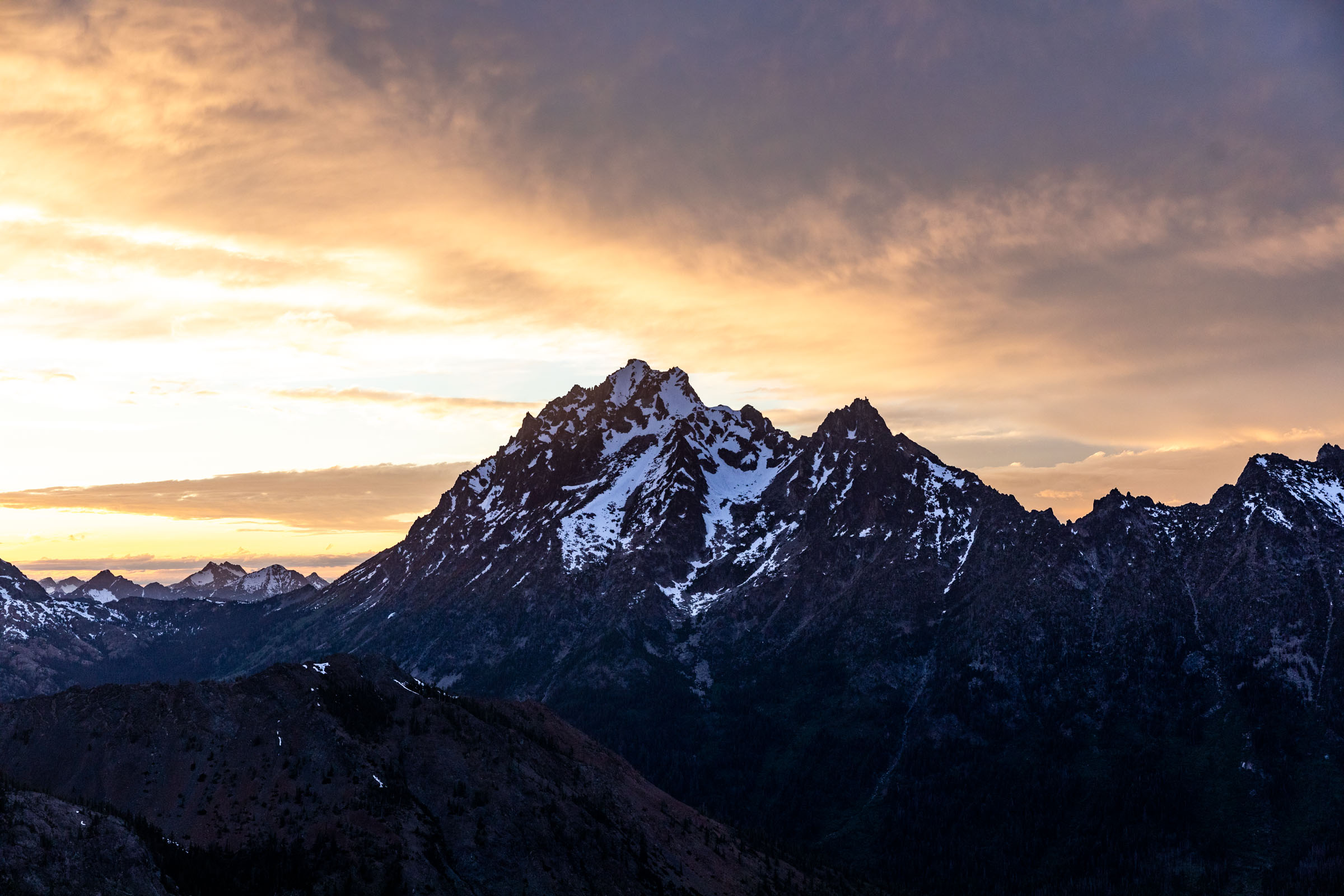
When we reached the intersection of Chatter Creek Trail, it was a huge relief. The trail was much more traveled. More footprints, a wider trail, larger cairns. The trail traversed across and we awaited our last short uphill. Short is relative since our legs were already toast. The kind where you feel every inch of uphill. Not before we reached our last ridge, we were treated with more bountiful red hillsides and the makings of a sunset.
A glorious feeling rushed over us once we could see our last descent. Well, it was still 4 more miles in the now dark and on uneven terrain. We were not going to be fast, but as fast as we could muster, trying to get back for dinner. At the trailhead, I’m sure the people in the van were confused, maybe amused by our extreme excitement and exhaustion. But who cares? We proved to ourselves what our bodies can do, not that we should always push it this hard, and we had the most wonderful time otherwise.
Notes
- This is a great larch march. The majority of the fall views are on the northern slopes.
- Go counter clockwise if doing this loop. Other options are out-and-back of Ida or Edna.
- From Chatter Creek, there’s a clear trail (unmarked) to Ida. It’s less than 2.5 miles from the trailhead, passing a major stream (which might be drier than expected) that leads from the basin in between Frigid Mountain and Lake Ida. Keep a look out for the obvious trail. After the stream, it’s the first opening that looks like a trail. It starts on some old red decomposing log, likely to see some semblance of footprints.
- Icicle Ridge Trail is extremely hard to see when the blueberry bushes are fully leafed. Not impossible to follow, but very possible to lose it if not careful.
Photos shot on Canon 5D Mark IV


One Comment
Hannah
Love the photos and write-up! Quite a beauty filled adventure indeed!