painting the hills | rainbow ridge high route backpacking
31 miles . 8200 ft gain . 7895 ft high
North Cascades National Park. Lake Chelan National Recreation Area.
I’ve known about the Rainbow – McAlester loop for a while now. But it’s a pretty long trail and while you can do it in a long trail run in a day, it seemed like it was the best fit for a backpacking trip. Earlier in the year after the lottery, I decided to look up what permits were available in the North Cascades. By chance, I found a free permit for the Rainbow Lake campsite. And by chance the permit was for early October right in the middle of larch season. But the best way to do this loop is to split it up into three days where each day has about an equal amount of effort. That meant to getting a campsite at the other pass. Fortunately, the next night would be out of permit season and it would be much easier to get walk up permits for that night.
The days leading up to the trip I kept checking the weather, hoping that we would get sunny days or at least days without rain. Luckily, the only rain in the forecast was on the last day afternoon and that never really changed for us. I had forgotten about the Good Samaritan program and could not print out my permit ahead of time, but at least the Wilderness Information Center was along the way to the Bridge Creek Trailhead. The Ranger was able to also print off a self issued permit for my second night. I checked out the bear again just in case we needed extra bear proof storage. This was mostly needed for the second in Rainbow Lake has a permanent bear storage bin.


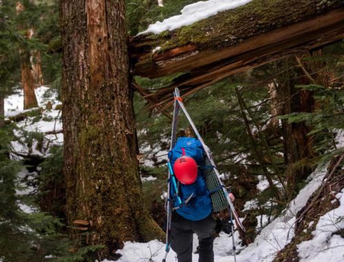
We started our counterclockwise loop along the PCT, passing quite a few PCT hikers. After about 6 miles, we turned off the PCT and crossed the river before slowly getting elevation from next few miles. All the while, we were not in the larch groves but we still got some of the best fall colors I’ve seen this season! Plenty of low forest plants painting the trail rainbow. It was odd to know that a couple thousand people were just a mile or two away on the next ridge. Driving by in the morning I had estimated a count of 1000 cars parked along the highway split between the Rainy Pass and Cutthroat Pass trailheads. It’s incredible how much these trails have boomed in popularity over the years, which is why I wrote my larch guide in the first place. Plenty of other larch hikes without overcrowding a trail that probably can’t quite support that number of people.
Anyway, what seemed like a short time passed before we got our first glimpse of larch along our trail. This was the beginning of the next wondrous 24+ hours of basking in the golden larches. The two guys had just done a big trail run the day before and so they were taking it easy. That was perfect for me because I kept wanting to stop to take pictures and I could only catch up if people don’t walk too fast for me. Eventually I did get left in the dust, but the solitude was welcomed as I got some solo time with the larches and my camera.


At the pass, the views were more colorful than I had expected. Rainbow Lake was living up to its name! There was some smoke blowing in from the Lake Chelan area, making it a bit hazier than ideal, but I think it still provided some cool lighting. We soon made our way into the shadows by the lake to find camp. I love camping near running water because 1. easy access to fill up water bottles and 2. a way to clean off dusty legs.
Sunset wasn’t that particularly exciting and we were in the trees, so we took it chill, saving the energy for the next morning. It was hard to convince myself to get out of bed but I was so happy I made it happen because some of my favorite moments happened that morning! We went up a little further up the ridge for views of Bowan and Lake Chelan below, doing our photography run-around amongst the larches. Soon, we had to return back down and clean up camp for our lazy wander to our next camp. But make it extra fun over a ridge scramble of course!


We didn’t get to finishing breakfast and packing up until quite late in the morning, but the slow wake up was a lovely way to start the day. We were able to properly dry off our dewy tent in the morning sun. The next little bit was off trail and we took a mostly well-trodden path off the main Rainbow Lake Trail near the first switchback up. The uphill was relentless and we could all feel our tired legs, but nevertheless marched on. At the saddle, we dropped our packs for a quick snack break and view of the next ridge, but quickly started to make our way up to Bowan Mountain. It looked fairly straightforward so we didn’t really look too hard at beta.
Scrambling Bowan Mountain is overall the type where you see the mountain or ridge, then you go get it and avoid steep cliffs. There are some loose rocks here and there but the rock is largely otherwise solid. At just under 7800 ft, it’s best to cross over the saddle for a neat little exposed ledge to the final scramble to the summit. The scramble is short in distance but since it’s less traveled, it can feel a bit more involved for the novice with route finding and loose rocks, but should be easy enough for the average scrambler.


We returned the same way we came up and continued descending down a stiff scree field. One where you couldn’t scree ski and had to take care with each step. After that steep 200 ft, the rest of the boulder hopping was easy enough and motivation kept increasing the closer we got to the deep larch groves. It was thrilling to be surround so much by the larches and for a lovely downhill descent. We found only one person who went the opposite way with at least another partner or so by the sounds of it. They seemed to be a bit newer to off trail, asking for the way up the saddle that we just came down. To me it seems intuitive but I guess it’s not always true of all people. Shaking off our worries for the other group, we began our last uphill to Rainbow Ridge where we were excited to pick up a trail again. Our trail walk was relatively uneventful as we passed more larch groves that turned into red huckleberry forests. Sun was starting to set and we were eager to get to camp. We found our last stream before camp and grabbed a potful of water to save time hiking back and forth. It was just the perfect amount for our meals.
We opted again not to really watch sunset except through the trees. Unfortunately High Camp doesn’t feel that high and it’s well hidden in the trees actually. In the morning the sunrise gave a surprising orange glow that completely filtered your view of everything. It’s like wearing tinted glasses. Wyatt got some amazing pictures and we heard his hoot and hollers as he snapped away at the amazing views he got while we enjoyed camp once again. Our mostly downhill except for the last 1000 uphill feet went by surprisingly fast and we made it out before the rain came in and in time to be back home at a reasonable hour, hearts filled with great camp vibes and larch-y goodness all around. A most spectacular way to end backpacking season (as far as I know).


Notes
- Entrance and exit: Bridge Creek Trailhead
- Please respect the plants and area when going off trail and practice Leave No Trace principles. Goin up to the Bowan ridge, there’s plenty of ways to stay off the plants, but choose your path wisely to avoid getting cliffed out.
- If doing the high route, counter clockwise is ideal for minimizing tricky ascent/descent of Bowan ridge.
- Bowan Mountain is a good mostly class 2 scramble with some parts edging on exposed class 3. Route finding is necessary.
- While camping is within the Lake Chelan National Recreation Area, it’s part of the North Cascades National Park complex and permits are required for overnight stays in summer and winter.
- I think this area is best seen in the fall for the full “rainbow” experience.
- We camped at Rainbow Lake and High Camp near the passes. It breaks up the trail nicely into 3 reasonable days.
- If you opt out of the high route, you can take a longer trail around the mountain, catching the Rainbow Creek Trail at the Bench Creek Camp intersection. In theory you could make a loop starting from Stehekin instead of Bridge Creek.
Photos shot on Canon 5D Mark IV


You May Also Like
beat the sun | green mountain sunrise ski tour
above the clouds | mt townsend backpacking