take it easy | tomyhoi & yellow aster butte overnight
15 mi . 5800 ft gain . 7439 ft high
Mount Baker Wilderness
We were planning to backpack a different summit camp but weather pushed us here to Yellow Aster Butte instead. I’ve always wanted to camp here by all the cute tarns, not minding the fact it does get busy and privacy is minimal here. But the lush meadows just were too enticing. And obviously, per usual, I have to tack on a nearby summit. I had already hiked to the true Yellow Aster Butte summit a couple years back, but Tomyhoi was still on my list.
So we set off at the trailhead with a much leisurely start than if we had gone with our original plan. Only 2 hours in we found our campsite for the night and were able to drop off our overnight gear before we decided to go wander around. We had a few options for out-and-back side excursions
- Short scramble on the true summit of Yellow Aster Butte
- Longer scramble to Tomyhoi
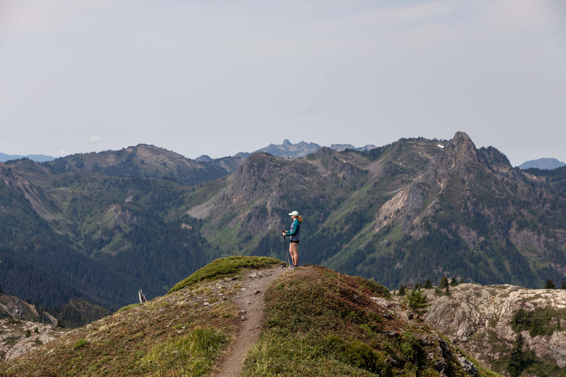
- Trail run along the High Divide Ridge up to Excelsior Peak
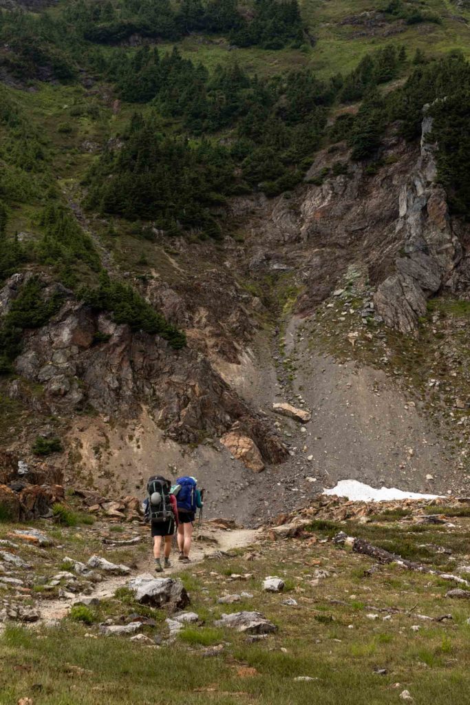
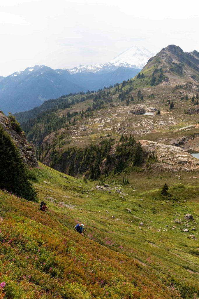
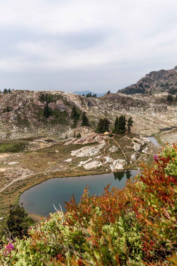
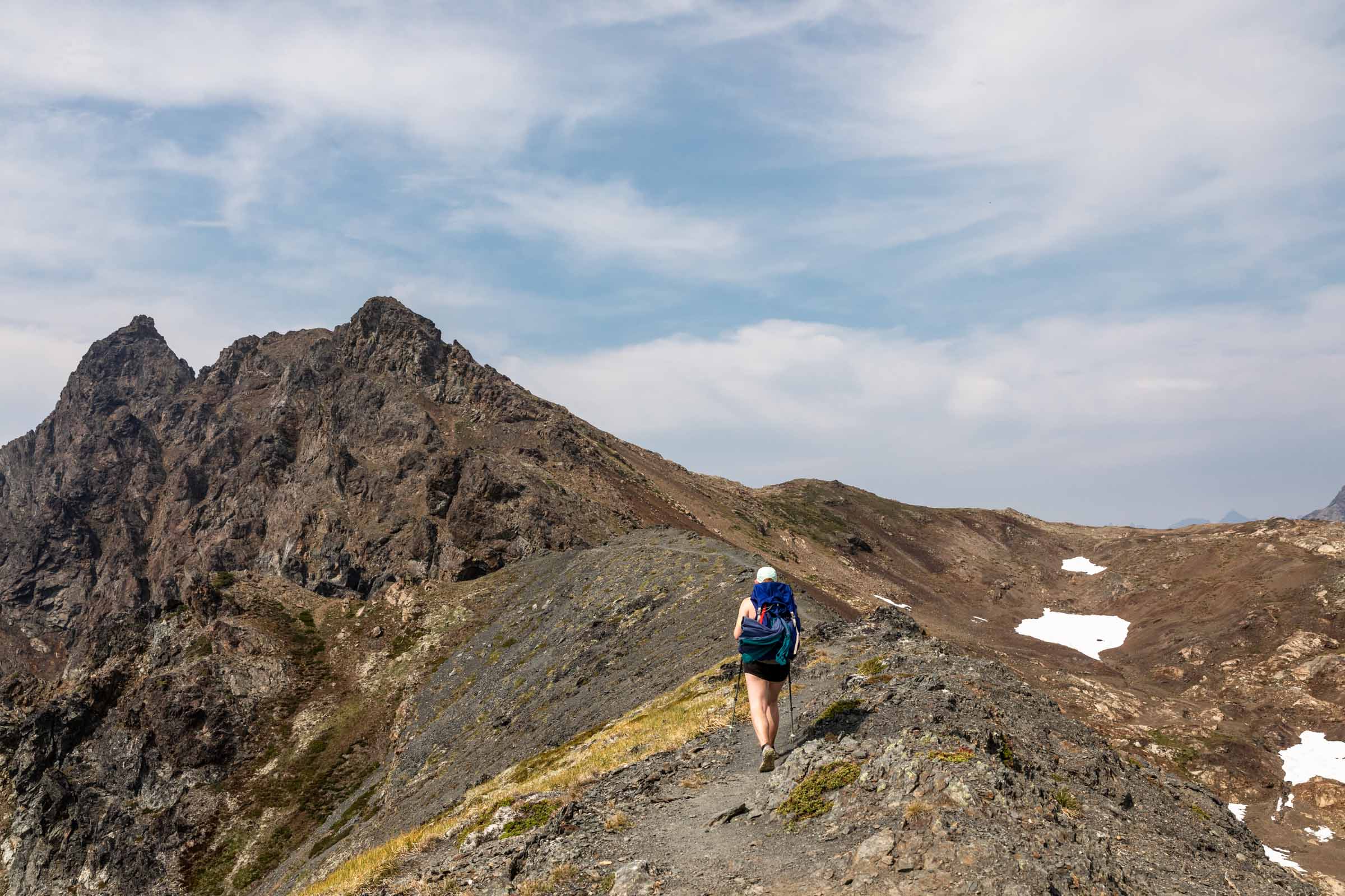
Our initial plan was to tag Tomyhoi the first day and finish the last 2 items the next day. At camp, we set up our tents and ate our lunch to refuel and repack our bags. The trails around the Yellow Aster tarns are not well marked and it’s sometimes hard to avoid stepping on vegetation, but with some thoughtfulness and perhaps roundabout trails, you should be able to find your way up the very visible trail above the lakes.
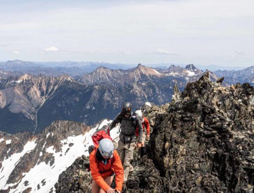
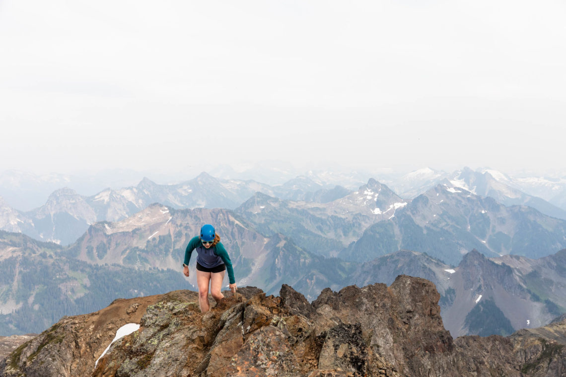
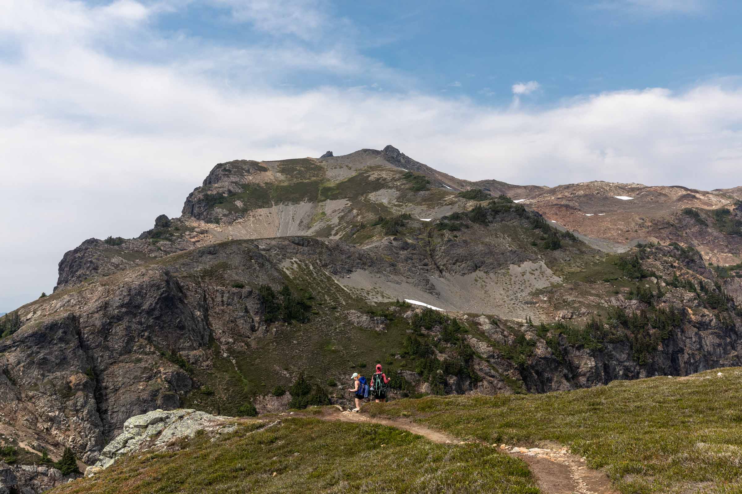
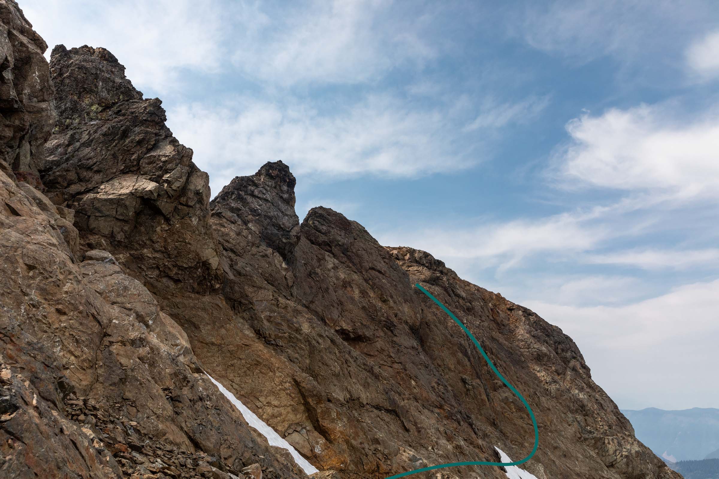
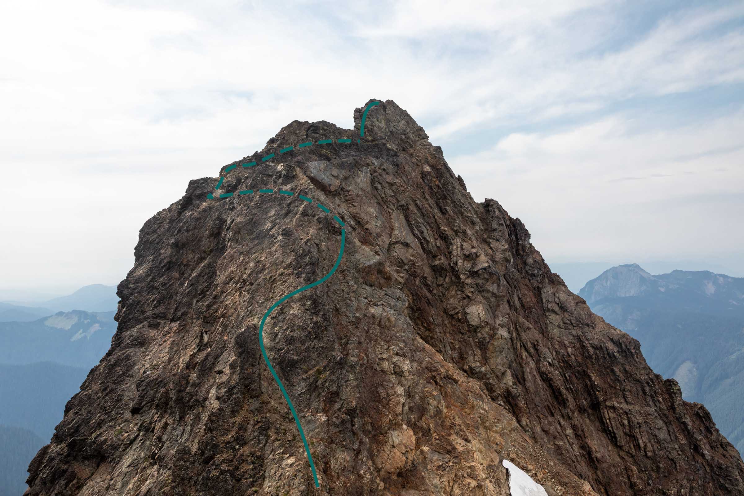
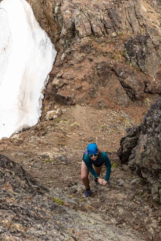
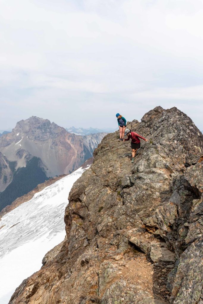
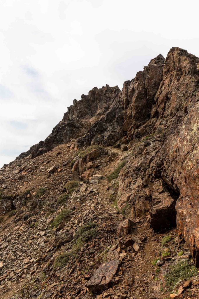
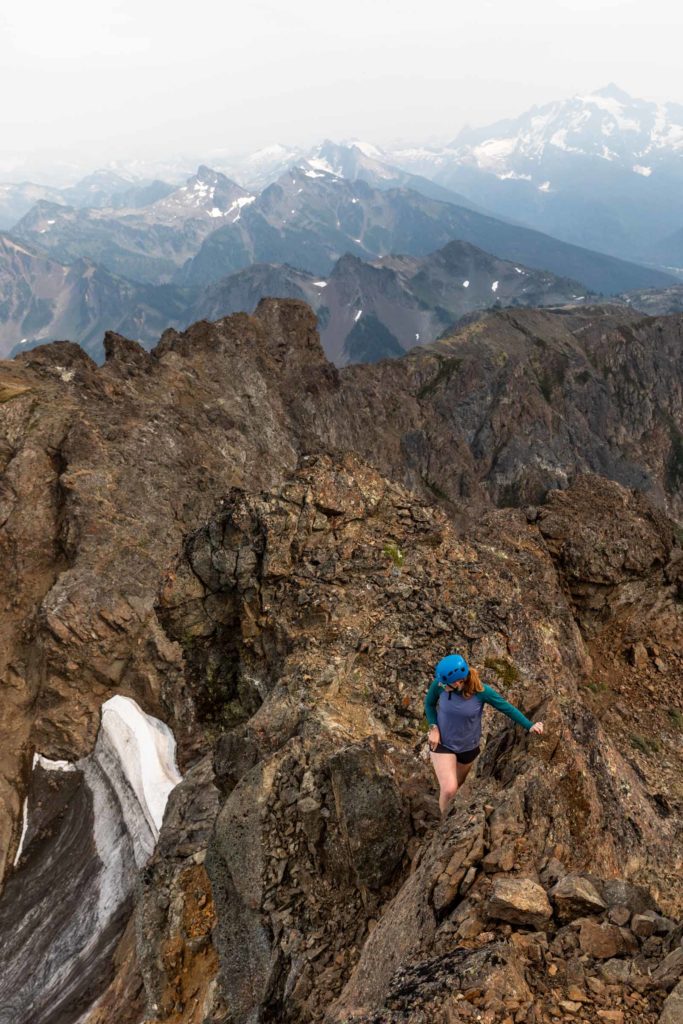
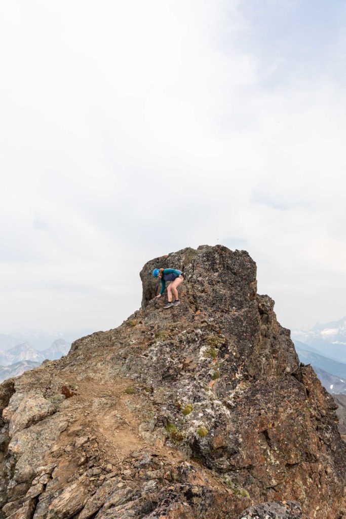
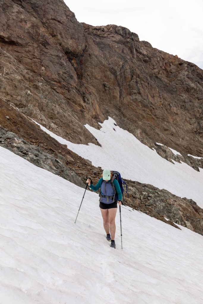
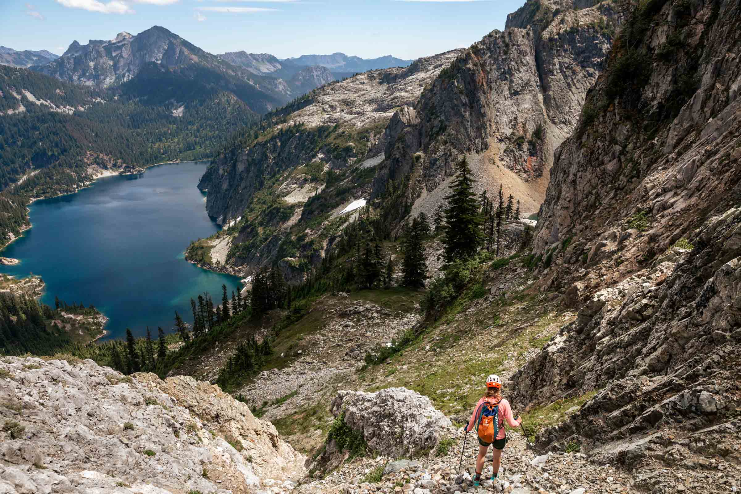
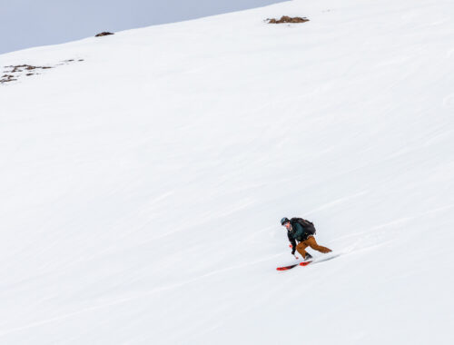
The trail continues fairly distinctly over relatively mellow terrain with a couple ups and downs, the biggest being a 200 ft descent on your way up to Tomyhoi. The trail then takes you up on a spine and wanders itself across a pile of choss. Keep following it across the snow (as opposed to up the ridge where you’ll likely get cliffed out. Depending on season, the amount of snow will vary, but for us we didn’t need any snow gear and poles were sufficient for the soft layer of snow. You might see 3 fingers of snow, or they might be mostly merged or melted out. Cross the 3 dips until you see some cairns that lead up a class 3 scramble on solid rock. The path takes you west (left of ridge) on a trail until you reach the false summit. From here, it might look like the true summit is impossible, but you have to trust that what looks entirely vertical has great steps all the way up. Sometimes you can use the coloring on the rock to see where other people have stepped. It weaves its way directly up the rib and to the right. It may feel a little exposed for a move or two, but it’s all sill just class 3. Traverse above a gully and keep taking the path left around the ridge. The scramble continues on the ridge and the the true summit. Beyond the summit is a lovely place to hang out as well! We did not find a summit register here though.
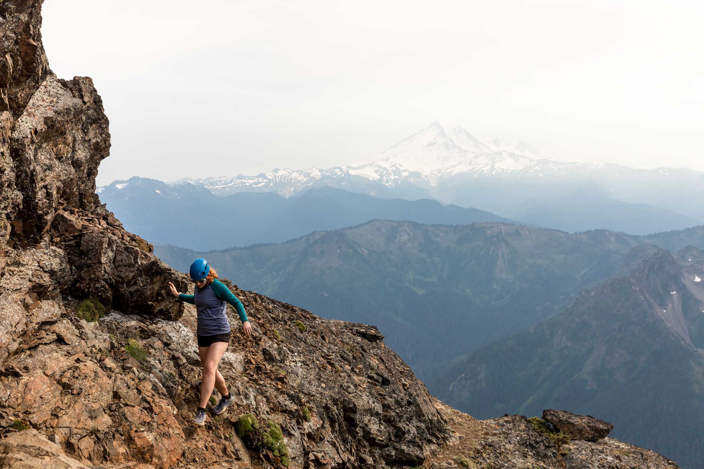
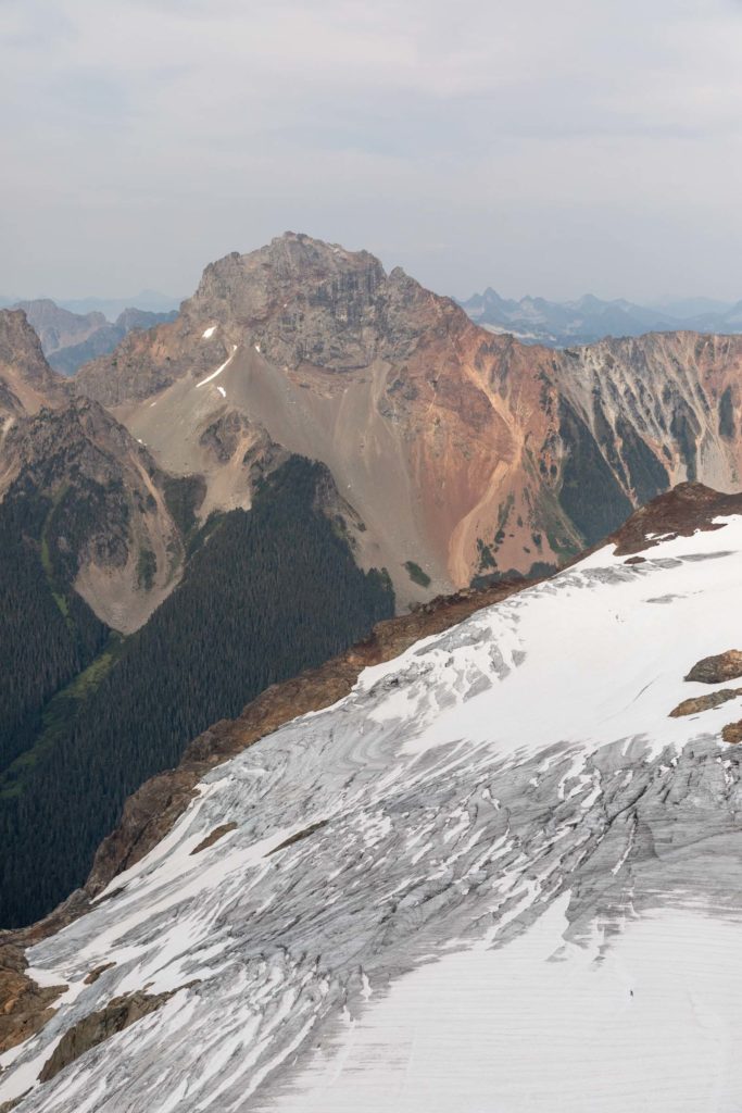
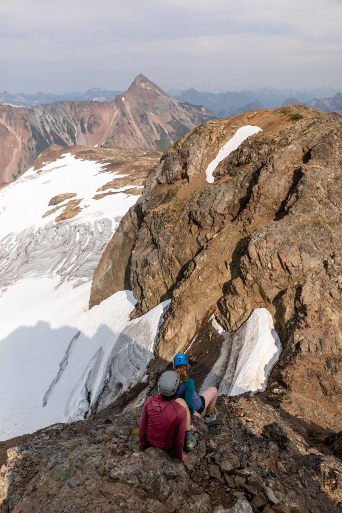
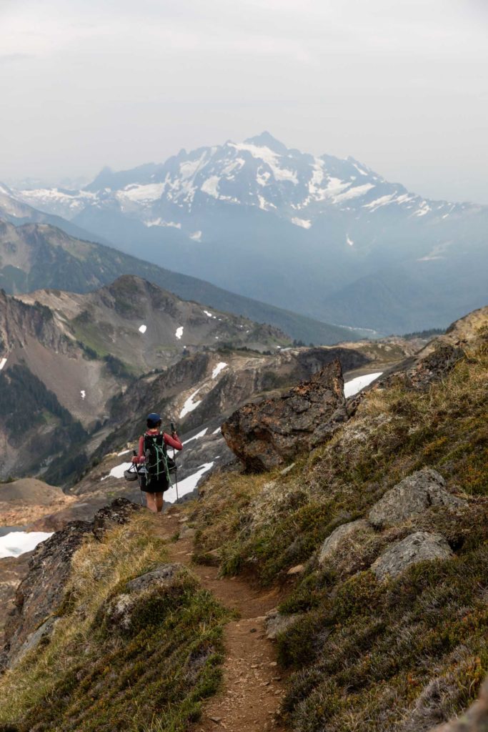
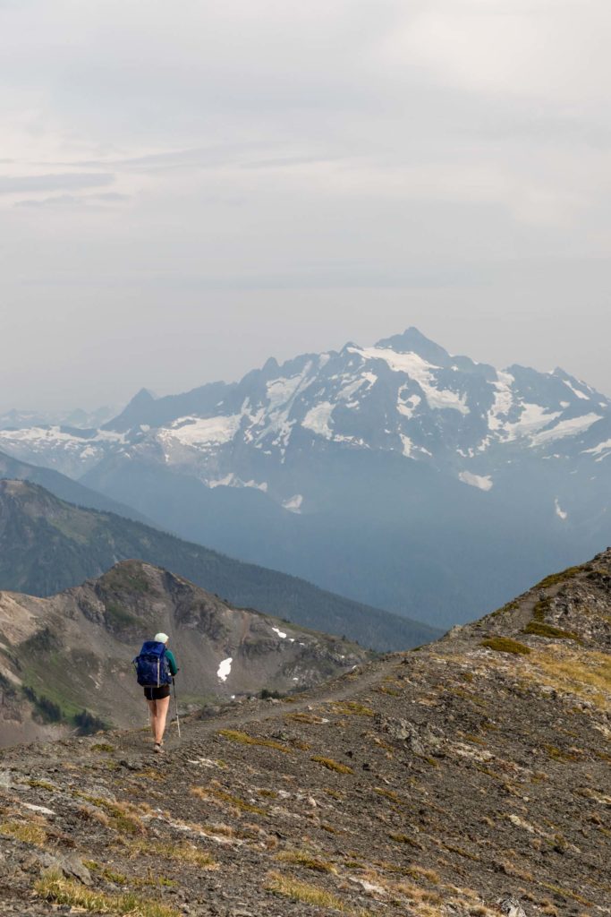
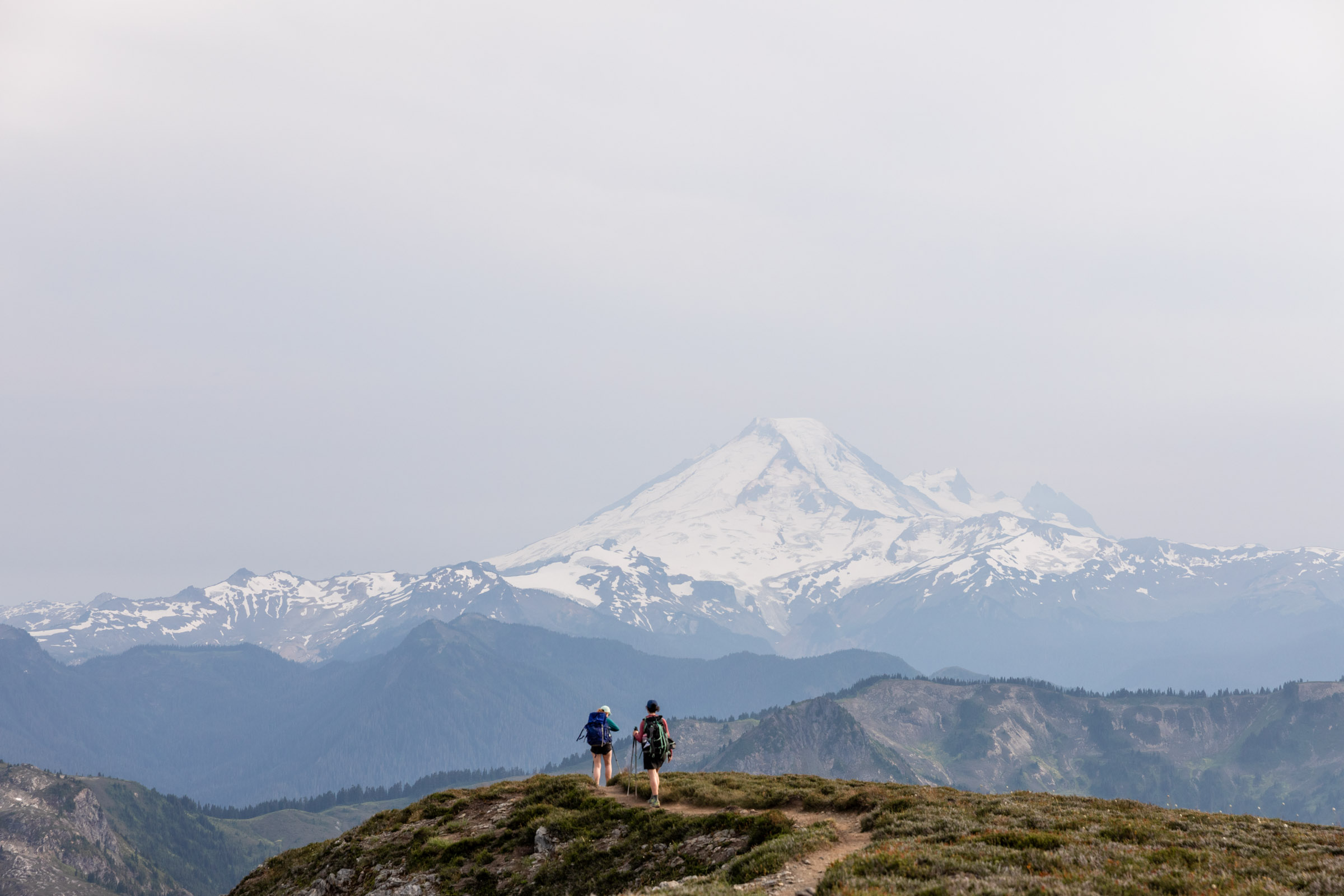
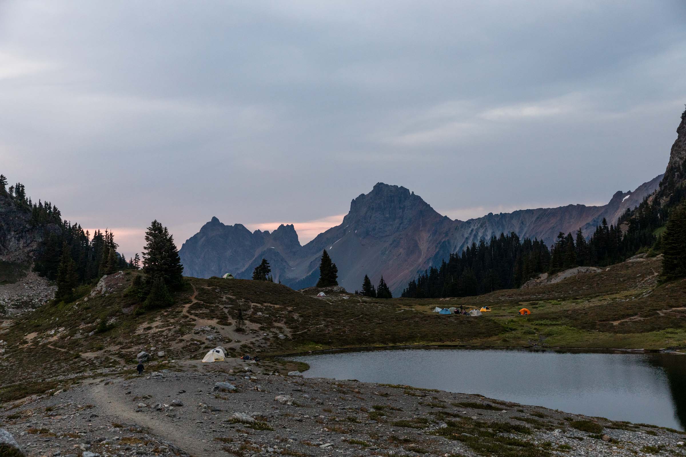
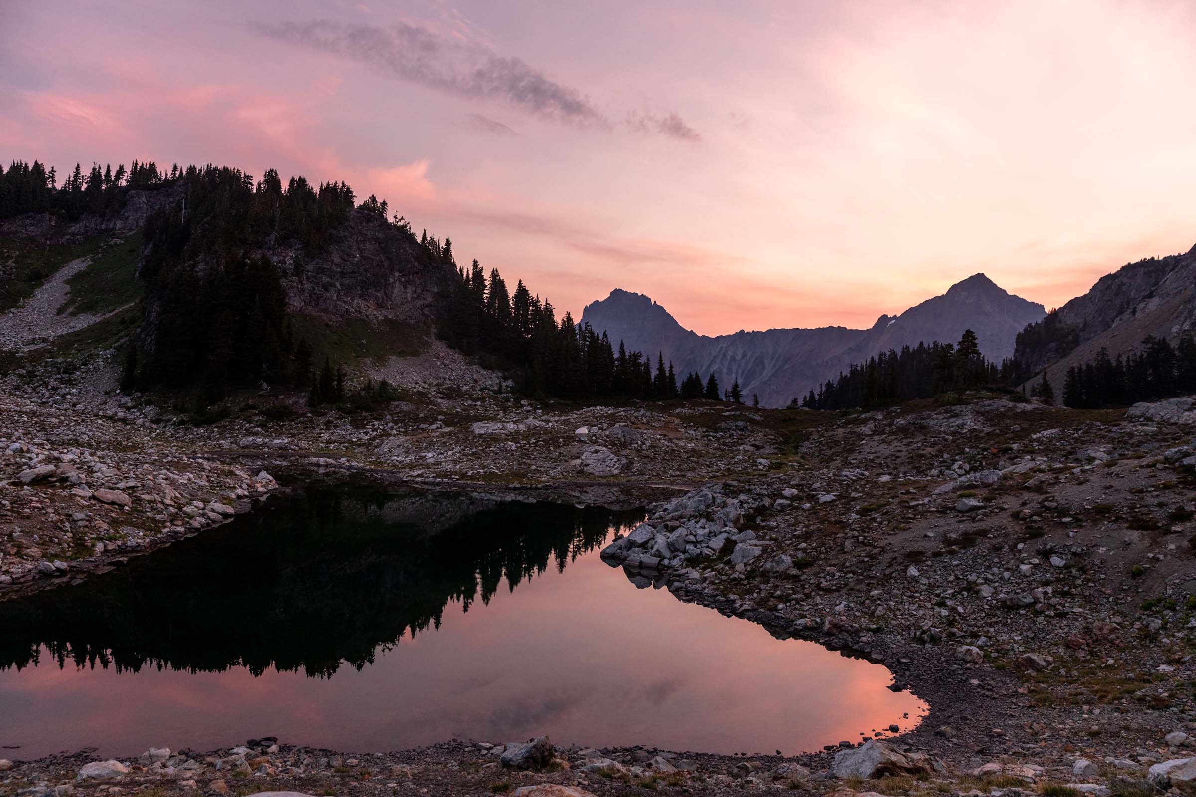
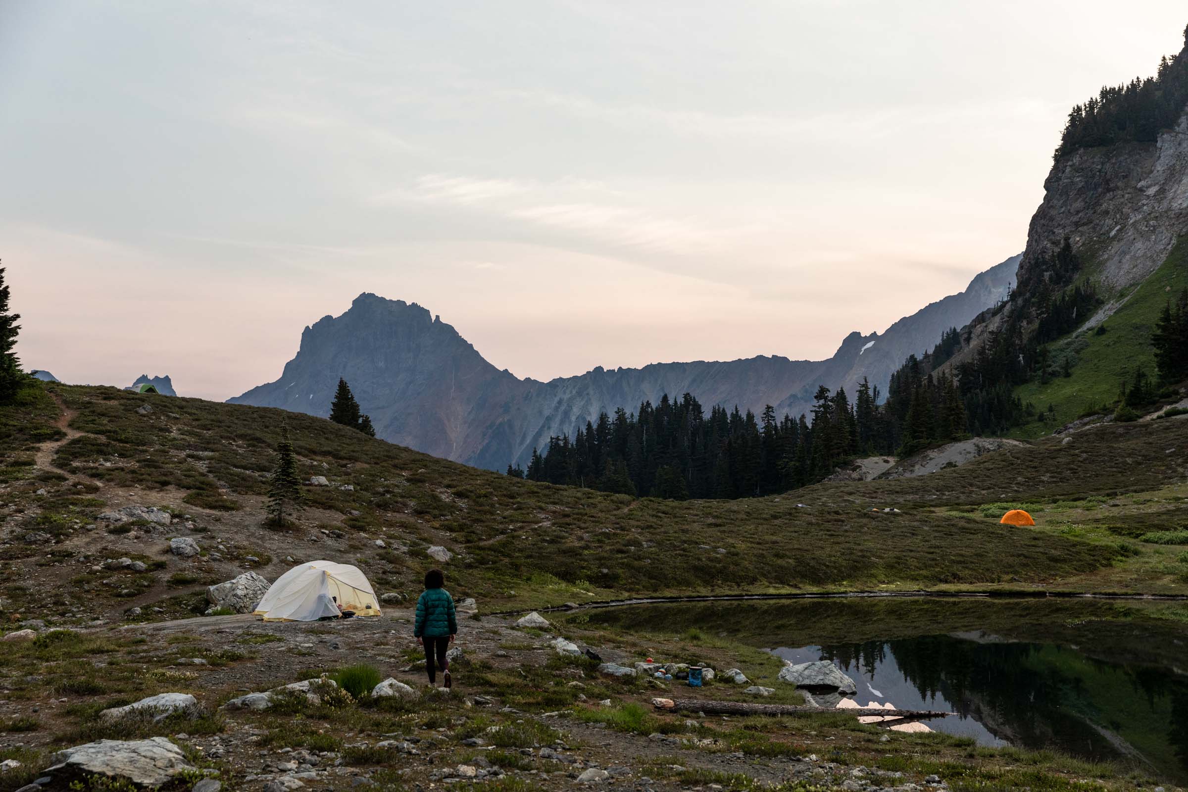
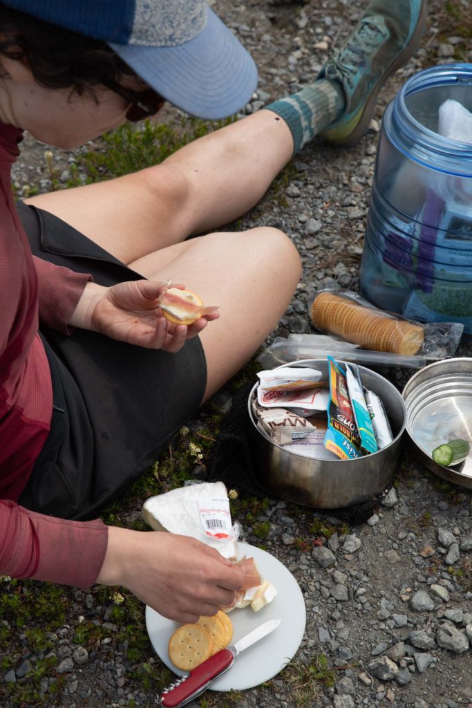
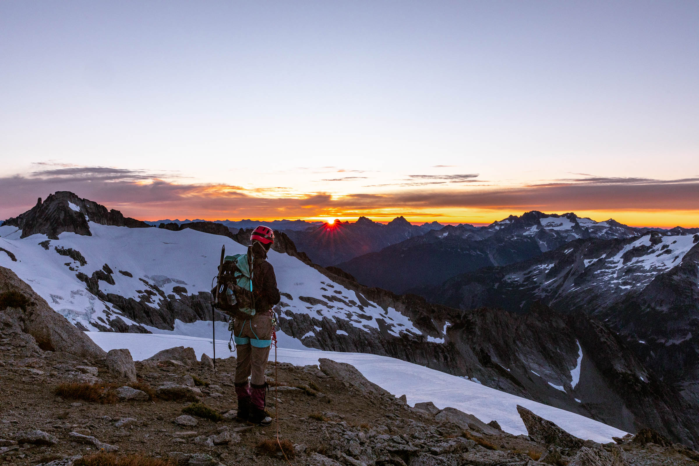
It was amazing having the peak to ourselves, looking at views to Canada and down to Baker. We returned the same way we came. At camp, we made dinner of couscous, sausage, onion, and fig. Recipe courtesy of Cleo. Sunset was more of a wash but we hoped for more colors come morning.
Camping at higher elevations and above the trees makes it really easy to watch sunrises. We stuck our heads out of the tent and saw the clear skies and the clouds turning pink before convincing ourselves to get up. After our little walk, we realized that we didn’t want to do a trail run so we had more time to take it easy so back to napping in the tents! A slow wake up again and we made breakfast and packed up without a rush in the world. Our last little excursion was walking out to the true summit of Yellow Aster Butte before finding the humid heat again back at the car.
Notes
- Tomyhoi scramble: From the trail, it’s best to go over the snow instead of taking the ridge. Light patches of snow late season. Follow the cairns the ridge and take the trail on the left to the false summit. Scramble up the true summit, no more than class 3 moves and short exposed sections. All the rock here is very solid.
- Yellow Aster Butte: Easy short scramble and possibly some loose soil right under the summit block.
- Camping: Lots of spots around the tarns and even a few spots on the way up to Tomyhoi.
- Did not include a map – most maps like Gaia or Caltopo will have the entire route available
Photos shot on Canon 5D Mark IV

You May Also Like
green envy | green mountain ski tour
meet me in the afterglow | eldorado peak overnight