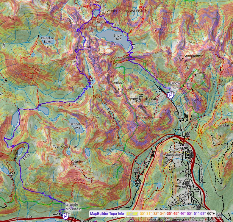
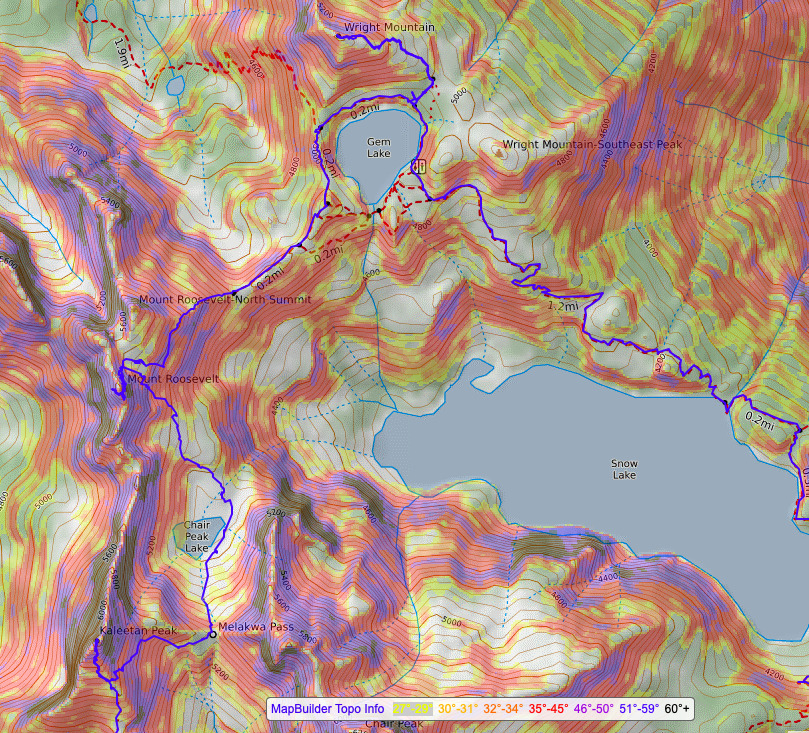
snoqualmie pass traverse | snow-wright-roosevelt-kaleetan-pratt
19.5 miles . 6500 ft gain . 6260 ft high
Alpine Lakes Wilderness
3 peaks and 7 lakes. I’ve been eyeing this Snoqualmie Pass loop for a while, but honestly without tagging the peaks, so I have to give Val the credit here for suggesting this great local adventure! It probably piqued my interest when Kyle + friends did some similar loop a while back. I’ve done some of these traverses before like the 3P to Mason Lake loop but the Snow Lake loop seemed more daunting for its length. It was reassuring to know that the terrain is relatively uncomplicated to just make the loop, just a pile of rocks to navigate. Plus I had already scrambled Kaleetan a couple times and knew what that scramble entailed. Mt Roosevelt was just the mainly new one for me!
(In parenthesis, I’ll be sharing some experiences we had with men on the trail. Especially after the new Barbie movie, why are some men so inappropriate and others are perfectly fine and then everything in between?)
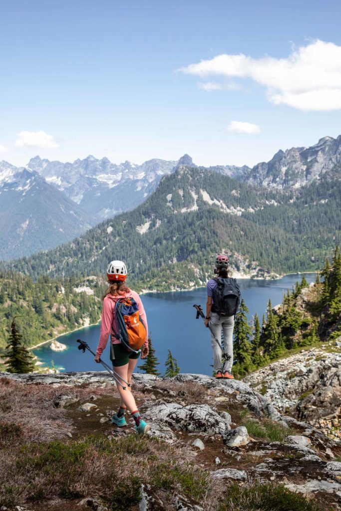
We started quite early to give ourselves enough time to take it easy. I love how Haley dubbed this her “exposure therapy” and I’ll likely steal that phrase for myself too! It’s always super fun to take people who want to challenge themselves in new terrain, so I was happy that Haley wanted to do this and Val and I could offer our little tidbit advice and encouragement here and there. At the Snow Lake trailhead, there were already dozens and dozens of cars. It’s easy to forget how popular this trail is when you’ve spent years avoiding it due to the popularity haha. Anyhow, it seemed like an exponential decay of people we say. The most by the trailhead bathrooms and fewer people we passed the closer we got to the lake.
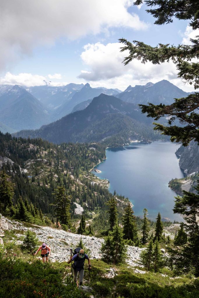
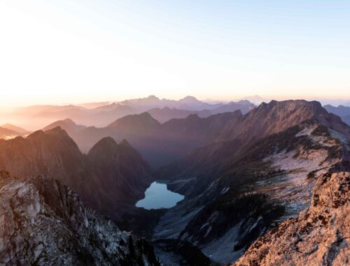
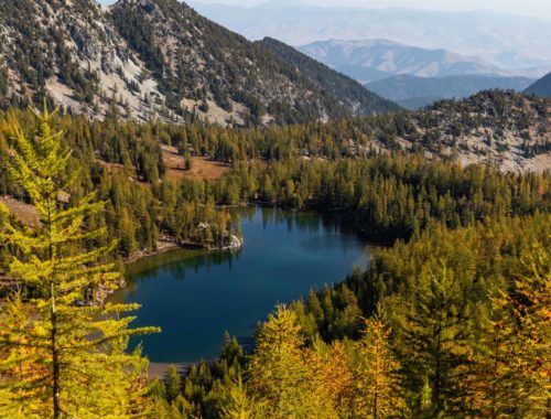
At the lake, there were already quite a few groups, some there earlier in the morning and others there since the night before. We barely made a stop before continuing on to Gem Lake. This one I’ve done before as well, and it is surprisingly deceiving how far away it is. You have to walk all along the shore of Snow Lake before beginning the true climb up to Gem Lake. Somehow the distance always gets to me and it feels like I’ve done as much vert as for Mt Si. In reality getting to Gem Lake is less than 3000 ft of gain. We skirted right around the lake and found a use trail to head up Wright Mountain. (An aside for a weird incident. A decent looking man asked us if we were scrambling Wright, to which we said yes and didn’t think much of it. Other than the fact that Wright is hardly a scramble and it made him sound like a novice, which in general is fine.)
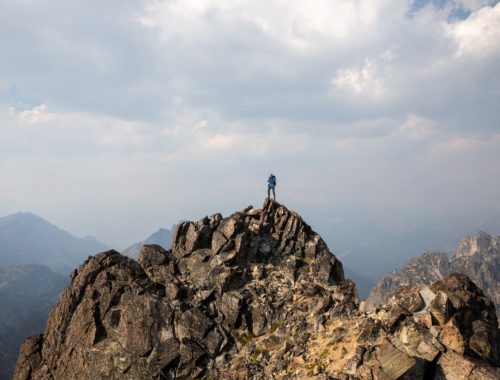
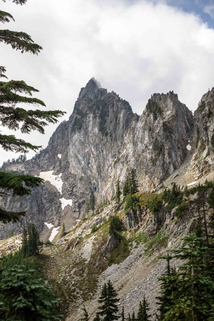
A short few hundred feet up and class 2 walking on some boulders with good cairns to follow, we were at the summit of Wright. Okay, nice little warm up and a good view of where we came and where we’re headed. From this point of view everything from Roosevelt and Kaleetan looked daunting. At least I knew Kaleetan wasn’t approached from this northern ridge. But getting up to the pass, that looked steep too. From years of experience, however, I knew that things are often not what they seem once you’re there in person. It is always more manageable than you think and never less. (The same guy eventually came up and we said a brief hi before we left him on the summit, not thinking much again.)
We got down back to Gem Lake and curved counter clockwise around it to find another trail up the ridge between Gem Lake and Roosevelt. It was a perfect amount of undulating steep uphill and slight downhill until the base of the real steep trail to get to the base of Roosevelt. (Here we met a very nice trail runner on his way down. He offered succinct advice and super pleasant to talk with. He mentioned snow we could get around and we were confident about our approach. No mansplaining hooray.)
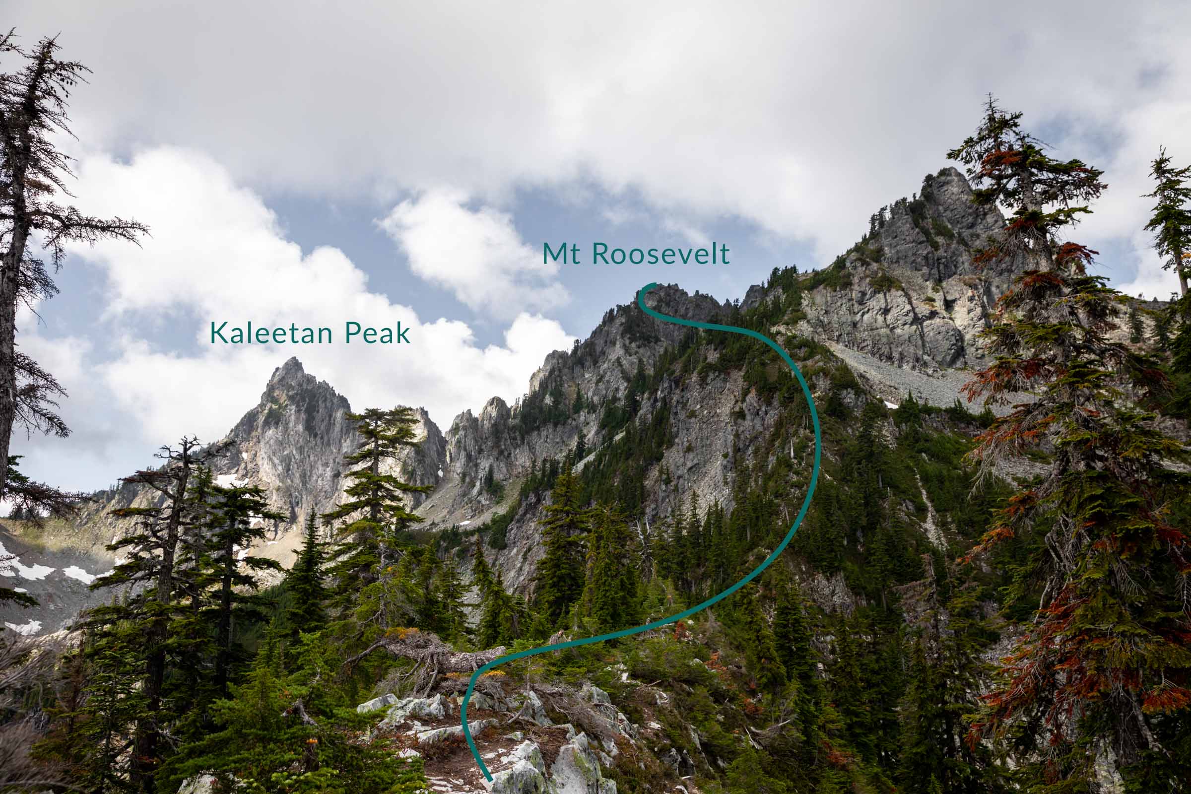
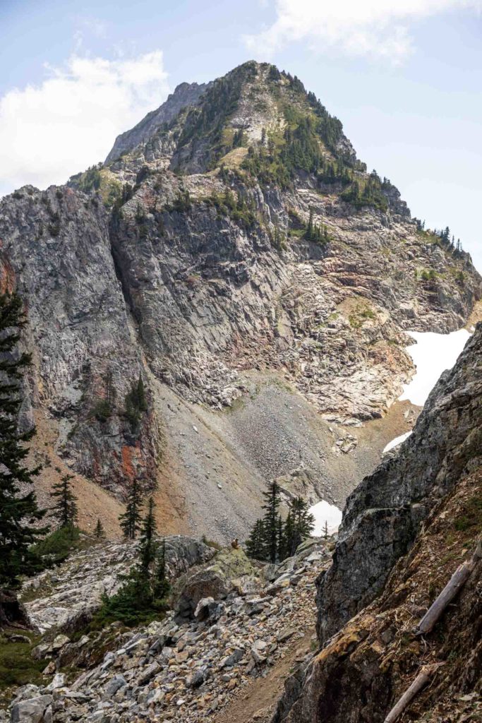
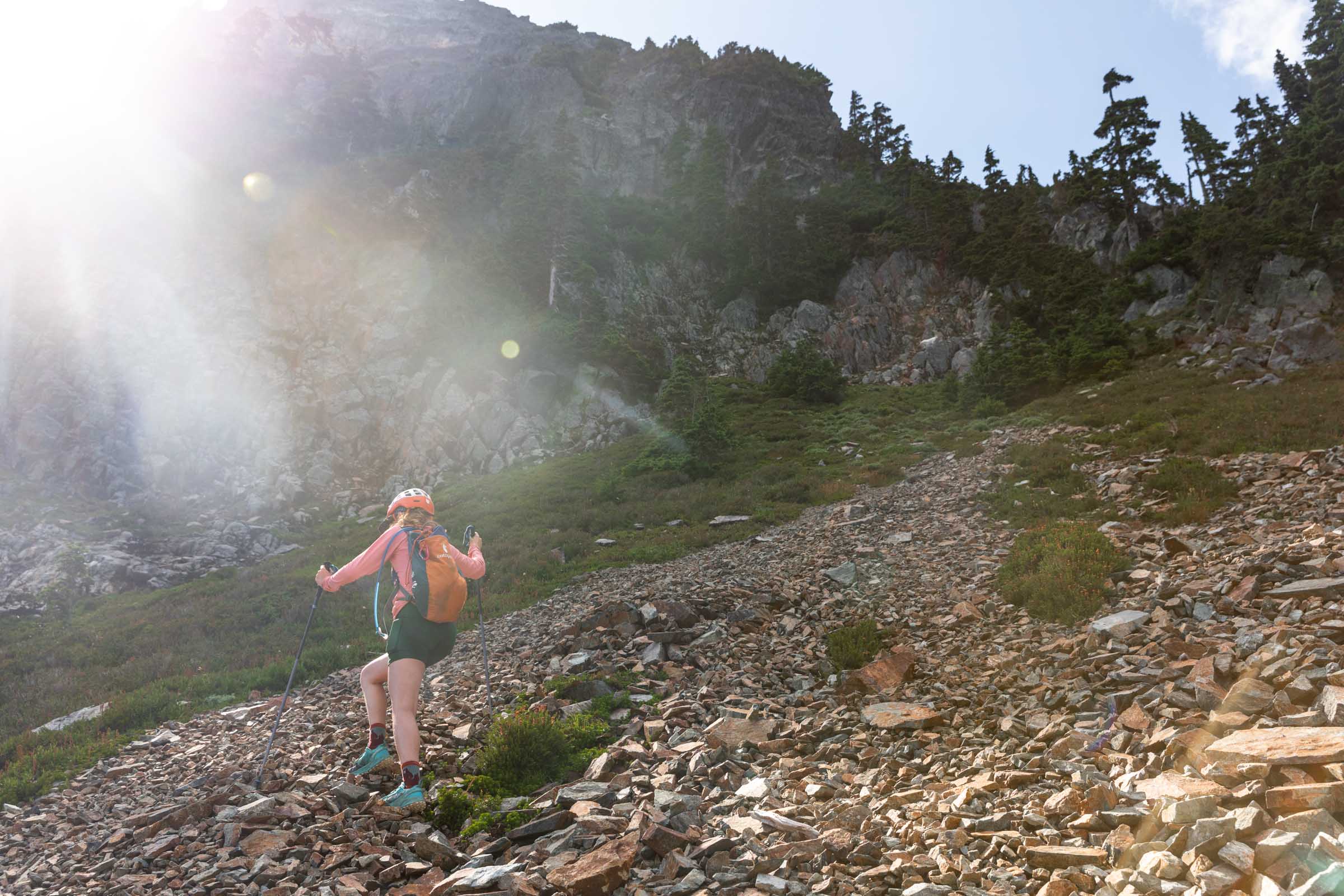
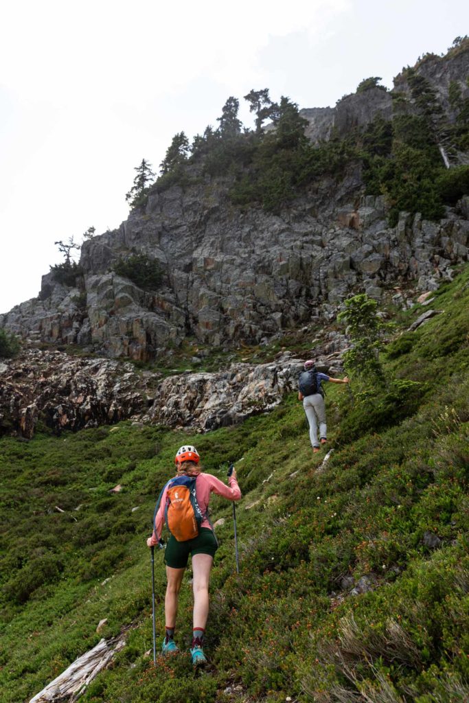
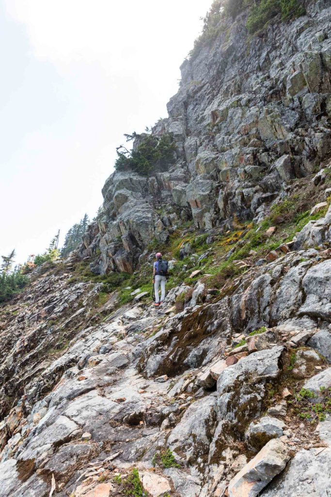
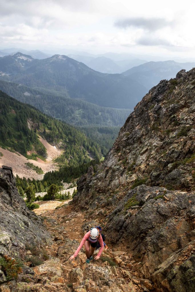
Scooting up the ridge, we managed to go a bit under a cliff instead of over, which is fine, we ended up a gully that reached the normal trail anyway. It seemed like people get a little turned around here and go up the same gully too. We took a nice long break next to the snow, looking at the next ramp we’d go up. Sometimes even I get in over my head about scrambles, but I do them anyway. And it’s definitely an interesting take to help lead someone else up and swallow any minute fear I have because once you start showing that it definitely doesn’t help someone new. We followed Val up the ramp and I started to see her cool way of showing scrambling – pointing out all the good steps vs loose rock. Definitely nicer than my method! (We then noticed a person off in the distance who was on the trail we missed but then also looked lost as they started going up the northern Roosevelt peak. For a while they just stared at us from what we could tell. We weren’t sure if they were trying to figure out how to get to the true summit or what.)
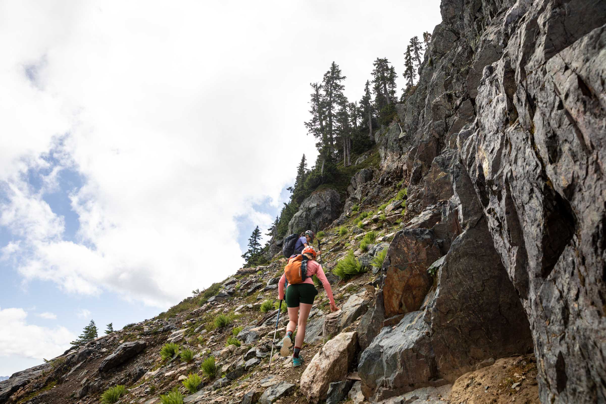
Passed the green ramp, the easy scramble began. It’s pretty short and boulder-y and mostly just a steep trail. It definitely feels exposed once you get above the ramp and you can see a cliff drop off. But don’t let it get into your head, it’s just a trail. Once again, we enjoyed the summit. (All of a sudden we heard noises again and up popped this guy. None of us put two and two together right away and struck up friendly conversation. We told him how we were doing a loop and I naively told him how this was sort of a half way point anyway, thinking it’s just friendly hiker beta for future use. But then he proceeded to not know about Kaleetan, which is arguably more popular according to Val. And also didn’t know Denny Creek, which is a trail next to the famous Franklin Falls hike. So it got a bit weird how much he was asking for not knowing.)
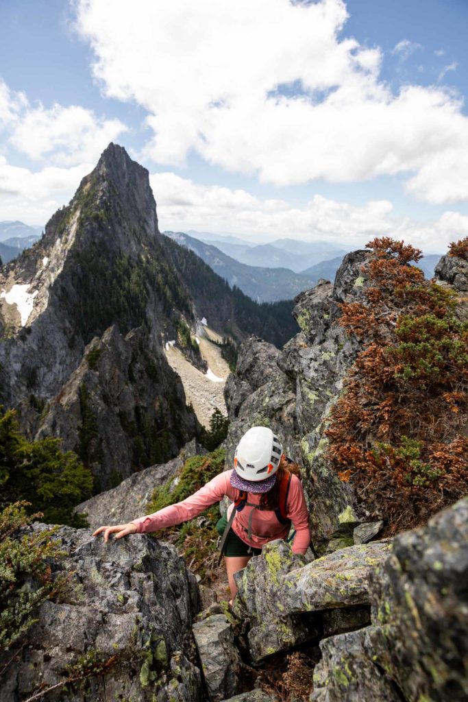
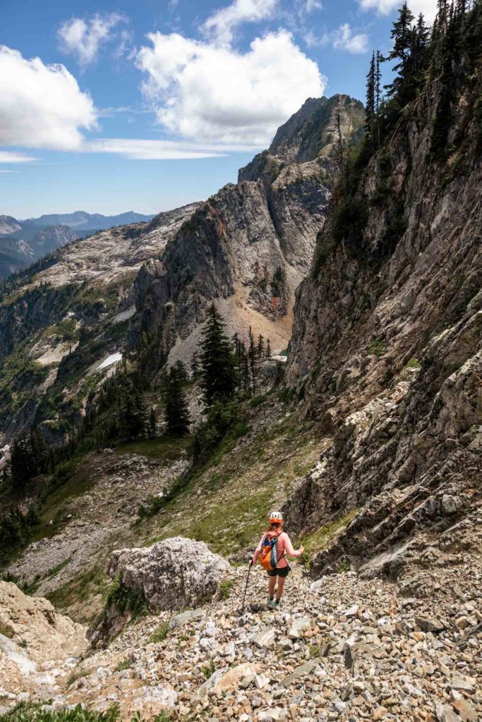
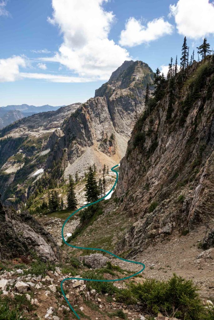
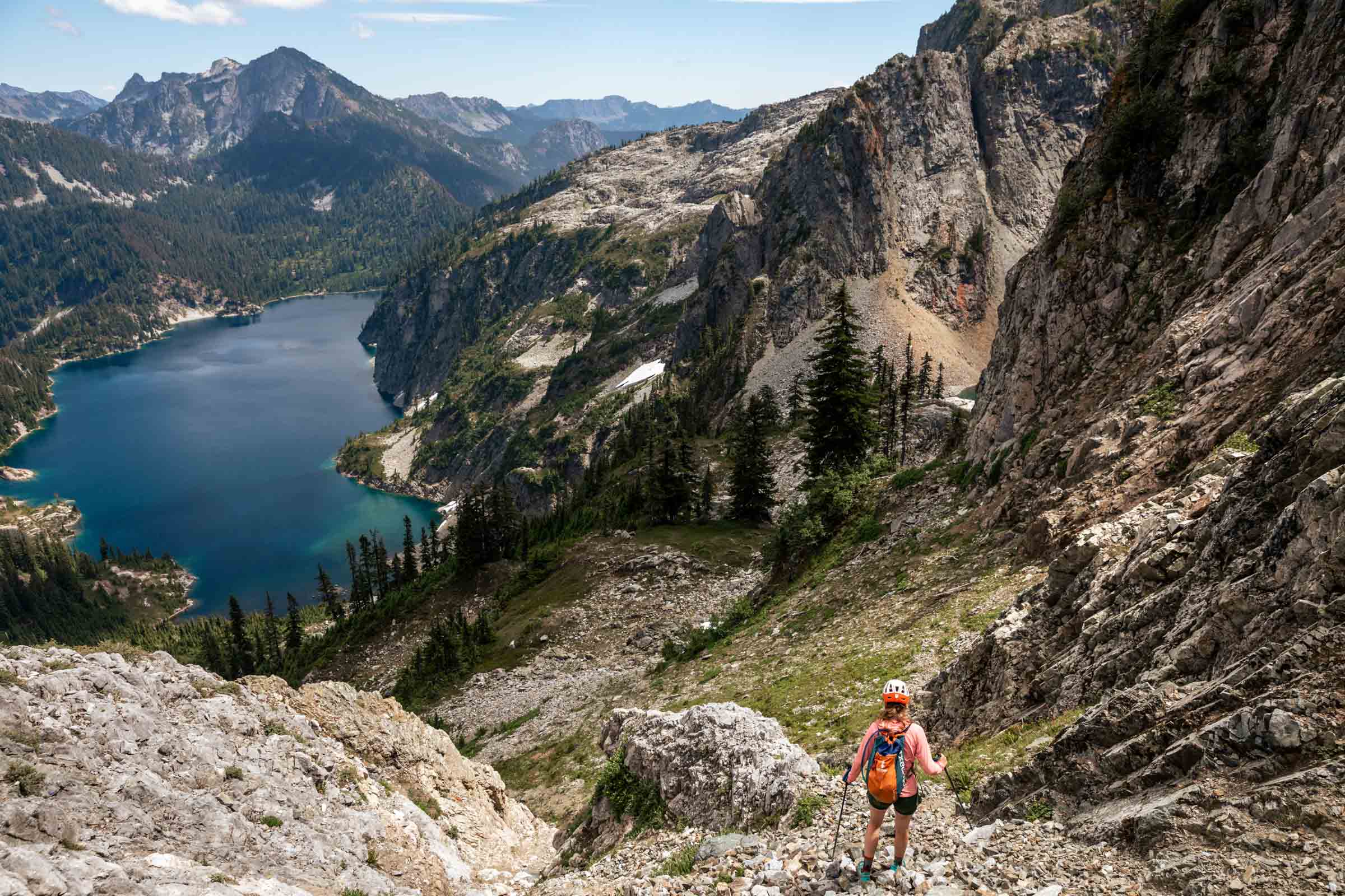
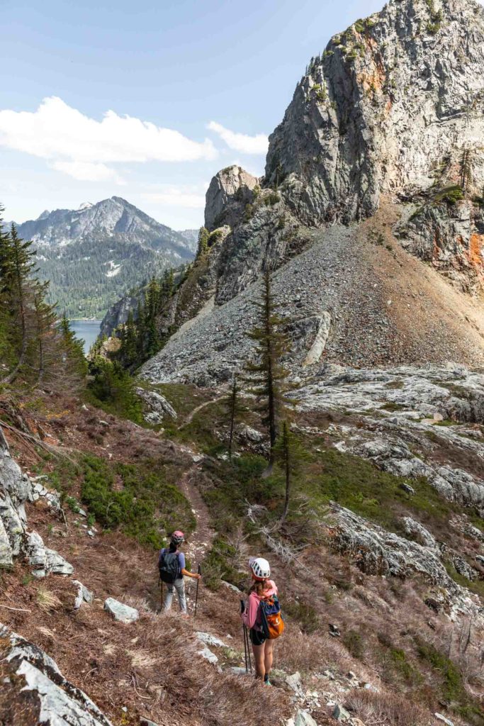
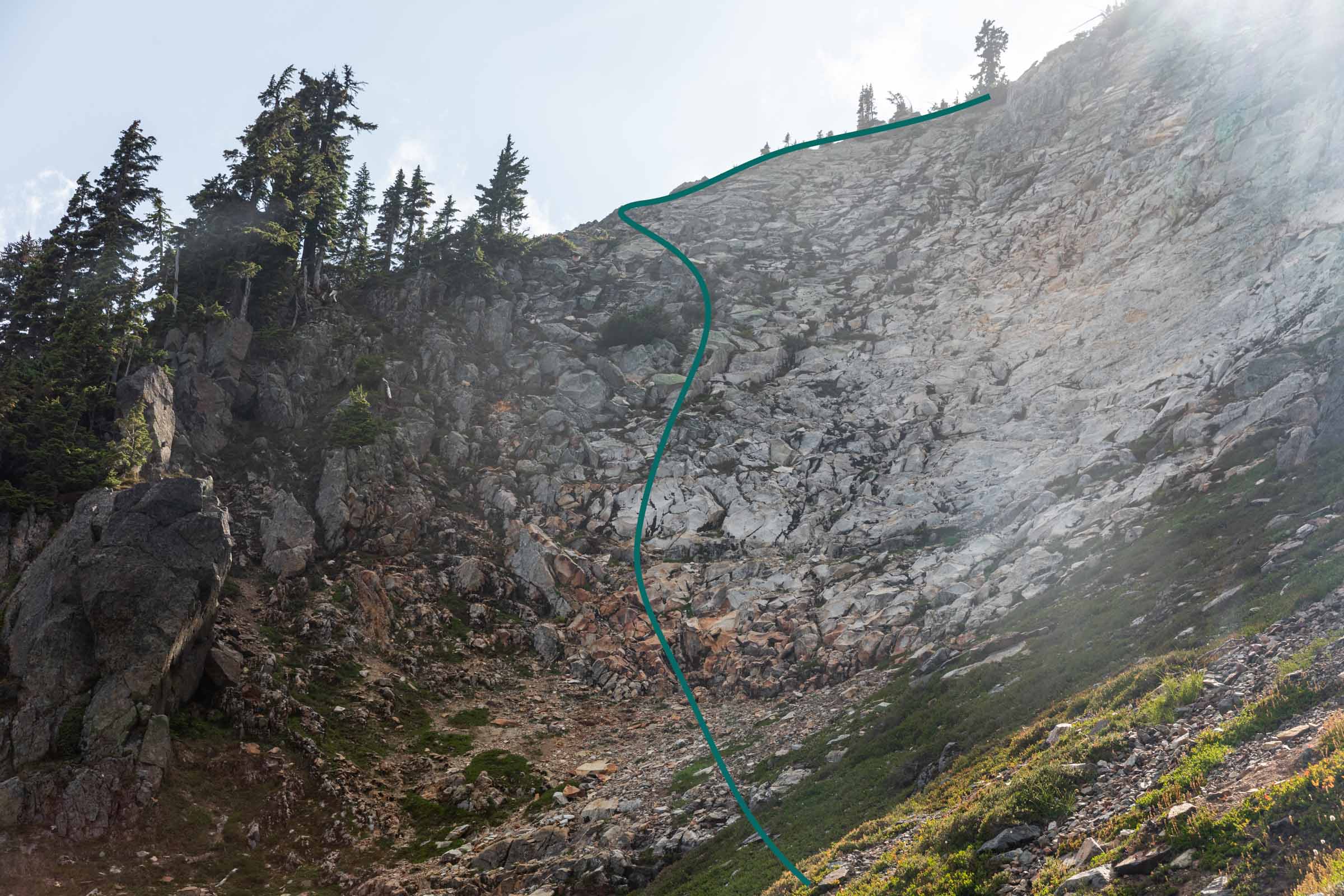
We made our way down Roosevelt and down the ramp before turning right down a different gully that we came up. This gully has a trail for a good way down before choosing the scree or staying on the soil. Once you clear the boulders from the ramp, it’s fairly clear where you have to go to hit the Chair Peak Lake. The trail is more or less there most of the way to the lake. (The whole time we all kept looking back, wondering if the guy would follow us again. I honestly thought there was a slightly 30% chance he would, but like what are the chances some random person follows some random group without doing some research? But once we got under the steep portion before traversing to the lake, we found him again. Or more like he found us. We were very creeped out and and we decided to take a long break right where we were rather than the lake itself. He never came to say hi again. But after we stopped he wandered over to a view point, seemingly pretending to look at his phone. He definitely seemed lost in what to do, he obviously didn’t know where to go.)
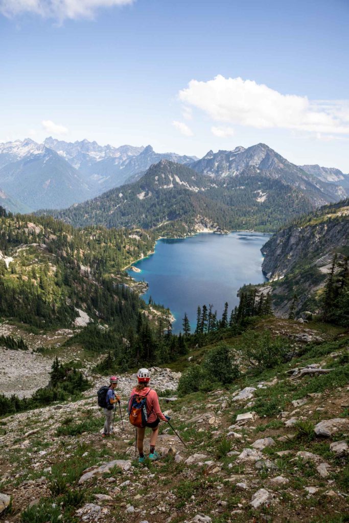
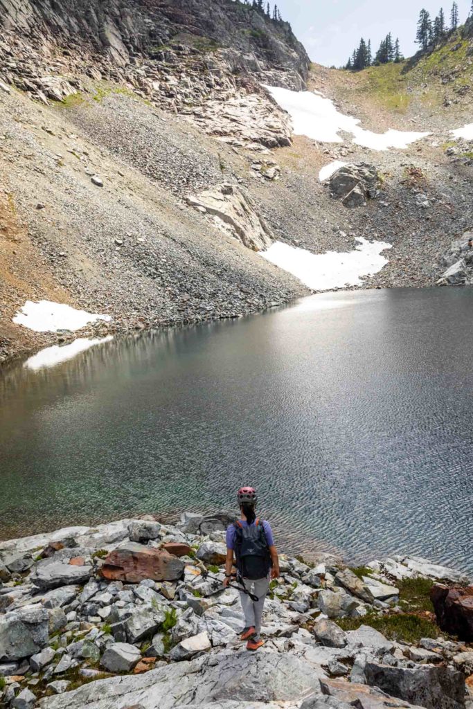
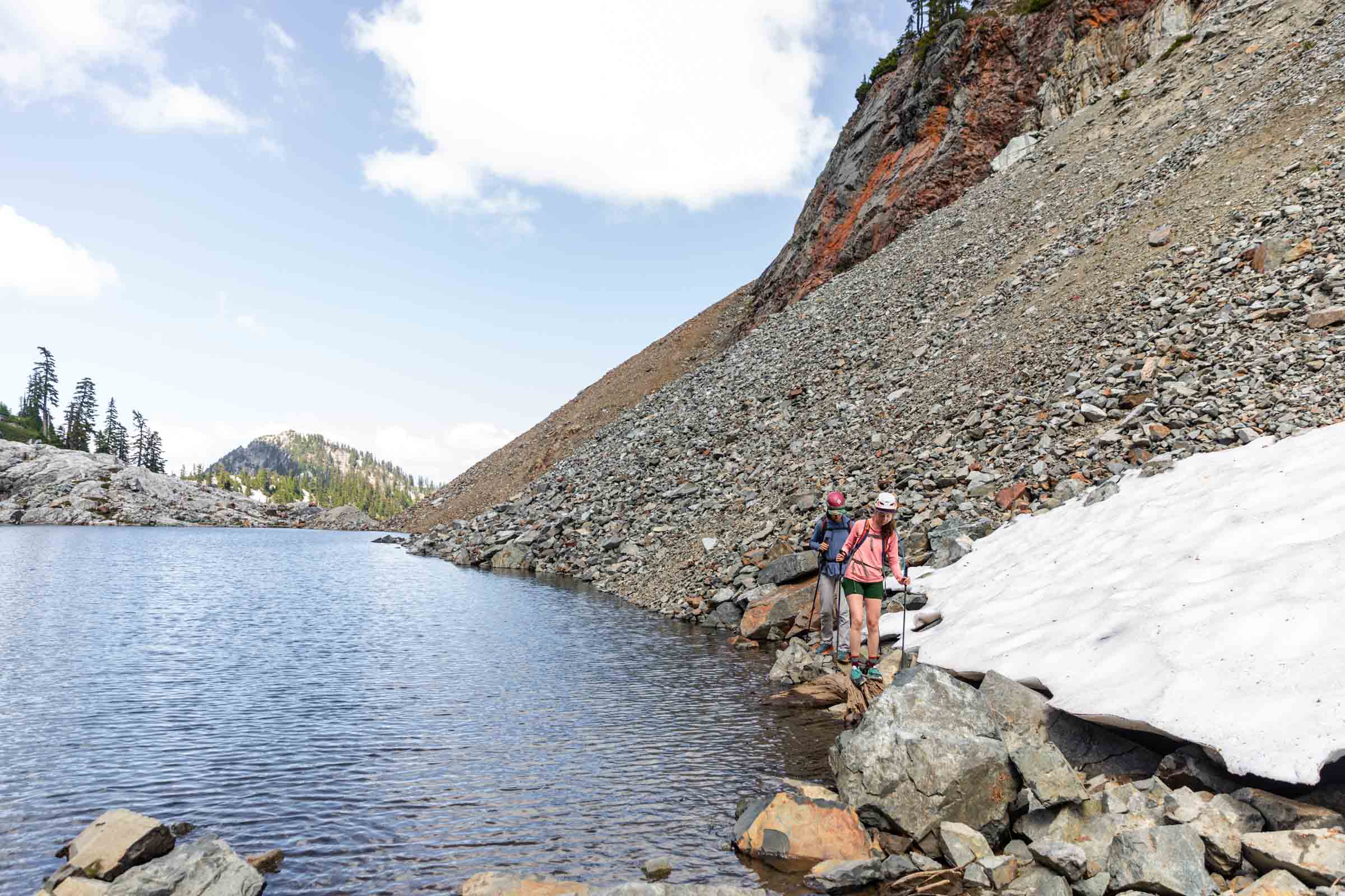
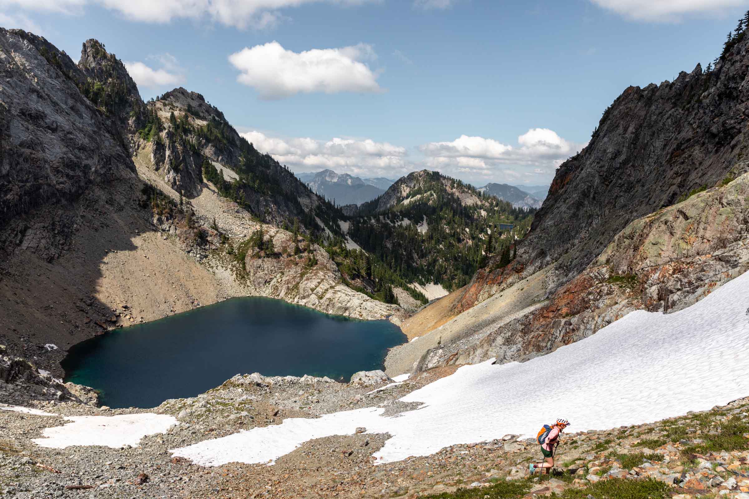
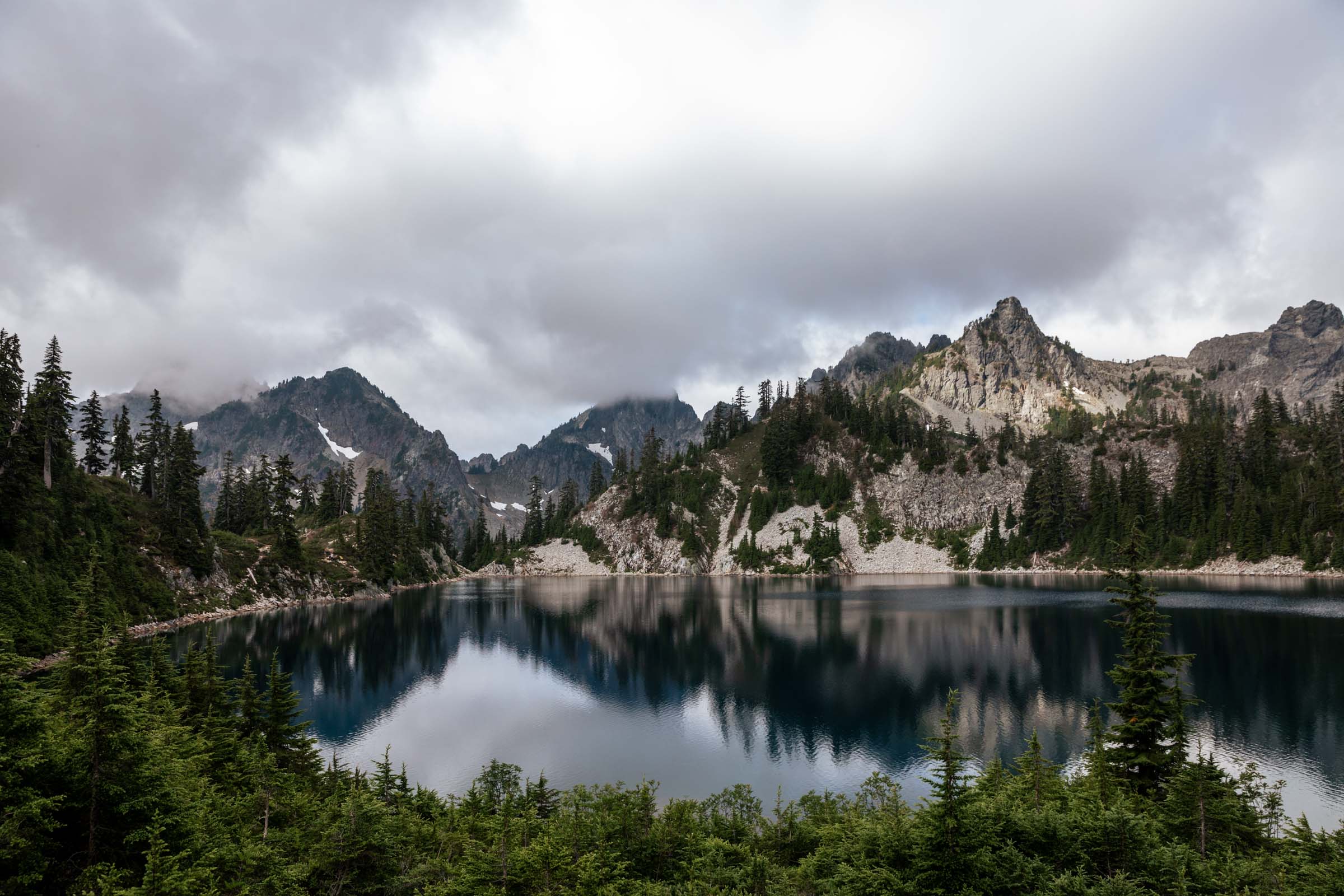
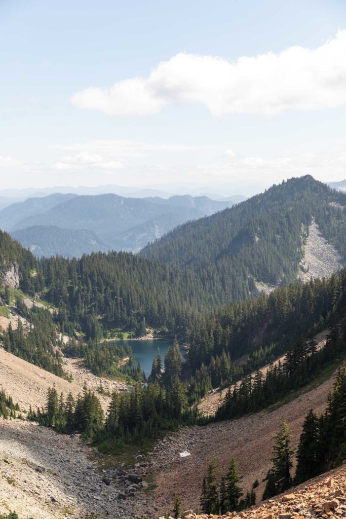
Tired of waiting and seeing him move back uphill, we made our way to the gorgeous Chair Peak Lake. We moved quickly till we were quite out of sight of the gully we came down. Another long break to enjoy the beauty without a single thought of time. It felt like somewhere in the deep wilderness but we were just a stone’s throw away from Snow Lake. We heard voices again above us but didn’t see people until they started to descend the Melakwa Pass. I get excited sometimes to see people just to know I’m not the only crazy one here. (The two guys stopped half way down, which I thought was a little suspicious but there’s three of us so we felt okay still. They started moving as we walked left around the lake and we met up with them at the lower part of the climb to the pass. They were two older men who seemed confident around this terrain and we a tad funny about their experience up a sub peak. They offered some insight into the closed trailhead but honestly talked a bit more than necessary. Sometimes it’s hard to know when to stop, but just little enough before I’d start calling it mansplaining.)
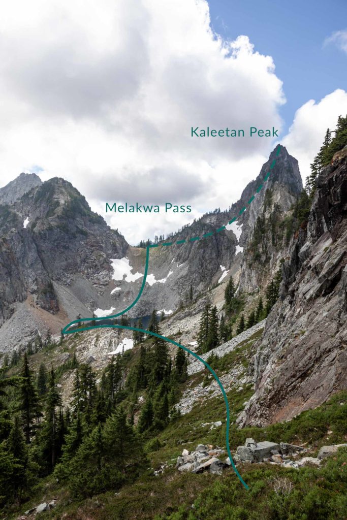
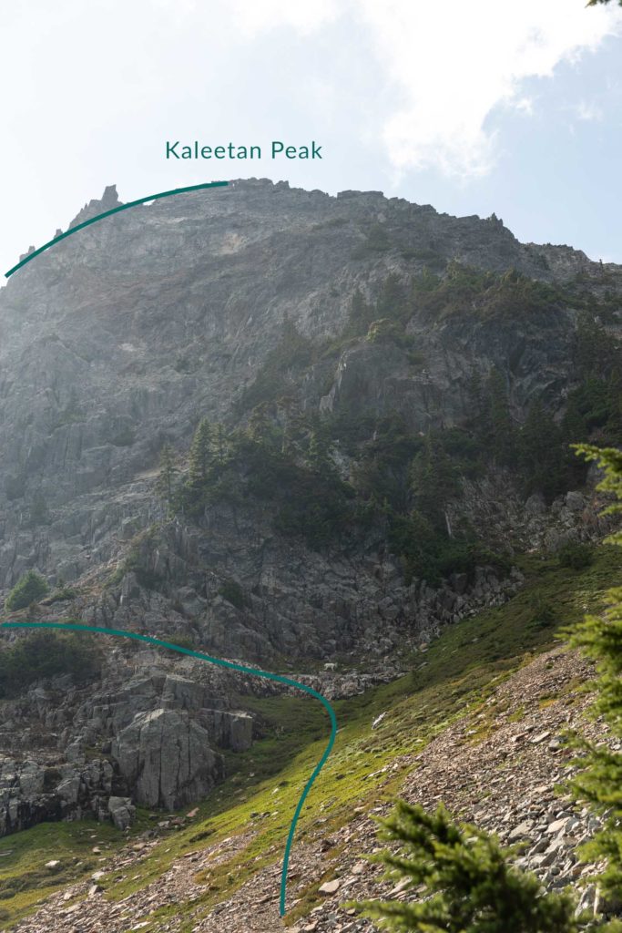
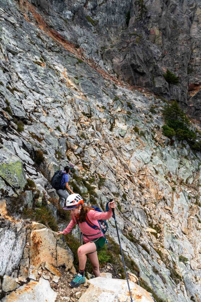
Up at Melakwa Pass, we had to decide between descending straight to Melakwa Lake or go up Kaleetan via the White Ledges. Obviously both Val and I are peak baggers at heart and wanted to continue Haley’s self challenge. So we convinced her to go up with us. Anyway going down a giant boulder field would be just as mentally taxing with less reward. You have to go decently right to get under the cliffs before traversing left on one band that gets you next to the White Ledges themselves. Here we saw a goat!! Never had we seen a goat in the Snoqualmie area. It seemed very content there by itself. Meanwhile marmots were screaming at us the whole time on the traverse. The White Ledges can seem scary at first but once you’re on it, there’s a lot of steps that make it seem like stairs, but definitely it can feel a bit exposed. The rock is all quite solid – but definitely test them too since it’s not a high traffic scramble. Making our way left up the White Ledges, we got onto a less steep slope that took us right to the normal trail up Kaleetan.
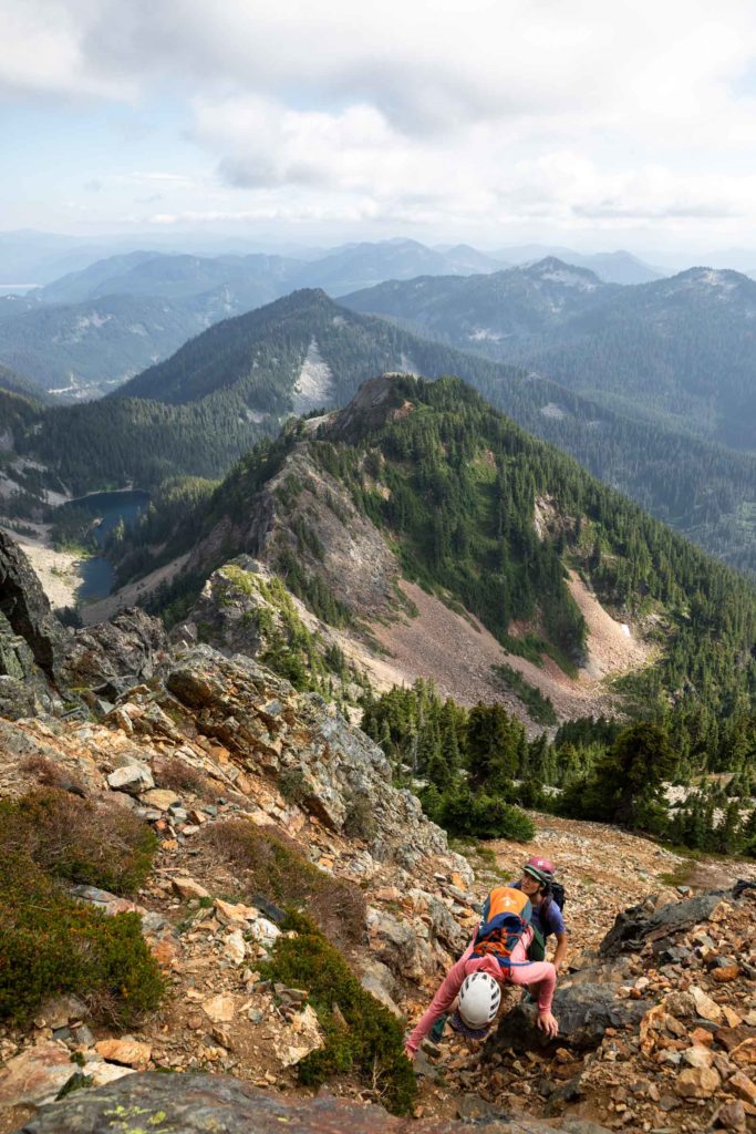
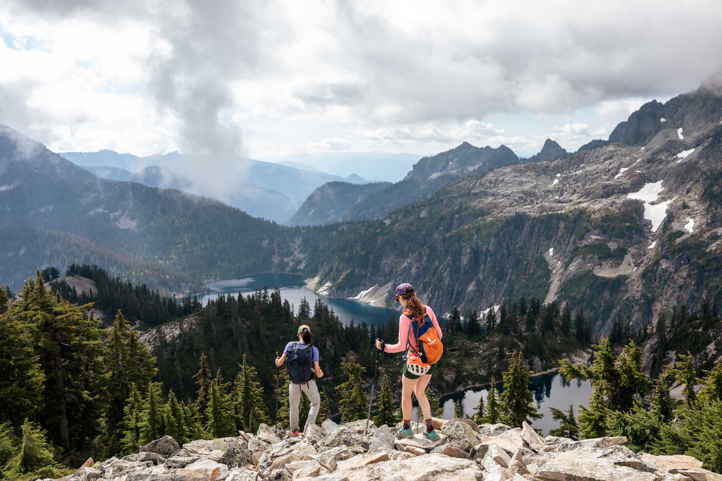
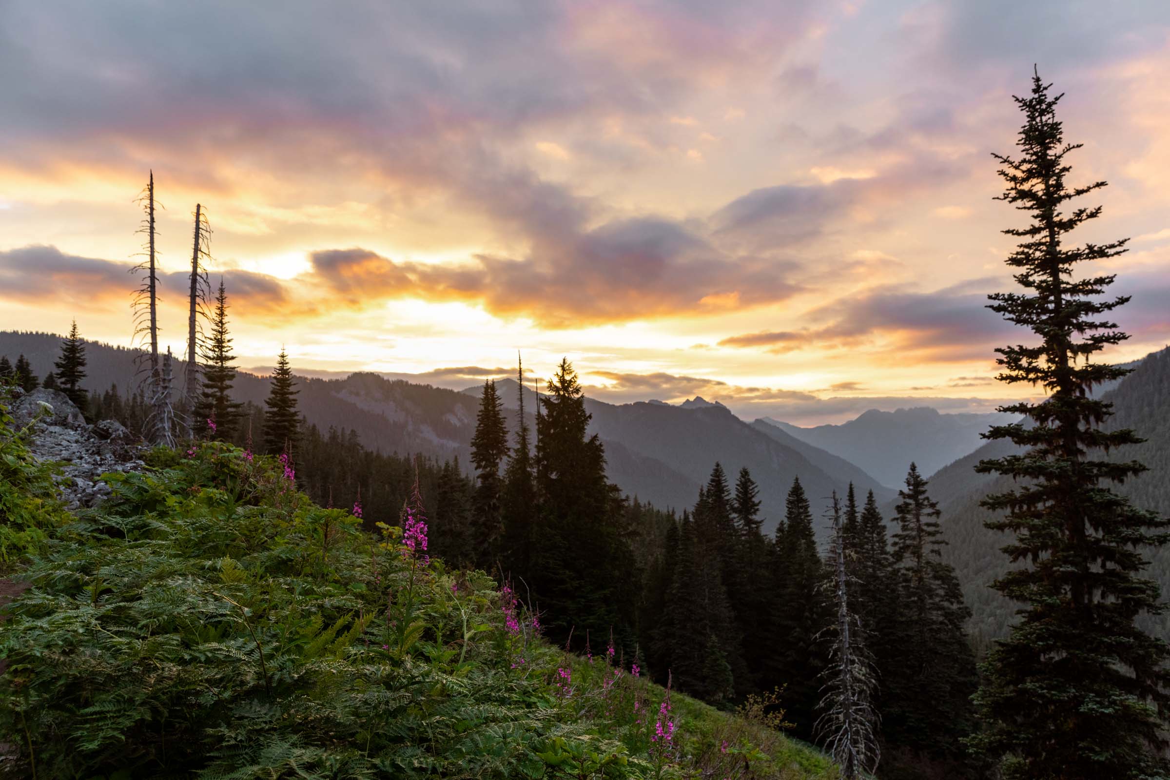
From here, everything felt more breezy. Even Haley was unfazed by the class 3 section beneath the summit. We must’ve been one of the few people who summited Kaleetan this year due to the trailhead closure by Denny Creek/Franklin Falls. At Melakwa Lake, we yet again had a decision whether to descend by Denny Creek vs Pratt Lake. Granite was already out the door since we were running out of daylight. Perhaps Denny Creek was the better option but I was intrigued by Pratt Lake. There would be no road walking necessary and we imagined the trail to be cruiser and easy on the knees. That was true, but it was so long after an already long day. We enjoyed some berries along the way and watched the sunset as we passed Lower Tuscohatchie Lake and Pratt Lake.
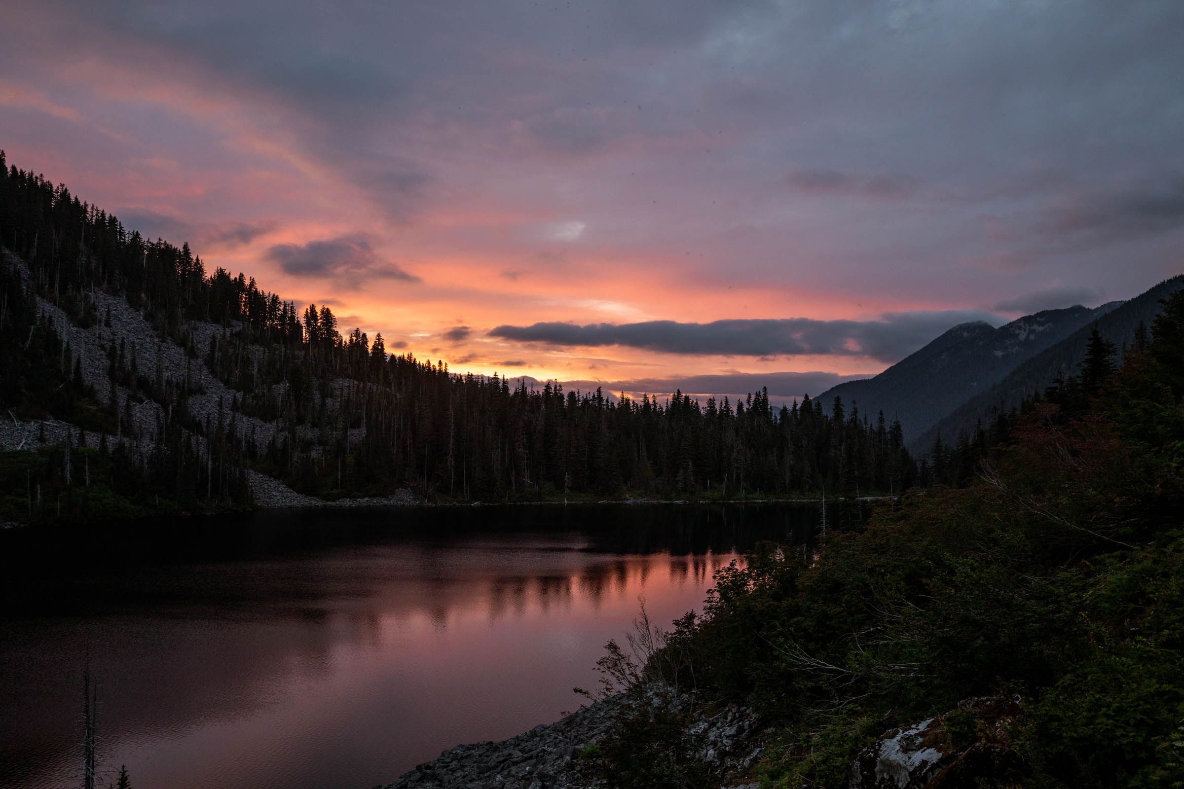
By this point, every time we went into the forest, it felt like darkness descended on us and every time in the open, it felt like the sun was shining. By the Ollalie-Pratt pass, my phone died recording and it was definitely all darkness. Headlamps were much needed but now the trail got quite a bit wider and pleasant with far fewer rocks to navigate. A mindless hike back down to the car, trying not to think about what looms in the darkness. We barely saw Ollalie Lake, just the slight reflection of the bright night sky and voices at the camps across the lake. We were so happy once we found the junction with the Granite Mountain turnoff. A few minutes later, back at the car, ready to rest our tired feet. Obviously the time it takes to complete this varies depending on your fitness and scrambling/off trail ability. But we all had fun on this one!
Notes
- Car shuttle with one at Snow Lake Trailhead and one at Granite Mountain Trailhead (also named Pratt Lake Trailhead) for the most options to exit. Normally for the shortest route, you’d park at Denny Creek Trailhead.
- Option to not tag any peaks.
- Option to add on Granite Mountain via Tusk O’Granite or via Low Mountain.
- Option to end at Talapus Lake Trailhead, which is slightly shorter than going to the Granite Mountain Trailhead.
- Pratt River TH and Pratt Lake TH are different – check it before you go.
- NW Forest Pass for all trailheads here
- Wright Mountain is entirely class 1-2 scrambling/hiking.
- Roosevelt Mountain is less traveled and the trail may be faint at times. Take the ridge between Gem Lake and Roosevelt. Take it fairly hight before traversing south along the east side of the true and false summits. Take the shallowest ramp up before a steep, semi-exposed trail up to a less exposed short 20 feet class 2-3 scramble to the summit.
- Between Roosevelt and Kaleetan, descend the ramp and turn right at the boulder field instead of continuing on the trail where you came from. Follow trail and gully down to an open slope. Keep traversing south till you get to Chair Peak Lake. To get around the lake, follow it’s east shore.
- Kaleetan via White Ledges starts from Melakwa Pass. Get as high as you can under the cliffs on the right most side facing the White Ledges using the boulder field and heather slopes. Find a grassy ledge that is easy to get on. Then traverse up and left, attaining the ridge above before finding the main trail up Kaleetan. White Ledges can feel exposed. 150 ft class 3 scrambling in a gully at top, minimal exposure.
Photos taken on Canon 5D Mark IV


You May Also Like
life on the edge | vesper via ragged edge rock climb (5.7 alpine trad)
hunting for larches | golden lakes loop backpacking