this ain’t a fairytale | whitehorse mountain
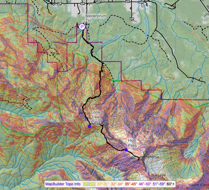
13 miles . 7000 ft gain . 6840 ft high
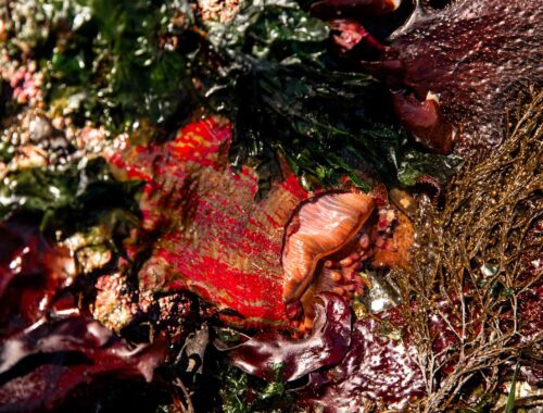
Boulder River Wilderness
When you think Whitehorse, which song comes to mind? Whitehorse by Taylor Swift or Dark Horse by Katy Perry? Naturally I’d say TS, but Dark Horse is very catchy too. Now that that’s settled, about climbing Whitehorse. It’s a pretty major mountain full of all the usual Cascadian shenanigans minus a bad forest road. You got a heinous bushwhack, glacier travel, exposed scrambling, and enough sidehilling to make you question your life decisions.
What started as a weekend dedicated to ski Mt Adams quickly turned into trying to find a fun alpine climb with other friends. I felt a little burnt out on volcano ski slogs after Helens and Baker recently. The idea of another non-volcanic alpine day like Sloan felt like a great idea! But I had somehow forgotten the mental and physical toll a full alpine day takes on you. Usually by June most people aren’t trying to summit Whitehorse due to a large moat issue unless you were super determined. If you’re reading for current beta as this is being posted, go literally right now, or it really will be out in a week or so and you’ll be climbing a moat.
Moats are problematic in the mountaineering world because when the snow melts away from the rock too much, it creates a giant chasm that is difficult to cross and impractical to try for most. Sometimes you can be creative and find other ways around though. But the earlier in the season you go, the less likely you’ll have to deal with the moat. For frequently visited places, you might be able to find reasonable trip reports for current conditions and what to expect.
We took the risk, decided to bring a few cams in case we wanted to protect the scramble. We were prepared with 2 ice tools each in case we had to climb any overhung ice or get into the moat and out. By golly we were going to summit Whitehorse, the looming mountain in the foreground of any drive through Darrington.
When we arrived at the trailhead, we were surprised to see another car. We wondered why their packs were so giant like an overnight pack, but turns out they were paragliding. To cut the chase, we never saw them again and the only evidence of them was the boot pack they made which melted out over the day and also their flight path from near the summit. You could see how the foot prints look like someone running and then they disappear into thin air. Must’ve been a beautiful flight!
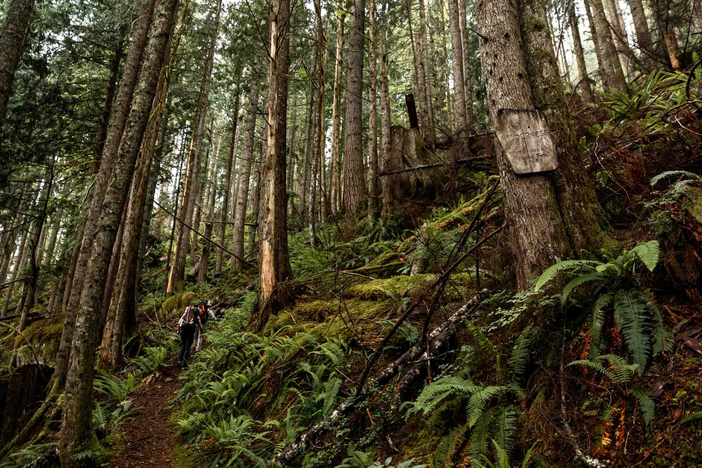
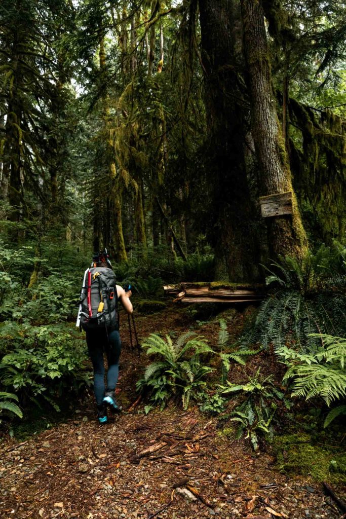
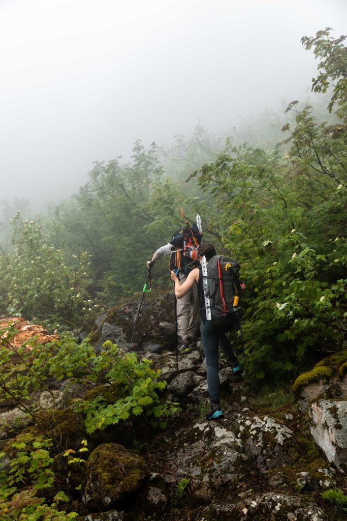
We started at the Niederprum Trailhead and followed the gentle grade for a mile before taking the trail straight up the forest. There’s a trail register! The trail is slightly overgrown in places but is honestly quite good for a fairly unmaintained trail. However the main trail will disappear part way up to Lone Tree Pass. If you go late season, you’ll likely find a good use trail that’s fairly faint but helps reduce the amount of sidehilling. We were in and out of snow and my choice in using trail runners started to be a less ideal decision. I like having light footwear but my non-waterproof shoes weren’t the best. On the other hand the other two wore mountaineering boots the whole time and still got water into their boots. What’s best? Who knows.
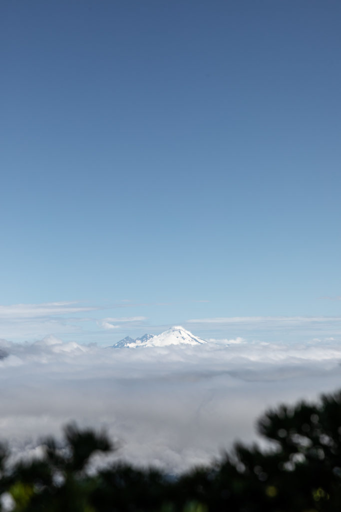
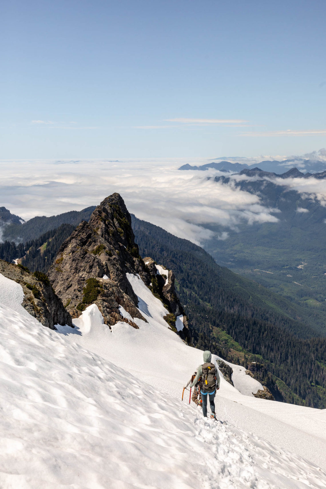
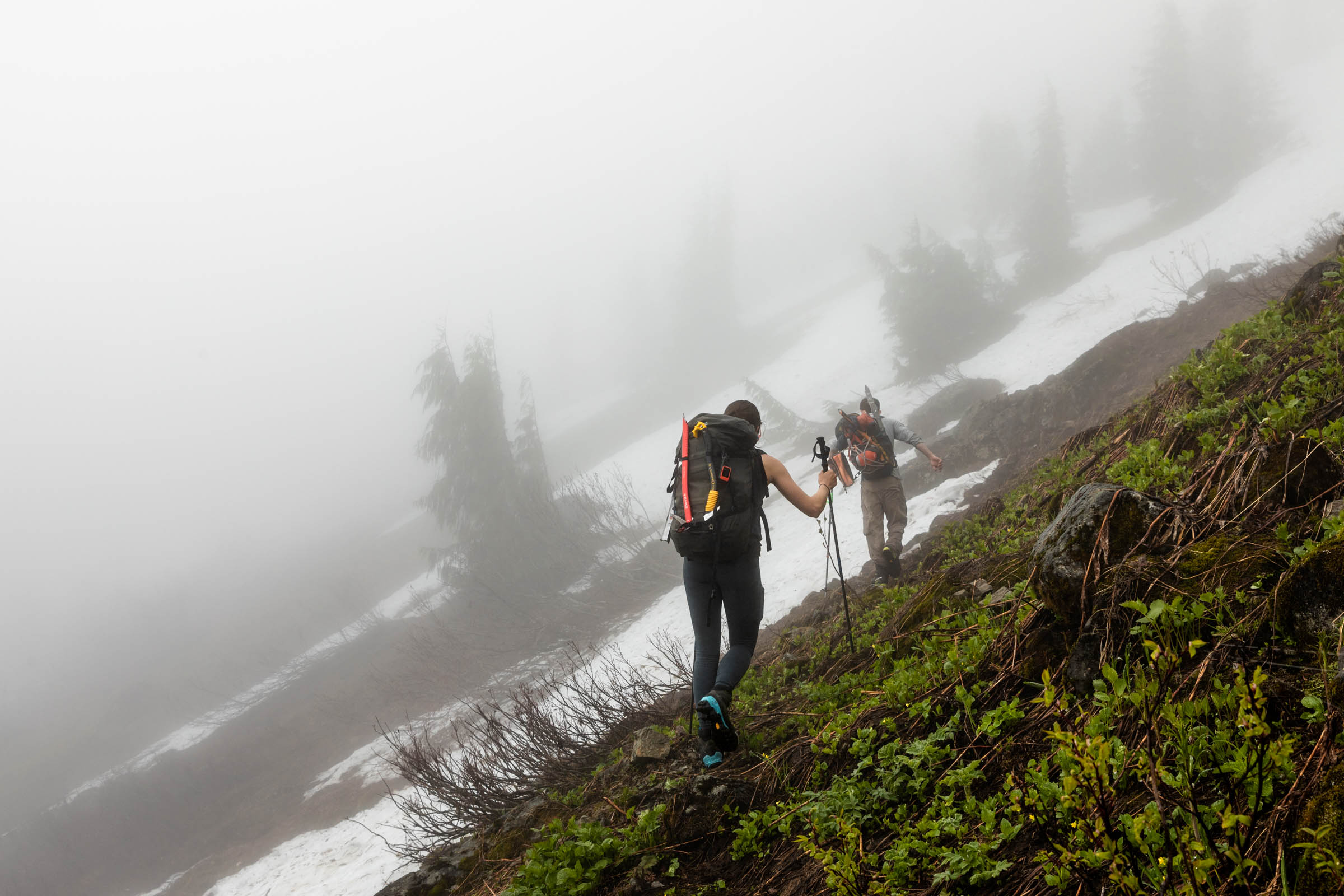
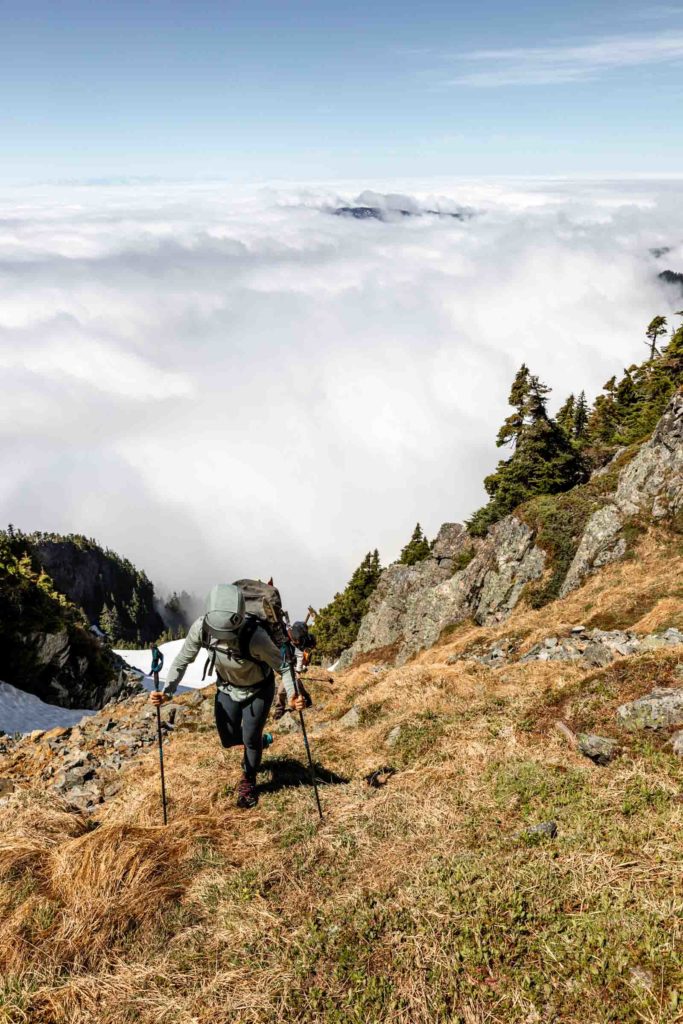
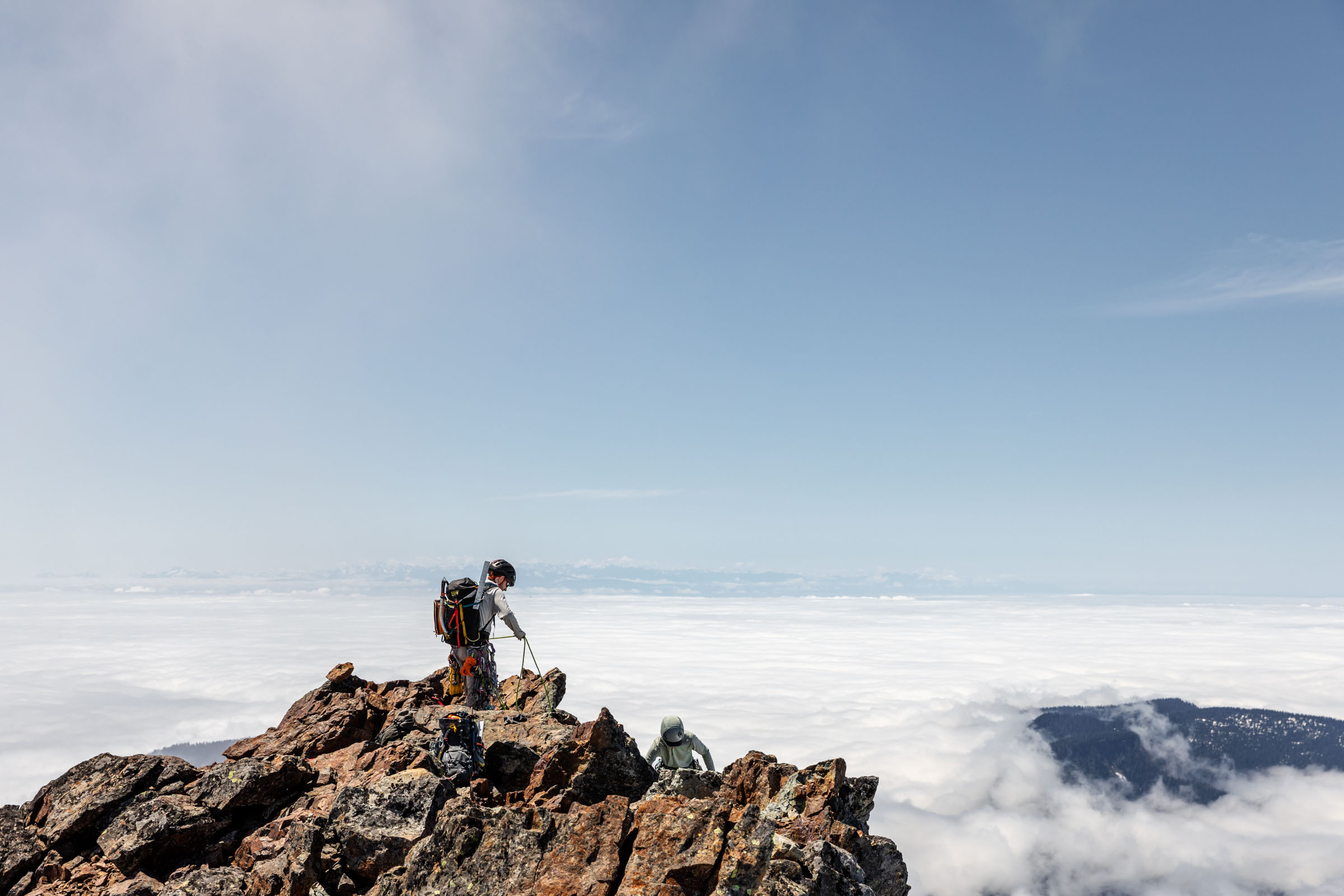
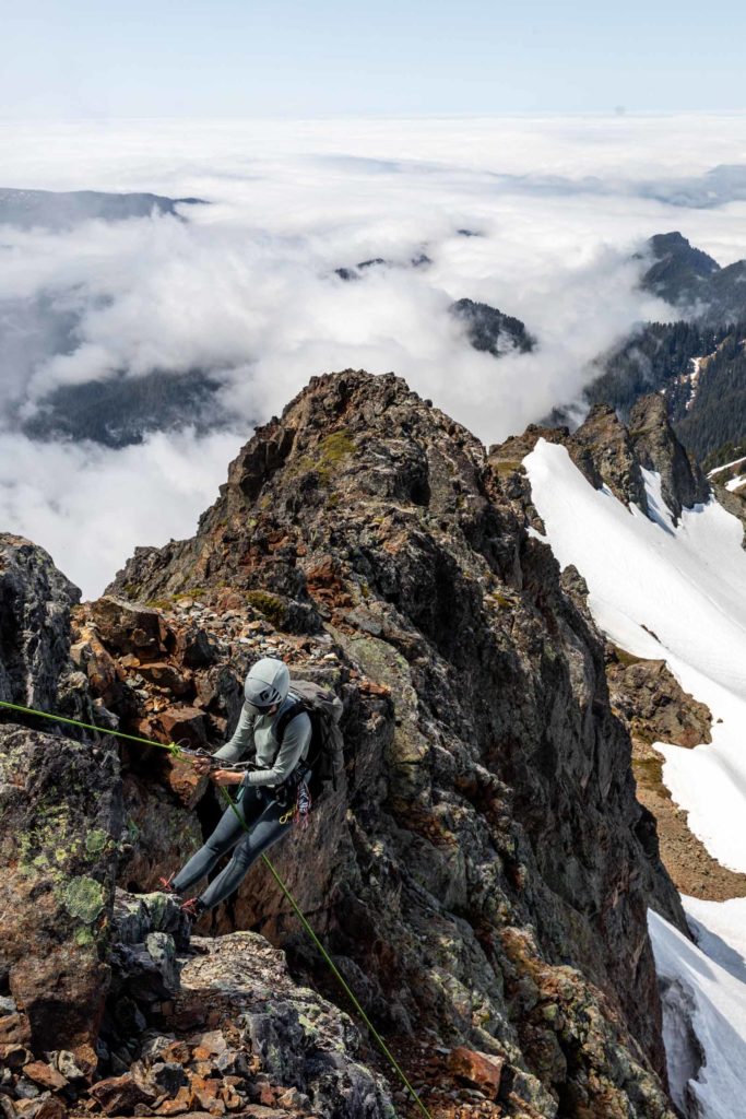
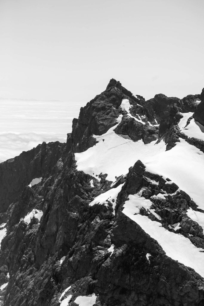
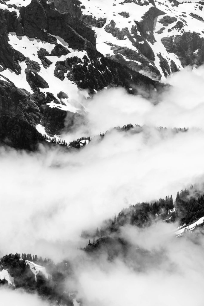
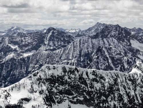
Traversing under the ridge cliffs, we found our snowy ascent to Lone Tree Pass. There were many trees, so I’m unclear why it was named Lone Tree Pass unless it was from eons ago. Up till now we were in clouds but at the pass, we just surmounted the marine layer and a lovely view of Mt Baker appeared before us. This is a great snack break point before you traverse the ridge. The ridge is actually a lovely walk, not overgrown and fairly flat. We were still in and out of snow until we broke out of the trees and really saw Whitehorse in its entirety. It was magnificent and the number of times we said “wow” could not be counted between that and all the other cascade peaks surrounding us.
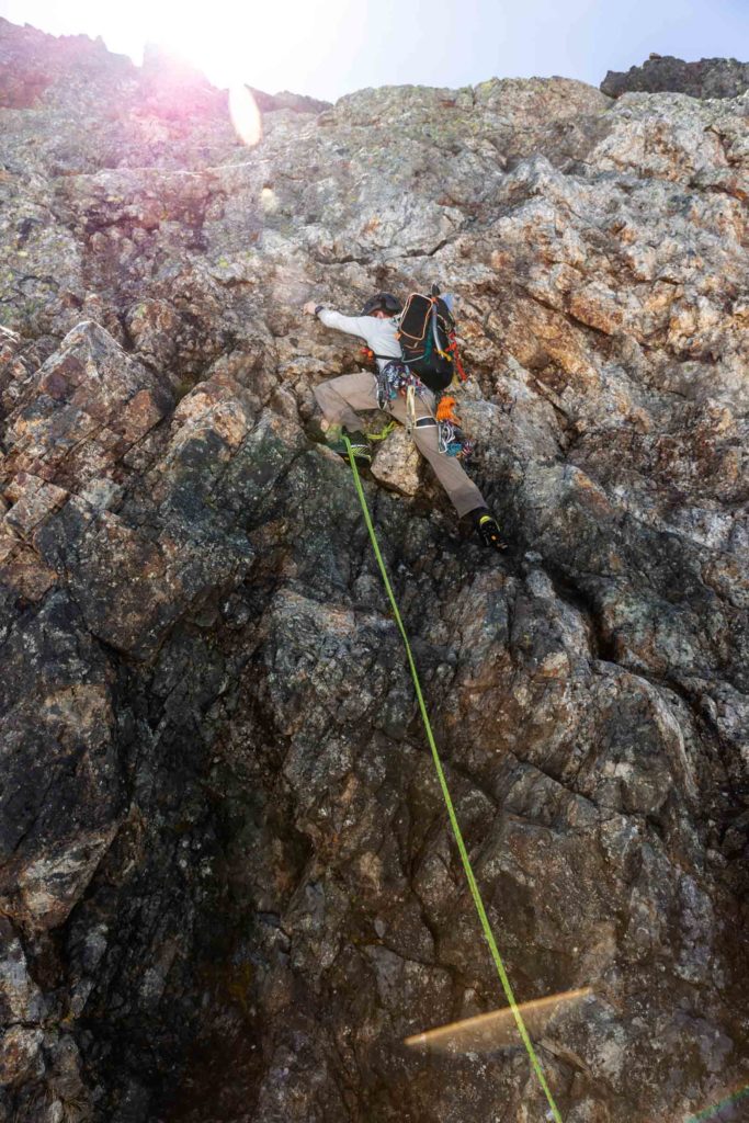
After a quick stop at a view point, we descend what we would all agree on was the worst section of this climb. At this point, you lose the trail and you descend however way you may on a steep vegetated slope while avoiding little cliffs along the way. Eventually it popped us onto a snowy section beneath a couple gullies. As with most sketchy things, I don’t take a picture of it. But we skirted under the cliffs again and started our long traverse climb up that consisted of a few more bushwhack small ups and downs. The side hilling, however, was arguably as annoying as the steep bushwhack. Sidehilling is bad both ways, whereas I can handle uphill bushwhack decently and will otherwise grumble on the downhill bushwhack.
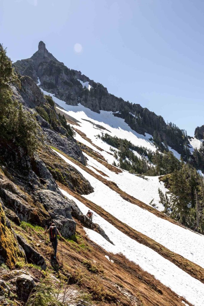
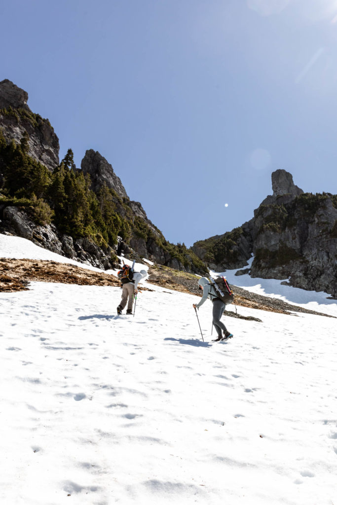
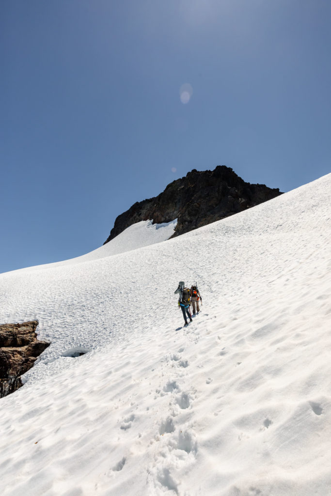
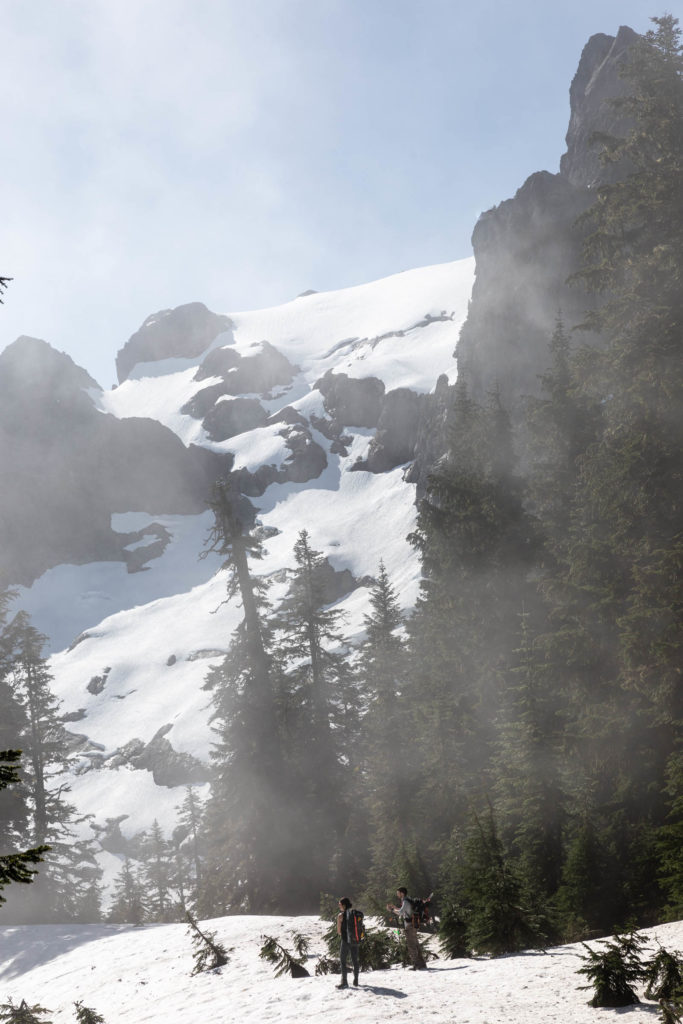
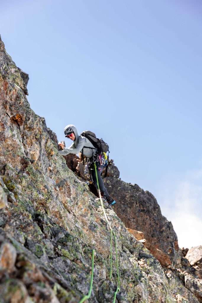
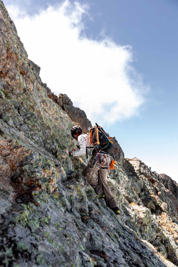
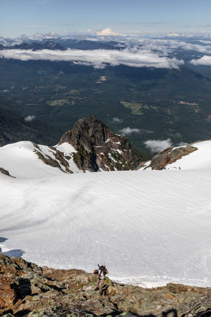
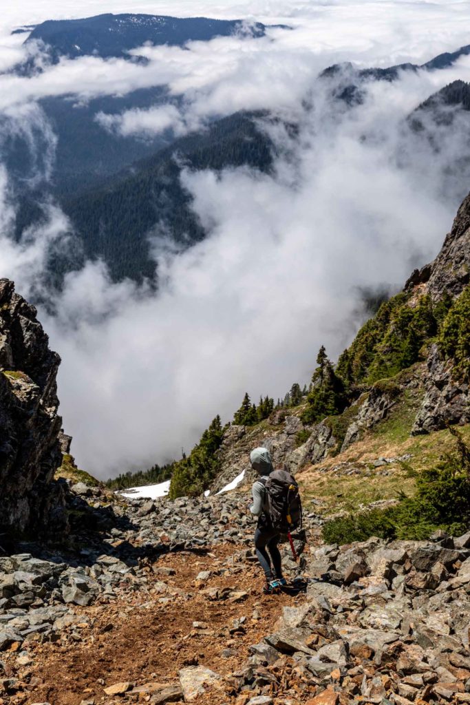
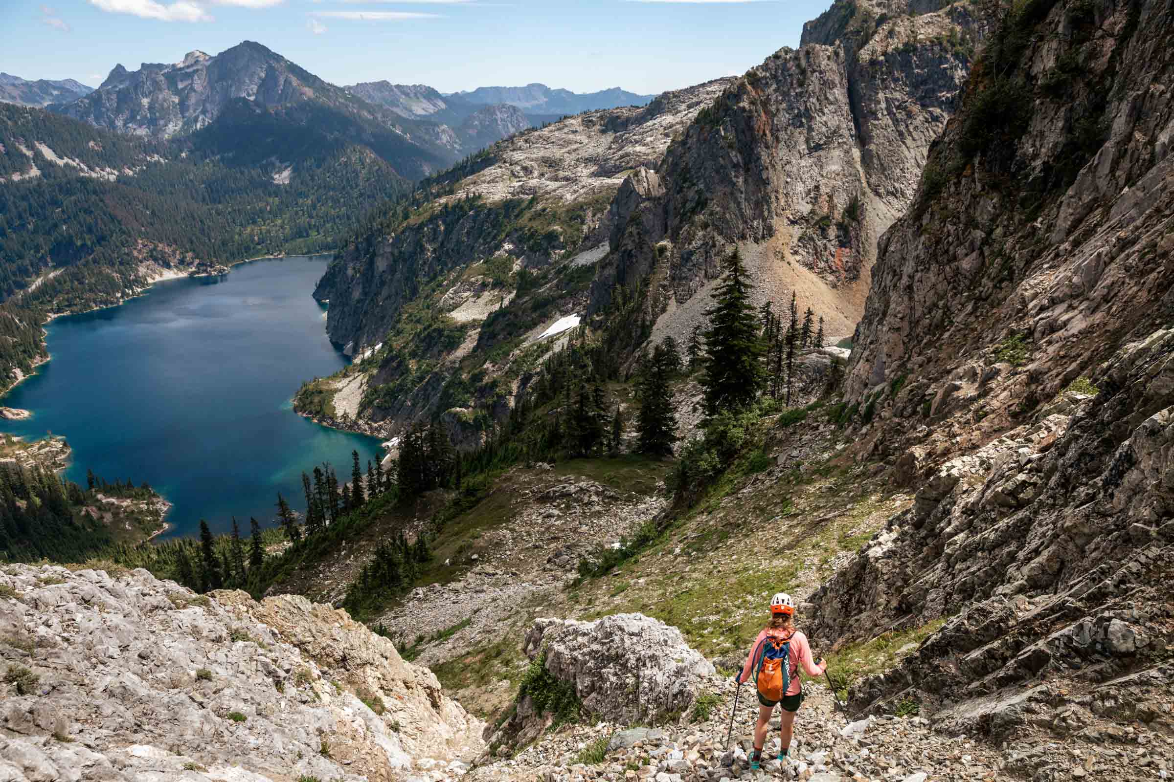
Memory already fades, but the mountaineer’s beta is pretty accurate. You “make a long rising traverse” and yes, it’s long. What all it entails, the pictures show a little here and there. We ascended until we were under the main gully where snow still funnels up. We took turns leading and eventually got onto dry land and quickly made our way to High Pass. From here the views were already incredible. The marine layer was starting to lift and you can see peek-a-boo views from Darrington and the land below. Mountains peaked above the clouds and it was layers on layers. From High Pass, we put on crampons for some extra traction and our glacier gear as a precaution. We did not feel a strong desire to rope up, so we left that in the bag.
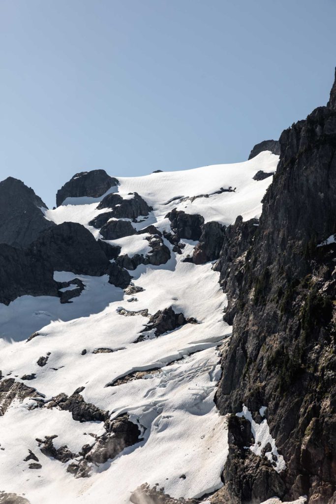
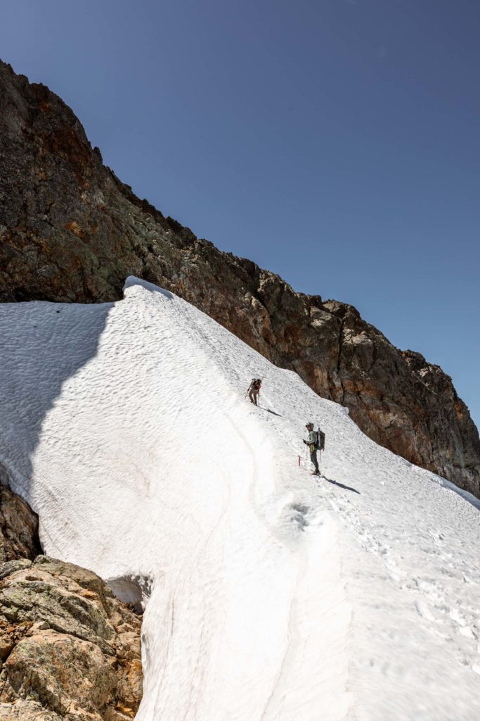
As we ascended the So-Bahli-Alhi Glacier, we eventually saw the flight tracks of the paragliders who were long since gone. We continued up the edge of the snow to view the moat. The moat itself was quite large, you’d have to go inside to access the rock where it’s opened up. Luckily there was one sliver of snow that still hung on to the rock. We made that our starting point for the scramble.
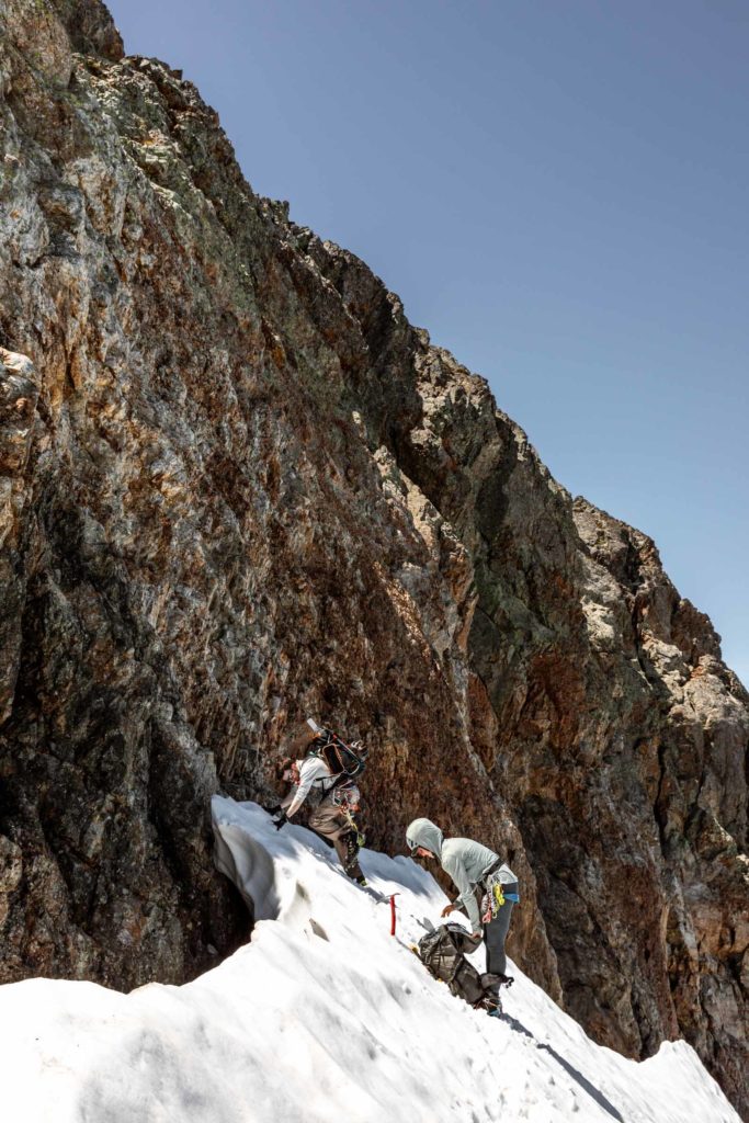
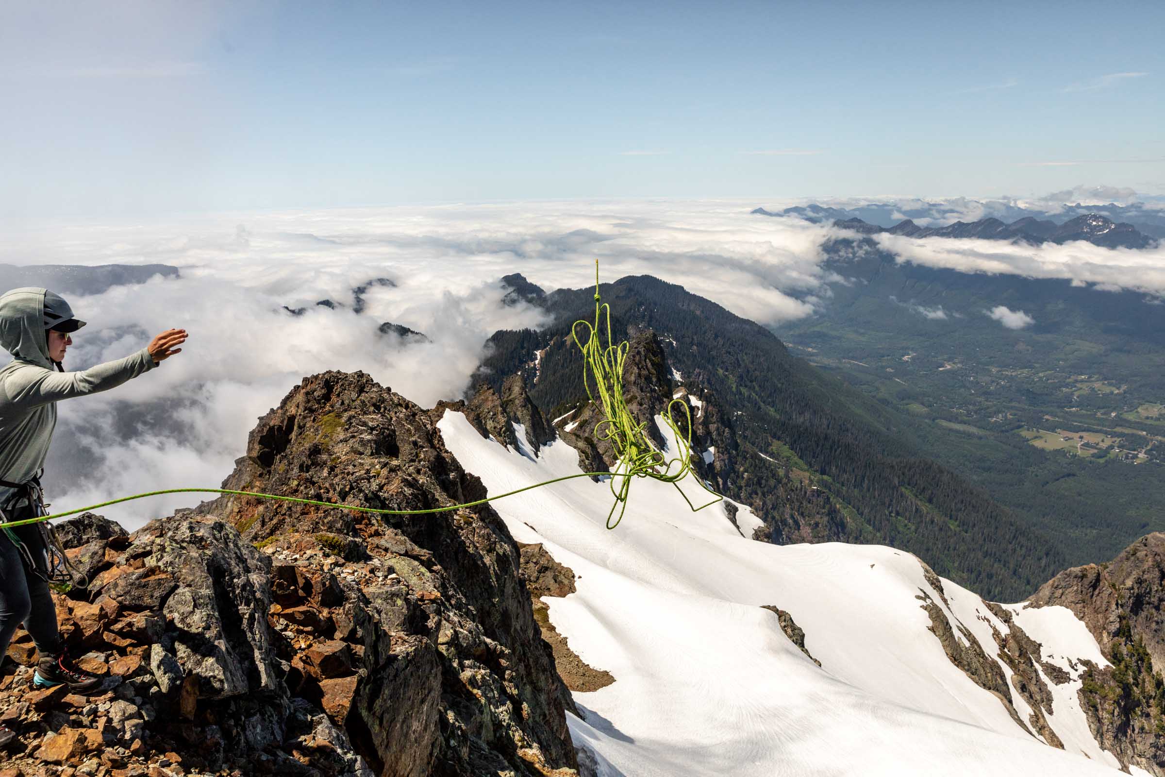
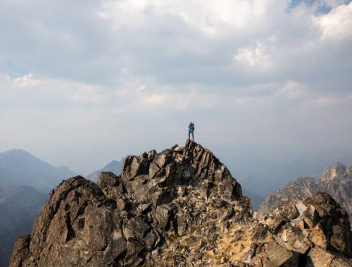
Because we already brought the climbing gear, we decided to pitch out the scramble. At this point, I had changed back into mountaineering boots, so I was happy to have someone else lead and get a belay up the steep rock face. I believe the snow melted off enough that our entrance point would be considered a few class 4 moves, but largely everything above 15 feet of the snow was fairly class 3. Our first pitch consisted of 2 cam placement sand our second pitch was no placements straight to the summit.
Sadly we couldn’t just stay on the summit forever, although we really wanted to. With just enough time for pictures and refueling our bodies, we started to prepare for our rappel down to the snow. Thankfully our 60m rope was just enough to double strand rappel down to the snow. Wait a week and you’ll need a 70m (or maybe more than a week depending on weather). The summit block has a bunch of loose rock that we had to be careful navigating or risk flying rock towards people.
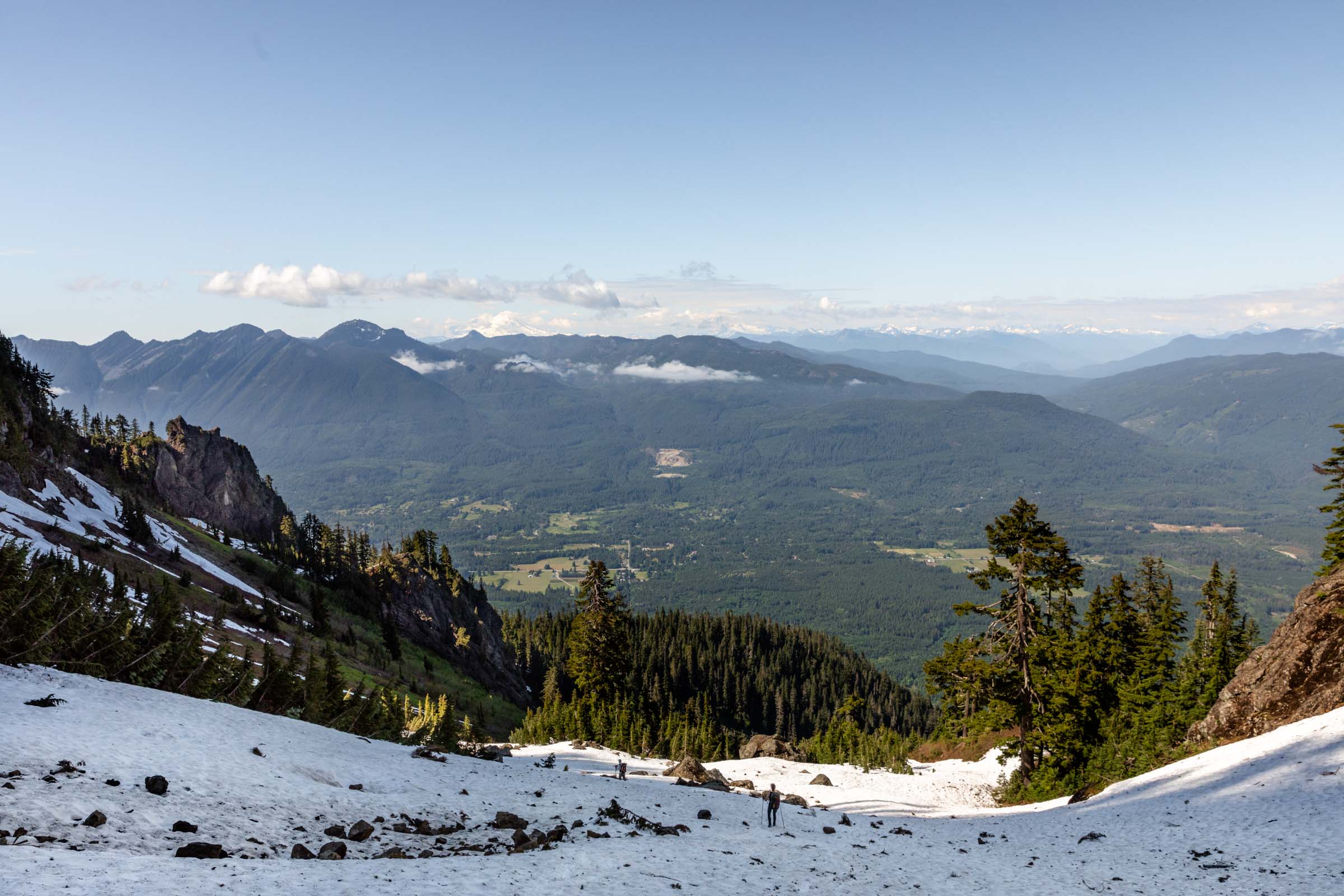
The way back to the car was pretty uneventful and surprisingly most sections were more pleasant than the way up. My only qualm was by that point, I think I was drained from big adventures later and simply not being in the best mental preparedness for such a big climb. You forget how 7k of gain takes a toll on your body as well. The trail back down felt quite long but at the bottom back to the flat mile, we were able to stroll along and munch on some salmonberries to pass the time.
Overall, Whitehorse was everything you’d expect for a classic mountaineering objective, but it is a lot even though it’s fairly broken up into larger than bite-sized pieces. In my mind it felt a bit like Sloan on steroids, everything similar but magnified in terms of gain and distance and technical difficulty. It ain’t a fairytale up here but it was still a dream fulfilled after years of staring at it from both the Darrington drive and even on the I-5 highway!
Notes
- Drive to the trailhead is short from the highway and poses little issue for any car, though a few bumps exist like most forest service roads.
- Parking lot can fit at least 10 cars.
- Long sleeves/pants are nice so you can barrel through any overgrown brush.
- We did not rope up on the glacier, but that is a personal group choice.
- We placed 2 cams for the scramble, which is short enough for a 30m rappel (60m rope).
- Someone left a solid anchor system on the summit with carabiners and slings and a quick link. We used that to rappel off of.
- June is edging on the end of the Whitehorse climbing season for most.
- We took 13.5 hrs round trip including breaks.
Photos shot on Canon 5D Mark IV

You May Also Like
classic funfetti birthday tour | washington pass ski tour
bike, hike, scramble, camp | chelan slam (emerald, saska, pinnacle)